
Greek Peak, NY: 2/26/10

A foot and a half at home, and Greek Peak also reported 18 inches. When I drove down my unplowed driveway snow billowed over the hood and into the windshield. Subaru face shots in the driveway!
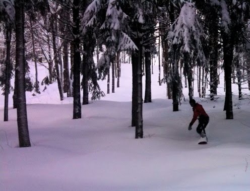
Snowboarding Greek Peak NY.

I was surprised to see a lift line up 15 minutes before opening. I got on the 5th chair. I thought yesterday was great, today was even better. The snow was light and powdery and DEEP.

I started out alone and skied top-to-bottom without stops, visiting all the ungroomed and untracked places. I ran into Marilyn on Chair 4, and we hit Chair 5 just as it opened. There was a lot of fresh snow on the trails and in the woods on the east side. I did 5 laps until Alsops and Arethusa were completely tracked out.

Continue reading →

Snow Reports from Warren County, NY

Gore Mountain phone call 10:30 am: Emily is out West, but her backup answered the phone. She indicated that 6 inches of snow fell before precip stopped overnight. I pushed on NCP. She’d spoken to the groomers and they made no mention of anything but snow overnight. Apparently it’s wet at the bottom, because that was how it fell. She said she’d call it packed powder.

I told her she should post it up, people REALLY want to know what is up. She said she’d talk to patrol first, and then update the site.


From the Garnet Hill Website, 9:30 am: “Friday, Feb 26th – 38″ of fresh snow. Trails are open as we are clearing down branches. We hope to commence grooming this afternoon after branches are cleared and the snow has time to dry.”


Email, Emily, 9am: Spoke to Patrol. No mention of NCP.


Email, North River, 1200 feet, 8:30 am: Snowed til midnight then NCP all night after that.


Email, Igerna Hermit, 1100 feet, 7:00 am: “Reporting from my station – 1.06″ ncp yesterday and .61″ ncp all last night ending this morning.”

The Big One: Snowmageddon 2010

2/25 Update: Looking at yesterday’s post, I was inclined to let it stand. But I all I have to do is look into my inbox to see how hungry eastern skiers are for information — so here’s the update.

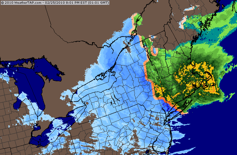
Snowmageddon 2010 radar

The current storm is currently behaving as predicted … The rain/snow line has set up north/south just west of the NY/MA/VT border. Areas to the west of the Hudson Valley should receive mostly snow.

This is good news for the Adk’s and especially the Catskills. There have been reports from the various mountains about multiple switch backs between frozen and mixed precip. Interesting to note that the Igerna HermitCam and the Whiteface Cam are showing snow as of this posting (2pm).

All regions will go back to snow late tonight. This storm will stick around into Saturday. Final changeover times will have big impact on totals. Here’s our call for additional snow through Friday:

  • Catskills: 18 – 24 inches
  • Adirondacks: 12 – 18 inches
  • Greens: 6 – 10 inches

I don’t think I need to point out that this is a very wet snow… certainly not Utah blower. Continue reading →