
Gore Mountain, NY: 1/8/11

It’s no secret that Gore’s had a tough year for natural snowfall. But yesterday, a clipper dropped down from Canada, and took its sweet time moving through New York State.

Topridge at Gore Mountain

On Friday, it dropped at least a half foot of snow across most ski areas in the state. And overnight, a “Norlun Trough” set up to drop another half of foot or more over the southeastern Adirondacks. It was bit of a coming out party for the Gore Mountain and the town of North Creek.

Jason’s Weather: 1/4/11

After a week of mild and tranquil weather, things are looking very interesting for the end of the week. Once again, there are big model differences. They all have a similar look, but their placements and intensities are different.

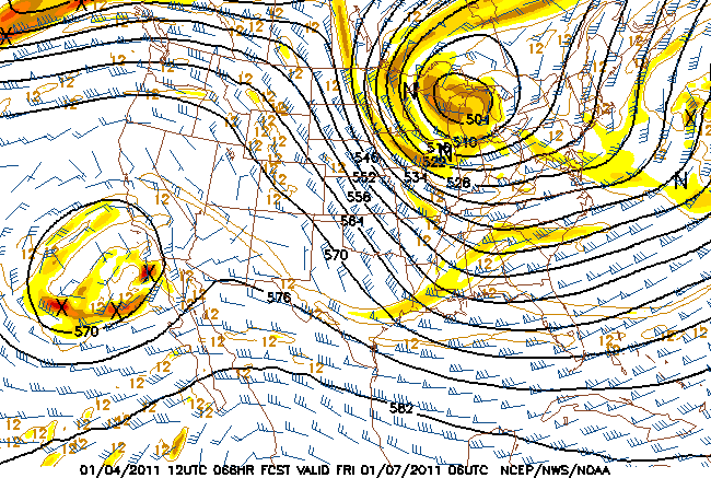
NAM 500mb at 66 hrs

NAM 500mb at 66 hrs

The NAM and GFS 12 1-4 both show a strong upper-level system dropping out of Central Canada into the Great Lakes. The NAM is stronger with this feature and moves it due south into Ohio. If the NAM went out to 90hrs, I bet there would be a nice low forming on the the Delmarv.

The GFS is similar, but keeps the upper feature more in Western NY and develops a slow-moving low further east.

Continue reading →