
“An April storm inside the Blue Line yielded close to a foot of new snow. With a five foot base, we scored great powder turns on north facing slopes all morning long. Later the warm spring sun yielded a creamy afternoon descent…” —skimore

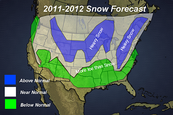
With the departure of Joe Bastardi, it looks like Henry Margusity may be the new go-to-guy for long-term winter weather forecasting at Accuweather. He just posted the snowfall forecast map above with his preliminary call for the winter of 2011-2012. Obviously it’s a long way off, but we like the way it looks. An excerpt from the full forecast:
“The basis of the forecast is on the prediction that a weak La Nina will be forming this fall and continuing through the winter. While the pattern will be similar to last year, there will be changes in the pattern that will lead to the heavy snow areas shown on the map.
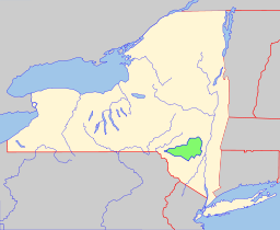 Catskill Park spans 700,000 acres inside the “blue line” in Delaware, Greene, Sullivan, and Ulster counties in New York State. Over 40 percent of the land within the blue line is Forest Preserve owned by the state and managed by the Department of Environmental Conservation (DEC). Another 5% is owned by New York City to protect four reservoirs that are within the park.
The park boundary stretches from near the Hudson River just west of Kingston NY to the East Branch of the Delaware River. Its northern extreme is at Windham and its southernmost point is near the Rondout Reservoir. In contrast to the Adirondack Park, the Catskill Park doesn’t include every peak of the Catskill Range. Only 33 of the 35 highest peaks are inside the Catskill Blue Line.



 In The Forums