Jason’s Weather: 11/2/10

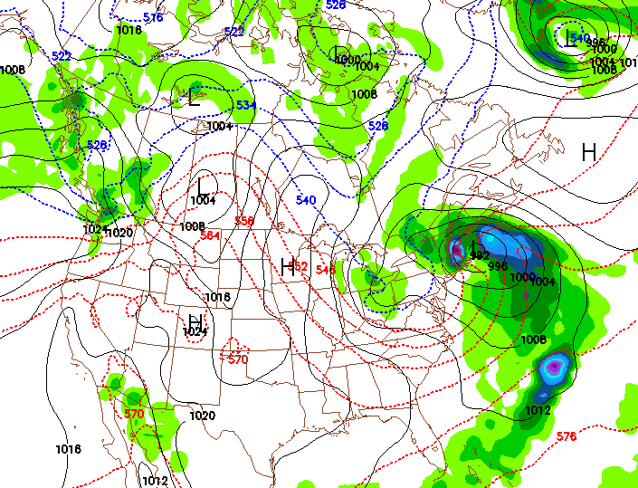
It’s a cold day in the North Country. And it looks like more cold air is in store for later this week. A much more pronounced and deeper trough will be affecting the Northeast after tomorrow.

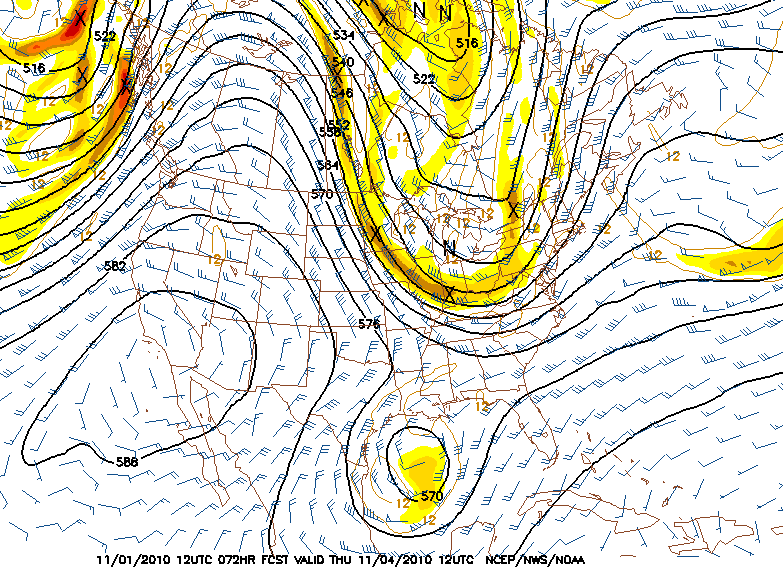
Vorticity (energy) rounding the base of the trough will spawn a moderate coastal system. This system will bring light to moderate snows to Western and Central New England. After the low passes, the coldest air of the season will follow.

Continue reading

First Snowfall of the 2010-11 Season

The model runs are finally starting to converge. Wednesday’s 18z GFS and NAM are calling for a developing coastal low that stalls over the Gulf of Maine. This will bring moderate to heavy rains to the mountains.

first snowfall northeast 2010

What makes this system interesting is that there will be just enough cold air aloft and strong vertical velocity for wet snow to fall in the Adirondacks above 3,000 feet. Amounts are hard to pin down due to the fact that there really isn’t much cold air at the surface.

The first snowfall in the northeast is always fun to predict and watch.

Zermatt, CH: July 2010

For the last couple of years, we’ve wanted to take the kids to Europe. The stars and our schedules finally aligned this summer.

After a week in Paris and a visit to the Normandy beaches, we headed to Zermatt, home of the Matterhorn and the largest summer ski area in the Alps.

Zermatt is a no-car town — all the vehicles are electric. After a short ($30!) taxi ride, we arrived at our apartment. I’ve been to some ski resorts, but haven’t had a view like this from my room.

Continue reading