Jason’s Weather: 1/4/11

After a week of mild and tranquil weather, things are looking very interesting for the end of the week. Once again, there are big model differences. They all have a similar look, but their placements and intensities are different.
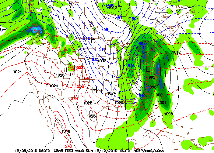
NAM 500mb at 66 hrs

NAM 500mb at 66 hrs

The NAM and GFS 12 1-4 both show a strong upper-level system dropping out of Central Canada into the Great Lakes. The NAM is stronger with this feature and moves it due south into Ohio. If the NAM went out to 90hrs, I bet there would be a nice low forming on the the Delmarv.

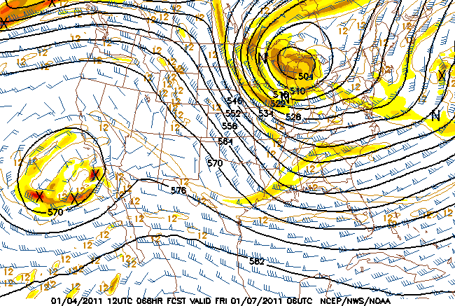
The GFS is similar, but keeps the upper feature more in Western NY and develops a slow-moving low further east.

Continue reading

Holiday at Le Massif du Sud, QC

Instead of our usual Vermont holiday trip, my wife and I decided to go to Quebec City for some culture and skiing. After planning and booking it, three other families came along too. We skied at Le Massif and Mont Sainte Anne, and for our final day we chose Massif du Sud.

le massif du sud

The bellman asked where we were going, and when my wife mentioned “Le Massif du Sud,” he said, “Bad choice. It’s a small boring mountain.” Obviously, the dude doesn’t ski. The place lived up to its billing as the best-kept secret in the province. From Quebec City, you drive one hour to the middle of nowhere.

Continue reading

Jason’s Weather: 12/8/10

Dec 8: After having a great run of cold weather and significant snow for some areas, we have to deal with a bump in the road. The storm that is currently giving the Cascades huge amounts of snow will move into the Lower Ohio Valley and strengthen, then it will move up the Appalachians to Central NY and on into Canada.

This scenario would put much of the Adirondacks and New England on the warm side. After the low pulls away, Lake Effect and upslope snows will follow. For some areas, the snow will be heavy. In the storm’s wake, we’ll experience the coldest air of the season.

Continue reading