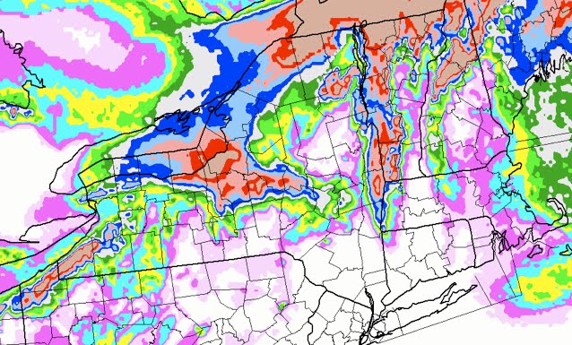
Weather Discussion for Feb 16 2010


Warning: Undefined array key 0 in /home3/nyskiblo/public_html/wp-content/themes/nyskiblog2016/functions.php on line 328

Finally some good weather news for the Northeast. A strong 500mb low, similar to last weeks system, is dropping down from Central Canada. This will spawn a weak low just south of NYC.

Unlike last weeks storm which blew up off the NJ Coast and moved east. This one meanders due north to around Southern Vermont / New Hampshire area.

For the Catskills and Adirondacks, I think we are looking at 4-6 inches.

It should produce some moderate snow fall for the Greens and Whites. Then set up a nice northerly flow that will produce more orographic snows to the Northern Greens. The Greens should pick up about 50% more do to a persistent northerly flow. Stay tuned.

Jason’s Weather: 2/8/10

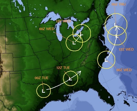
Monday Feb 8 4:30 PM: A very intense and dynamic system will impact the Northern Mid-Atlantic and Southern New England states …starting Tuesday night into Wednesday evening.

February 8 2010 Storm Track

The latest data (18z) has a 975 low lurking off the NJ shore. The precip from this low should extend as far north as the Catskills and Berkshires. If the system is a little further north and west then Southern Vermont will also receive some snow. With a system this powerful any thing can happen. Stay tuned for updates.

Update 2/9 Jason’s Call:

  • Catskills : 4″- 8″
  • Gore / Southern ADKS : 4″- 6″
  • Killington /Central VT : 3″- 5″
  • Northern ADKS : 3″- 5″

The Gore Mountain Snow Shadow

Gore Mountain snow shadow

This snowfall map shows predicted snowfall for the New Years weekend. There was a low off the coast of Maine that was moving “backwards” towards New England. Almost every ski area in the northeast scored more than the 5 inches Gore was able to squeeze out of it.