
Monday Feb 8 4:30 PM: A very intense and dynamic system will impact the Northern Mid-Atlantic and Southern New England states …starting Tuesday night into Wednesday evening.
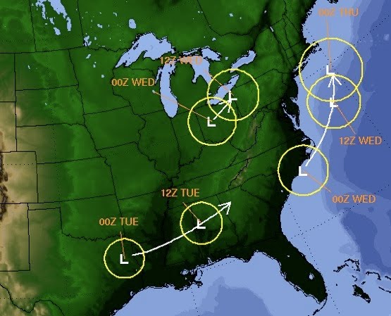
The latest data (18z) has a 975 low lurking off the NJ shore. The precip from this low should extend as far north as the Catskills and Berkshires. If the system is a little further north and west then Southern Vermont will also receive some snow. With a system this powerful any thing can happen. Stay tuned for updates.
Update 2/9 Jason’s Call:
- Catskills : 4″- 8″
- Gore / Southern ADKS : 4″- 6″
- Killington /Central VT : 3″- 5″
- Northern ADKS : 3″- 5″
Here’s how I did…
The Catskills received 7
Gore..got zip, so I bombed
Whiteface received 2
Okemo received 2-4
Overall not too bad.
I checked Bell this am, and they updated it to 8 inches.
Now I know WF has upslope potential, and Gore doesn’t… but outta this thing? At least Gore was in the VIRGA. You’d think Gore would net more than a trace.
Gore was right on the edge. They had a couple inches in Saratoga.