
New York state has a wide range of environments, from densely populated cities to spread out expanses of farmland. This section of the NYSkiBlog Guide is designed to help us understand NY weather by presenting historical weather data.
-
 The Topography of New York
-
 The Climate of New York State
-
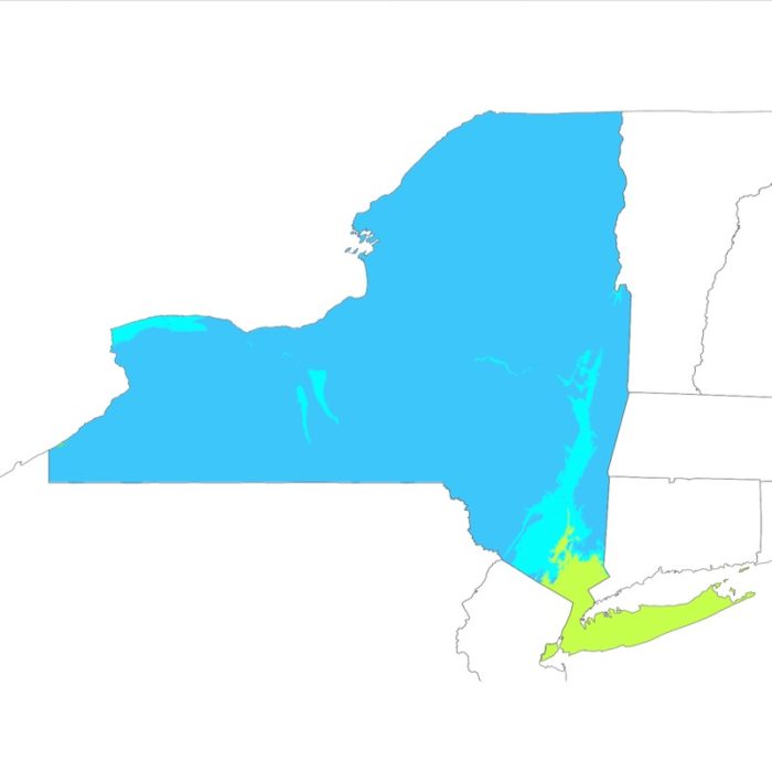
 New York State Average Temperature
-
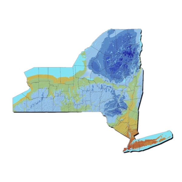
 New York Annual Precipitation Average
-
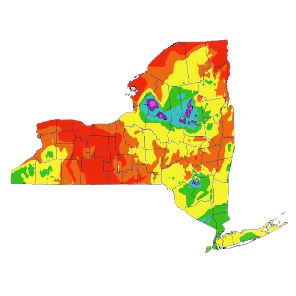
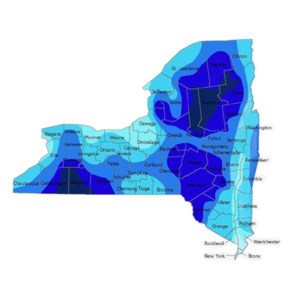
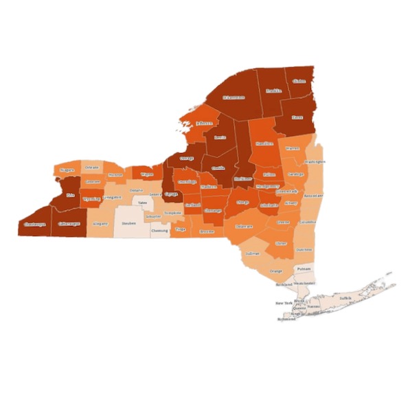
 New York State Annual Snowfall Map
-
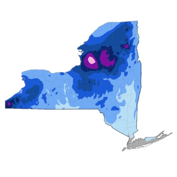
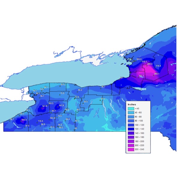 Western New York Snowfall Average
-
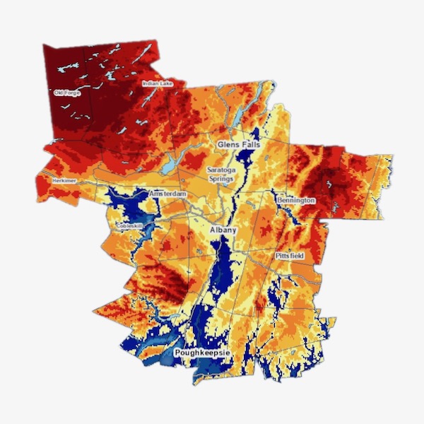 Albany Average Annual Snowfall
-
 First Frost in NY State
-
 Last Frost in NY State
-
 Central Park Snowfall Records
-
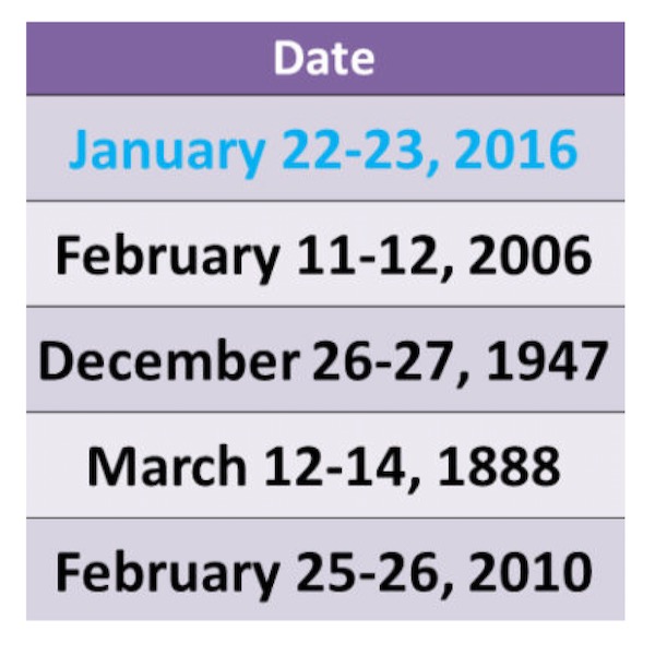
 NY Winter Events and Disaster Declarations
-
 New York Weather Records
The climate of New York is influenced by an ocean, a few lakes and a variety of topographic features. The Atlantic Ocean has a moderating effect on the coastal areas, while the Great Lakes and Lake Champlain moderate the northwestern and northeastern parts of the state. In winter the higher terrain of the Adirondacks, Catskills, Taconics and the Allegheny Plateau harbor the coldest air.
During much of the year, the prevailing west winds bring air masses from the continental interior across the entire region, with episodes of bitter cold during winter. The polar jet stream, which is often located near or over the region during the winter, brings frequent storm systems which cause cloudy skies, windy conditions, and precipitation. New York is often affected by extreme events such as floods, droughts, heat waves, hurricanes, nor’easters, and snowstorms.
Since 1900 temperatures have risen approximately 2°F, and temperatures in the 2000s have been higher than any other period in measured weather history. Warming has been concentrated in the winter and spring while summers have not warmed as much. The increase in winter temperatures has had an identifiable effect on Great Lakes ice cover. Since 1998, the maximum ice cover extents on Lakes Erie and Ontario have been below the long-term average.
We’re always looking for maps and data to drill down on weather in New York. If you’ve got data to share please contact us.
Source: