
Moxham Mountain has always been, for me at least, a general term I used to describe an area sprinkled with ledgy cliffs on the “other” side of the Hudson River near North Creek, NY. Even now, after finally summiting Mox, I’m still not clear on the what parts of the landscape are truly considered part of the peak.
Take 28N from North Creek past the Minvera Fire House and turn left on 14th Road. Drive to the end of the pavement. After a mile on the dirt road, look on the left for a “trailhead parking” sign.
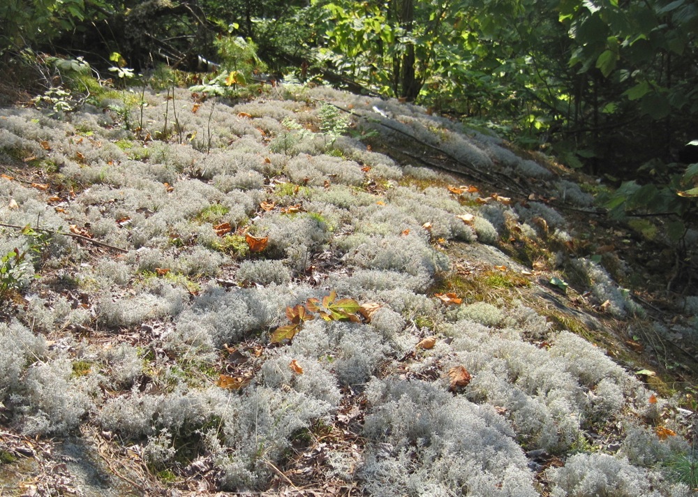
The trail feels to me more like a cleared bushwack as there is really no discernible roadbuilding on the route. Yet. Right now, the ground is very soft and really nice to walk on. There are some beautiful lichens on the rocks, but sadly I fear they won’t last without swift action to protect them.
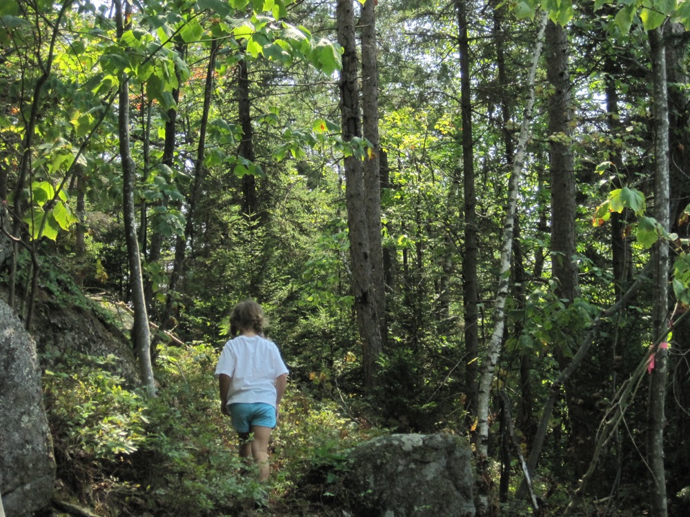
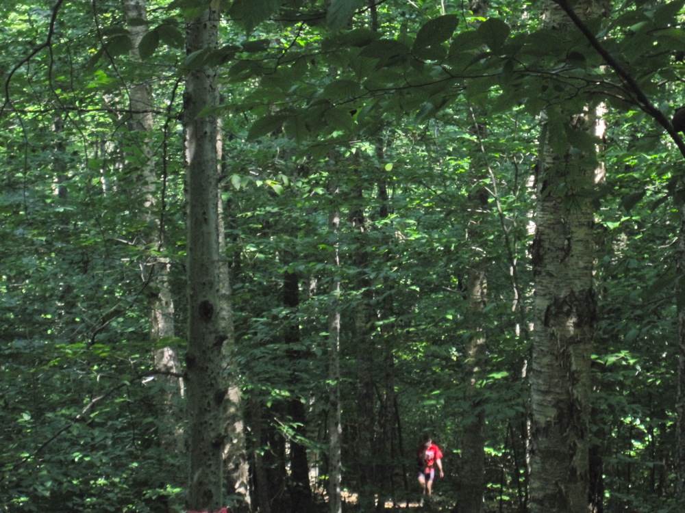
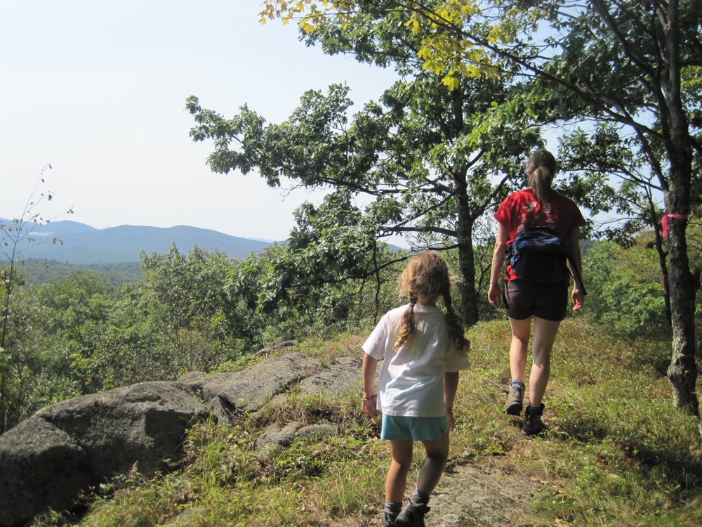
The Moxham Mountain Trail is gorgeous across much of the 2.5 mile route. We hiked our way gradually up and over the first rise. Then you drop for a bit and start climbing again.
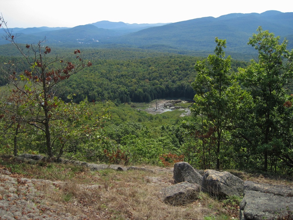
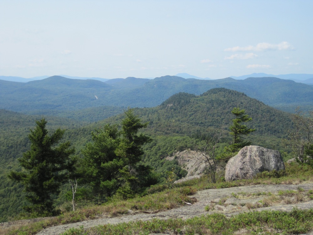
As you start to climb again, views appear and they get better as you progress along the ridge.
This hike was just too far for Neve. We had lunch fairly high up, just below the final summit push. After we ate our sandwiches, we sat back. Zelda looks at me and says “I guess you could run up to the top.” I went.
Fifty yards past the lunch spot the summit really came into view. I crossed paths with Phil Brown of Adirondack Explorer for the third and final time as I pushed for the top.
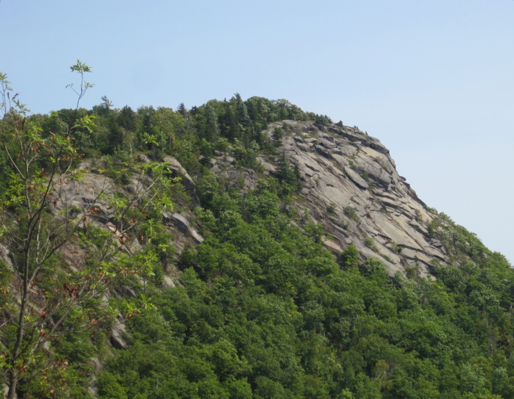
The whole trail is beautiful and the top is definitely not a disappointment. The panorama is expansive and there are landmarks in every direction: The Hudson, North Creek and Gore Mountain. Off to the west is the distinctive outline of the Siamese Ponds Wilderness.
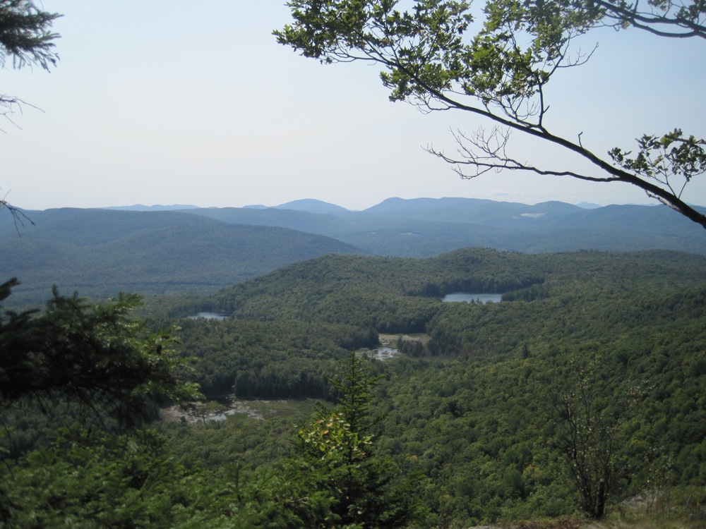
On the way back down, you see all the views you were missing on the hike up.
I could sincerely understand the bushwacking community mourning the loss of “Maxam” as a trailless peak. It was classic bushwack to a beautiful, remote spot, overlooking town. I totally get that.
But from North Creek’s perspective it’s awesome. An exciting, short hike to cliffs that are so close to town. Even better the view highlights some of the region’s biggest attractions — the river, skiing, town and the wilderness. I dig this hike.
Looks great Harv. But isn’t the Siamese south of Moxham?
Thanks for the TR, Harv.
Have you ever climbed Pete Gay mountain? I always thought the view of the North Side of Gore would be great to see from the top. Though I am not sure if there are any treeless clearings on Pete Gay.
Very cool.
is it a rugged trail, possibilities of mtn bikes?
Nice shot of bear “tracks” on the beech tree on the left side of the first photo.
Neve looks so big!!
That looks like a fun hike with good views. Nice shots.
@witch hobble, Gore is due south of Moxham and many of the bigger peaks of the Siamese are off to the WSW. Sorry for the confusion.
@Kid – I did climb Pete Gay once. The summit is on private property, but we got permission to ski up one new years eve. There is a small cabin up top heated with propane. It’s very cool and an inspiration for our own cabin. After midnight we skied down with sparklers. It was snowing and cold and the stars were out. Magic.
@chris – the last mile (at least) would be very difficult on an MTB.
@Adk Keith – good eye. Click on the image to get a bigger view.
We climbed this mountain on Saturday and really loved it – it’s great to have another hiking option so close to North Creek! Any idea how the name morphed from Maxam to Moxham?
@Gillian: I wondered the same thing when I saw the summit marker. I haven’t been able to come up with an answer.
Gillian and Harvey44: The mountain is named for Robert Moxham, who surveyed the area around 1798. When Verplanck Colvin later surveyed Moxham, he mistakenly referred to the mountain as “Maxham” and “Maxam” in his report and on the summit bolt. So “Maxam” is really just an error or mis-spelling of Moxham. Colvin erected a surveying tower on the summit, and there are some remnant anchors and bolts that still exist there today, along with the summit bolt that he set. I love coming across original Colvin summit bolts when I hike in the High Peaks and elsewhere in the Adirondacks – Colvin and his Adirondack Survey were incredibly important to the formation and early years of the Forest Preserve.
Did this hike yesterday with my friend and really enjoyed the day.
We did think it was a bit longer than 2.5 to the summit. We are experienced hikers and thought maybe about 7 miles round trip? Loved the lichens and the views. Met a few other people enjoying the day. Sure it will be gorgeous in the fall. Thank you for all the info!!! Cynthia
Cynthia… glad to help, if this post did that. I agree this hike is a treasure.