
In the last days of August, the High Point Carriage Road, a historic 2.8-mile piece of the Minnewaska State Park’s carriage road network, officially re-opened to the public. On September 1, my friend Brian and I set out to explore the new road on bicycles.
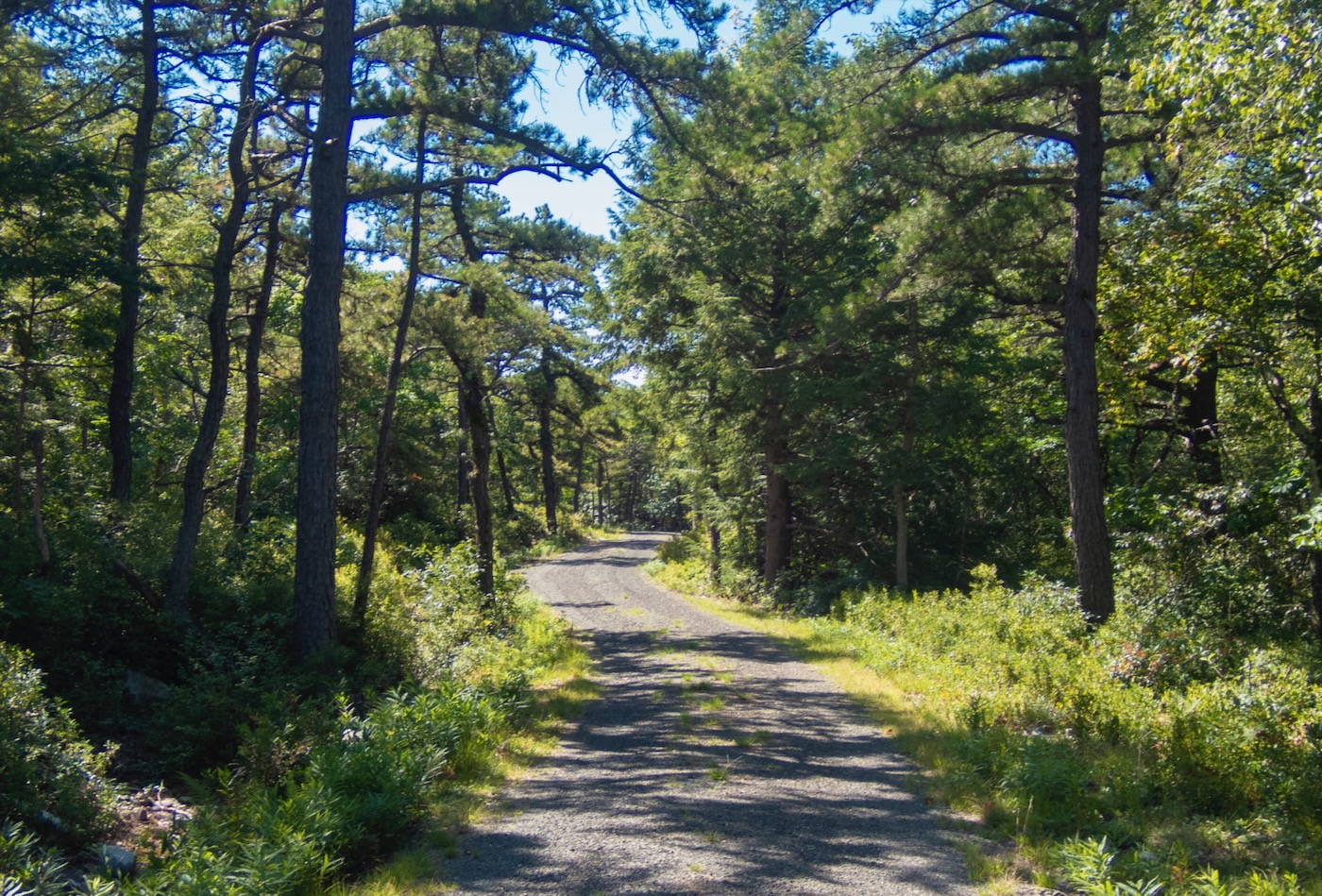
We started at the Minnewaska parking area and rode on the Upper Awosting Carriage Road to Lake Awosting. From Awosting, the Smiley Carriage Road would connect us with the new High Point road. Although I’m a frequent visitor to Minnewaska, this was my first cycling trip on the full length of the Smiley Carriageway that was restored a few years ago.
We set out on Smiley at the junction with the Lake Awosting Carriage Road. After climbing for a bit, we enjoyed the half-mile long descent to the Fly Brook bridge. Fly Brook was flowing nicely for this time of year, and we stopped to take in the scene. The first time seeing this well-designed bridge a few years ago really drove home to me that Minnewaska was developing into a world-class public recreational destination.

From Fly Brook, we continued west towards Napanoch Point on Smiley Road, pushing hard on the mostly uphill ride through the deep forests of Shawangunk backcountry. Along the way, we passed a great viewpoint looking east and northeast to Castle Point and Mohonk’s Skytop in the distance.
Continuing, the Long Path joined the road from the south and followed the road for a short distance until starting its descent of the ridge off to the northeast. After a relatively steep, curvy descent we arrived at the junction with the new High Point Carriage Road.
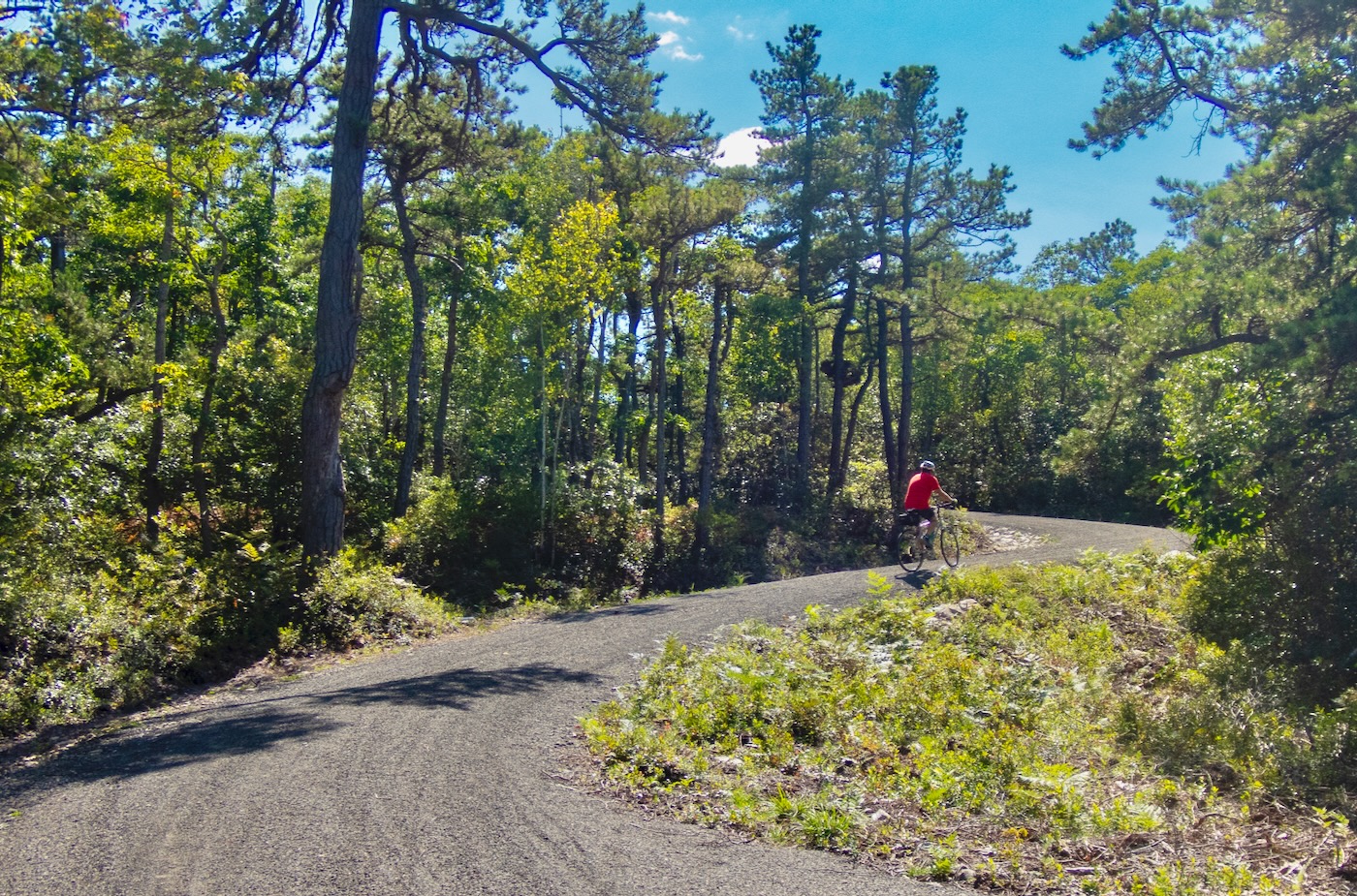
The new road was full of fresh gravel, packed looser than the older Smiley Road. The road started immediately with a steep, curvy climb that lasted longer than we were expecting. It was one of those places where new uphill sections of road revealed themselves around every curve. Towards the top, we got a great look at the new construction of the roadbed as it curved uphill, and found a nice view looking north to the Catskills.
From here, the road mercifully leveled off a bit and we crossed one of the beautifully constructed new bridges. The road continued through the Shawangunk woodlands, traveling mostly uphill, until we came to a set of two bridges placed closely together on the road. In reviewing the NYNJ Trail Conference Shawangunk hiking map I saw this is a newly constructed section of road, with the bridges crossing over an area that was always swampy and muddy on the old trail.

Continuing along the road, the elevation gain continued, eventually reaching 2000 feet – getting close to the top of the Gunks. At this point, the road takes a wide curve uphill on another newly constructed section, bypassing the short, steep section of the old trail.
We arrived at the junction with the High Point (hiking) Trail, where our adventure continued. From here the restored carriage road travels another 1.7 miles to join the Sam’s Point Loop Road, which then continues another 1.2 miles to the Sam’s Point visitor center, linking the park’s two visitor centers by carriage road.
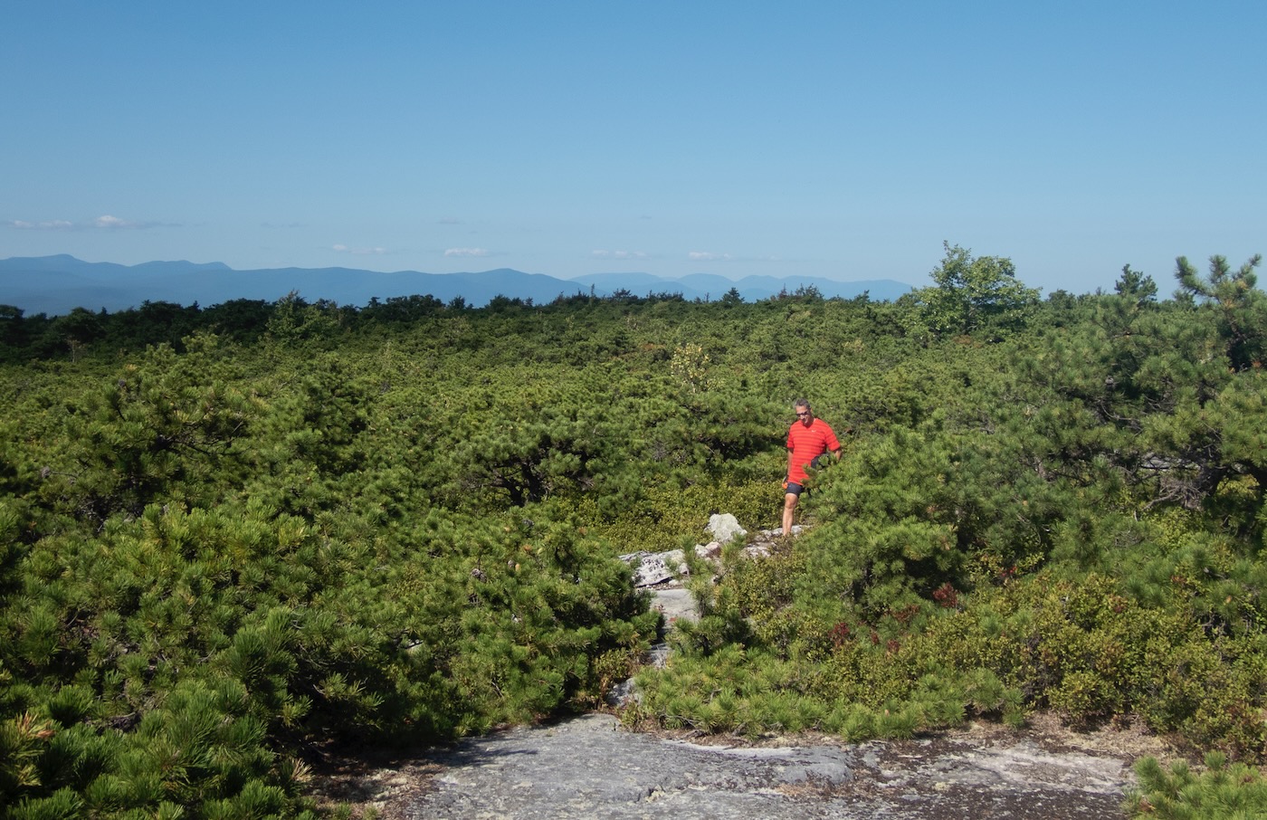
After stashing our bikes, we hit the High Point Trail starting with a short, steep climb up to the junction with the Long Path Berrypicker Trail. At the top of the climb, we continued on to High Point. This portion of the trail winds through the classic Gunkscape of quartz conglomerate, blueberry bushes and thick scrub pine. It’s a truly unique environment up here, and is one of the reasons the Shawangunks were designated “One of the Last Great Places on Earth” by the Nature Conservancy.
We meandered along the trail, through the thick brush arriving at High Point at the top of the Shawangunks. Most Shawangunk summits have south facing cliffs, offering great views limited to about 270 degrees. High Point is unique, offering a 360 degree view. One can look north and south, up and down the ridge, or look east to the Hudson Valley and New England or west to the Catskills and the Appalachian plateau. High Point is truly a one of a kind view in the Shawangunks.

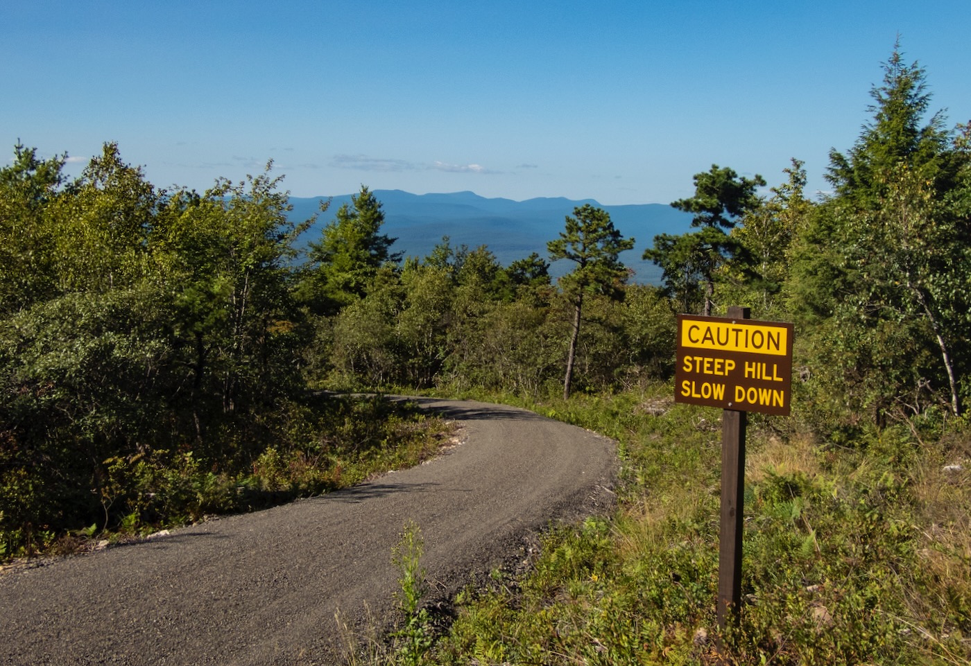
From the summit, we hiked back to our bikes and started the journey back to Minnewaska. Enjoying the curvy downhills on the High Point Carriage Road, we smiled while passing signs warning cyclists of the road hazards ahead. We stopped to take in the view of the Catskills again and headed back towards Lake Awosting on the Smiley Carriage Road, passing 4 Mile Post, which was one of the camps used by the commercial berry pickers on the ridge in the early 20th Century.
Overall the return trip went by pretty quickly, with the favorable downhill pitch to Fly Brook. The climb out of the Fly Brook valley up towards Lake Awosting was a long grind, and I was happy to arrive back at the lake. From here, we retraced our steps back to our cars at Minnewaska.

The new carriage road opens up the Shawangunk backcountry to the cyclist or hiker, and provides a a trail link between Minnewaska and Sam’s Point. The route is hilly especially heading towards Sam’s Point, which may discourage casual cyclists a bit. Fit cyclists, e-bikers, XC skiers and hikers are sure to enjoy this new route across the top of the Shawangunks.
Steve Aaron is an avid skier, hiker, cyclist and photographer, always armed with a camera. Steve’s landscape photos have appeared in Backpacker Magazine, Hudson Valley Magazine, NY Newsday and the Albany Times Union. His work is also featured in pieces for Ulster County Tourism, Scenic Hudson, The Trust for Public Land and other outdoor oriented organizations. Every August, Steve publishes a wall calendar featuring beautiful landscape images from the Catskills and Shawangunks. For more information on the calendar, join Steve’s mailing list.
Awesome. I went up there a couple or so weeks back to drag my kayak down to the lake. Great area and it looks like you got some nice weather for it too.
I love the idea of restoring an old road. It looks like it was done without too much disruption too. Plants growing right up to the gravel.
Great pics Steve.
Nice story, nice photos. I think that road was under construction when I first checked out the Smiley Road. Haven’t been to Minnewaska in a while, now I have a reason!
New to your blog – great piece on a gorgeous part of eastern NY!! thanks.
We just moved away from the area, but Minnewaska has always been one of our favorite places. I’ve been to all the places you mentioned, but on foot and before the improvements. Maybe we’ll get back out there some day.
BTW, you should go to Rough Cut Brewery after your hike or ride. (And no, I have no affiliation with them.)
Love these photos Steve!
This area is my all time favorite places to explore. The Badlands and Berry Picker Trail is a truly wild place. Lots of hidden gems out there. Since the roads were in such bad shape you always had the place to yourself. Glad to see it finally get the love it deserves. The recent improvements to the park are top notch.
From what I understand the Smiley Road from Ellenville was the original entrance to Minnewaska for guests staying at the old hotel before 44/55 was built. That must have been some ride back in the day.
One foot of fresh would make for a really fun ski. Can’t wait to check it out.
Thanks everyone. That was so much fun, I tried it again on Sunday Sep 17. Seemed a bit easier the second time. Another thought would be to spot a car in Ellenville and ride one way from Minnewaska to Castle Point out to Awosting, Smiley CR, High Point CR to Sam’s Point and then take the Gully Rd down to Ellenville. That would be a nice trip.
“One foot of fresh would make for a really fun ski. Can’t wait to check it out.” Late to the party here, but what he said. Thanks for the write-up