
This winter, I’ve been content skiing in the neighborhood. There are seven ski centers (OK, two of them are golf courses) within 20 miles of my crib in Saranac Lake. Why travel?
With the disastrous thaw, my local options have diminished. This winter, most of the big storms have gone south of the Tri-Lakes. Paul Smiths VIC was reduced to a few kilometers. Mount van Hoevenberg’s legacy trails, which I’ve only skied once this winter, were toast. I’ve lost count of the number of laps I’ve done on van Ho’s World Cup trails. On Sunday, I cleaned kitty litter, loaded the Fortunate Son and drove down to Gore.
Gore’s FIS homologated nordic trails predate those at Mount van Ho. In the 2015 – 2016 ski season, Gore management repurposed the tubing hill at the Ski Bowl, laying out a primitive nordic ski loop. In a low-snow winter, that loop, replete with machine made snow, saved the New York scholastic race season. With that experience in the books, Gore/ORDA management laid out formal nordic trails in the Ski Bowl. In 2018, the International Ski Federation (FIS) homologated a four of those trails at a variety of distances.
The drive south deserves a post in itself. I took the scenic route through Tupper Lake and Long Lake, as it was only a few minutes longer than driving down the Northway. Leaving Tupper Lake, I entered uncharted territory. There’s vast swaths of forest between hamlets. If your car breaks down out there, you’re in deep.
In Indian Lake I turned on to Route 28. I thought I was going in the right direction, until I saw a sign: Utica, 83 miles. I retraced my steps. Route 28 north actually goes east. What’s up with that? Explain it to me like I’m five years old.
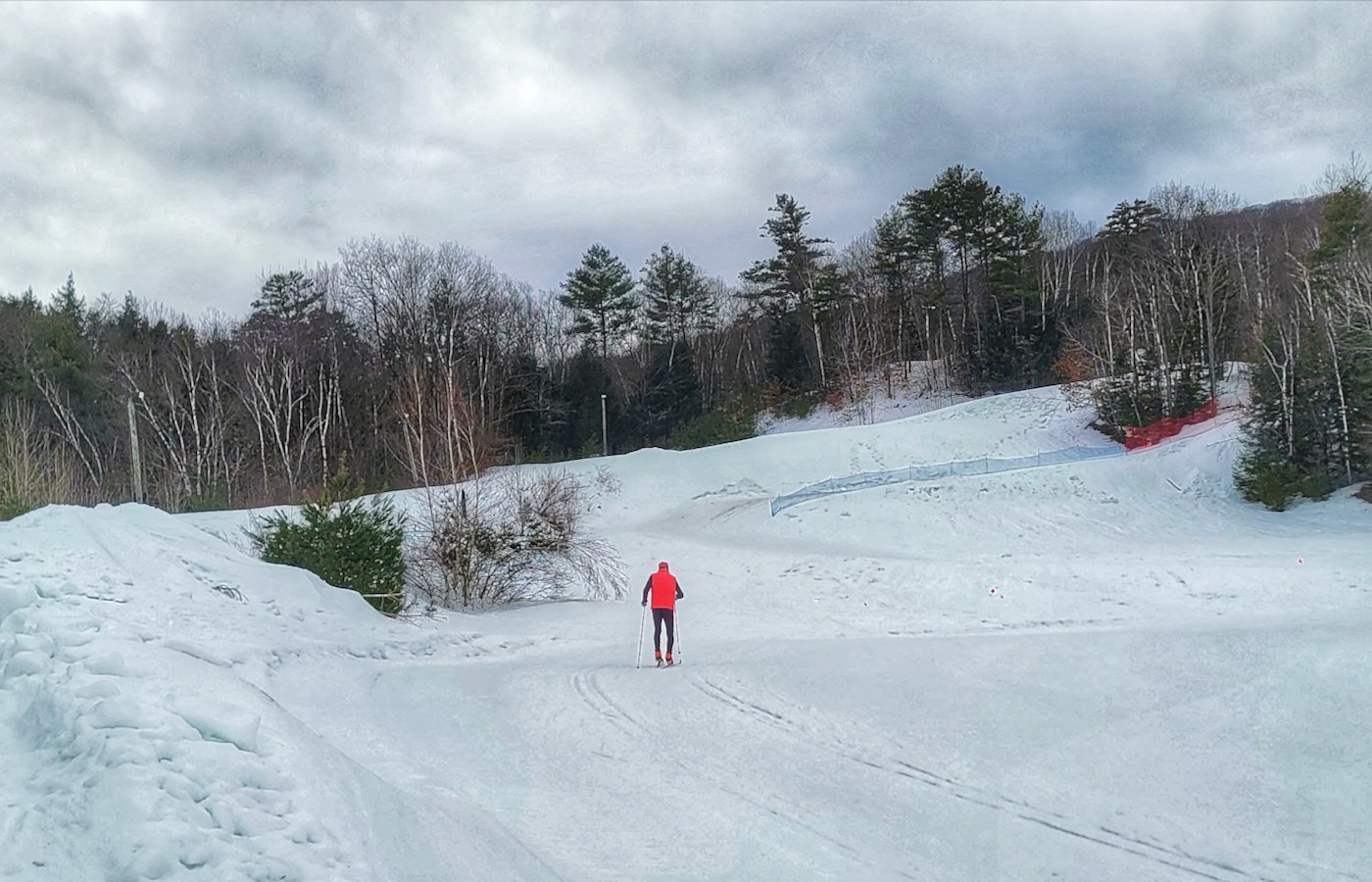
Clipping into my skis, I skated away from the Ski Bowl lodge in the direction of the race route. While their was plenty of snow, the trail was beaten up from heavy use. I went up the first gentle grade, then downhill, and made the looping left on to Gore’s A climb.
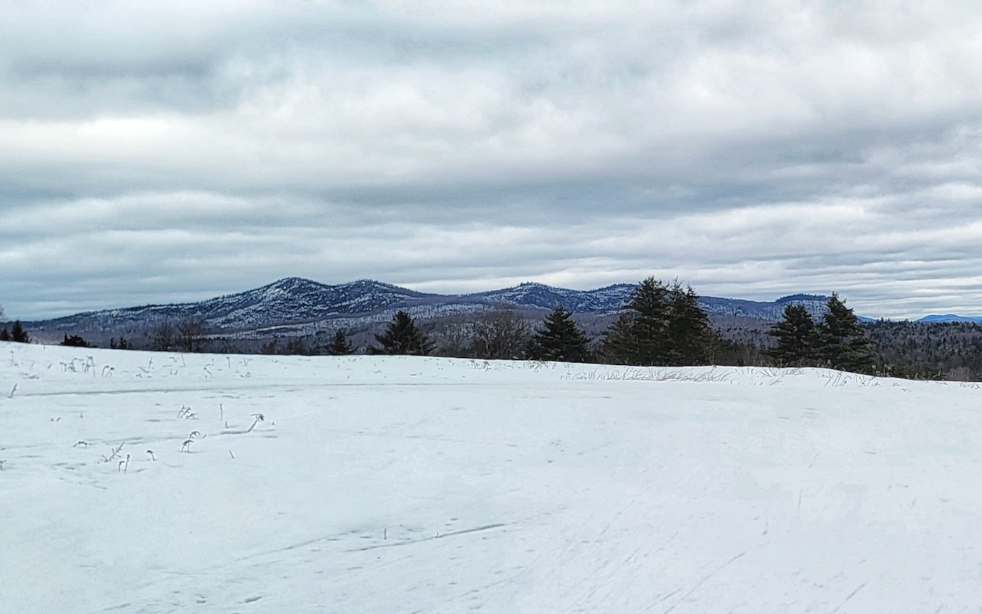
After a steady diet of the Ho’s comp trails, Gore’s A climb wasn’t the gut punch it used to be when I raced here. With a 26-degree grade, the last five meters is still humbling. I skated over the top and out to Three-pin. This rolling section lets one recover from the A climb and has great views to the north. You make a hairpin turn and the trail ramps uphill. Not as steep as the A climb, but it will get your attention as you head back into the woods.
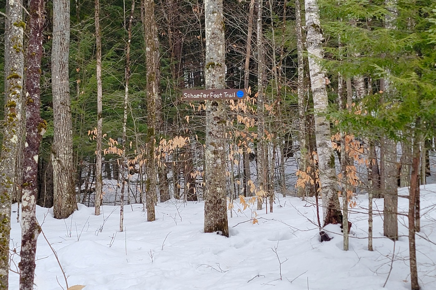
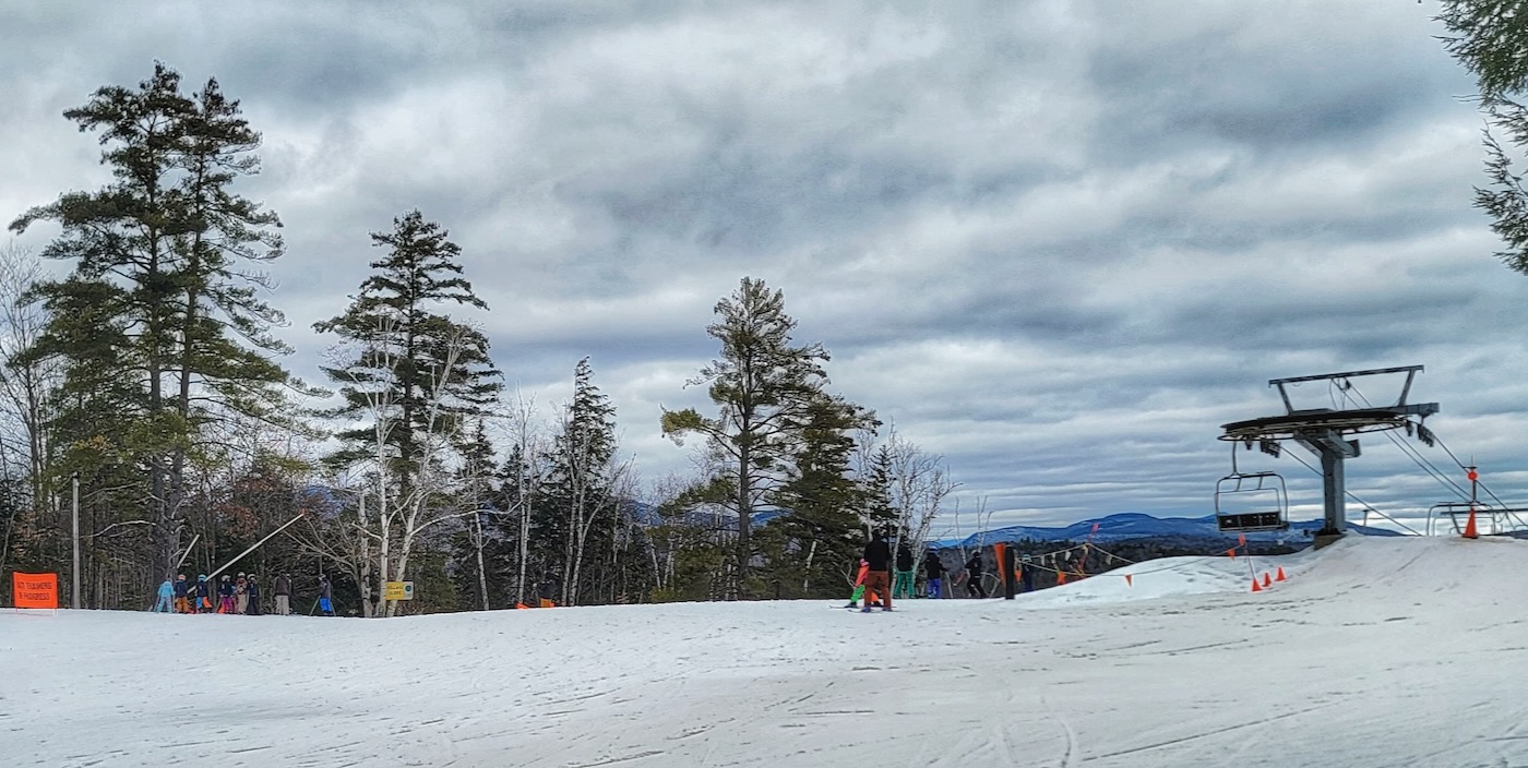
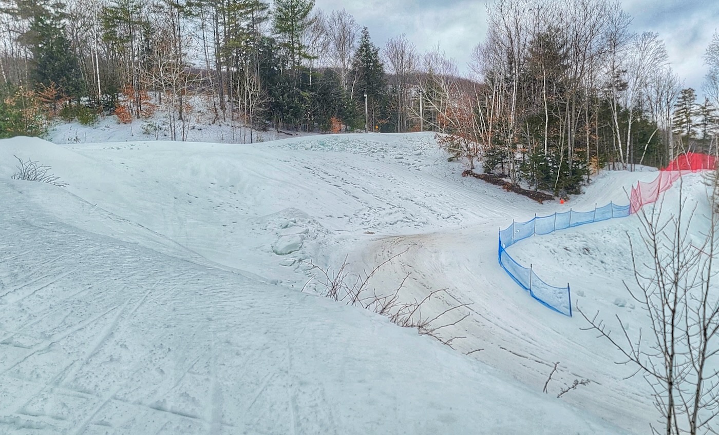
I crossed the Schafer trail, the hiking trail to Gore’s summit. Then I merged with — I think — the Peaceful Valley alpine trail. You’d best believe that I stayed far right with skiers and boarders zipping past me. A snow fence would be useful here. At the top of the Village chair, there was an orange banner, Race Training in Progress. Skiers were disembarking the chair and sending it. One kid dropped in on one ski, holding the other. Balance training pays off.
I stayed right to head downhill. With all my time on the Ho’s comp trails, I’ve gotten better and more aggressive at descending. But Gore’s big drop is a law unto itself. There’s a quick, steep slope at the top, and two crankin’ 90-degree corners close together. With mashed potato snow in both the apexes, the first corner ate me up on my first trip down. The second 90-degree turn throws a lot of G force on you. It’s narrow, with a tight line. But if can carry speed, momentum will take you halfway or more up the next hill.
Unfortunately, Gore eliminated the final section of the original nordic loop. The B climb and following descent are no more. Unconfirmed scuttlebutt has it that management viewed intermingling nordic and alpine skiers as a safety issue. IDK, I don’t recall any near misses with alpine skiers from my races there. These days, you’re routed to the right, down to the flats by the lodge. More mashed potatoes challenged me to keep upright there, and threw up a wake like a speedboat.
Along with a couple of laps down low, I put in three more laps on the comp trails. I got better on the descent; why it’s not rated most difficult is beyond me. There were only a few other people skiing nordic, but seeing all the alpine skiers ripping it up added plenty of stoke.
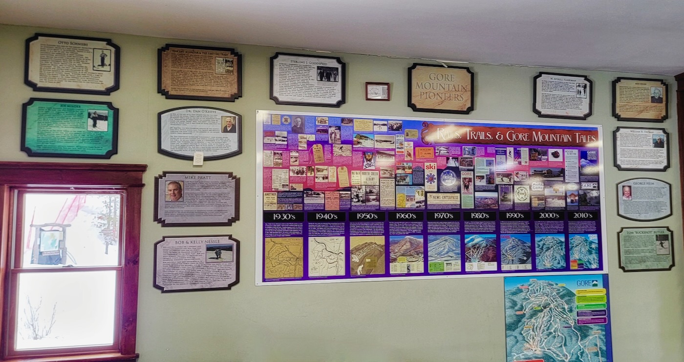
In the Ski Bowl lodge, I scoped the wall devoted to Gore’s rich history. This is something that Mount van Ho’s lodge desperately needs. I changed and repaired to Izzy’s (strongly recommended) for a late lunch before returning north.
The ski bowl has been great for a quick exercise routine and usually has good conditions. Wednesday night citizens races also fun. Garnet Hill also has had the best conditions around for the most part. I am a local.
Route 28 is definitely funky. It goest northeast from Route 12 through Old Forge to Blue Mtn Lake and then it goes south east from Blue Mtn Lake towards Warrensburg. So 28 North starts off Route 12 and ends in at Route 9 north of Warrensburg, making an arc. I could never figure out why I was going north on 28 out of Warrensburg and it was actually called 28 South. Since I usually come from the west, it made more sense going north on 28 to Old Forge. I had to look at it on a map to figure it out. Theoretically it should change names/directions in Blue Mtn Lake but it doesn’t. I often wonder why north starts from the west and not from the east. Glad you got some xc skiing in. I may go to PA to xc ski this weekend and hit Camelback on Monday since they got some real snow there.
Route 28 has another life in the Catskills, beginning at the NYS Thruway at Exit 19 in Kingston, NY. It provides a transportation link to many, current and now defunct, ski areas in the Catskills in addition to those in the Adirondacks.
Pete’s confusion with Rte. 28’s direction is well founded as the highway forms a large “C” shape of about 280 miles in length. So, the Route is both East-West and North-South.
The Adirondack route is an older road dating back to the late 1920’s and served as a link from the North Creek rail station to Sagamore lodge.
Near Kingston, Route 28 is predominantly East-West, turning Northwest after Margaretville and due North by Oneonta before briefly overlapping with Route 12 between Barneveld and Alder Creek, north of the NYS Thruway. It appears to have been built later in the 1930’s as a scenic byway.
Wikipedia has a nice map depicting the “C” shape of Route 28.
Some links besides Wikipedia provide further details:
eastcoastroads.com
adirondackalmanack.com
https://www.dot.ny.gov
Mike
Nice write-up. Too bad about the lack of snow. Phil Brown (ADKexplorer) recommended Whetstone Gulf in such years. Road trip!