
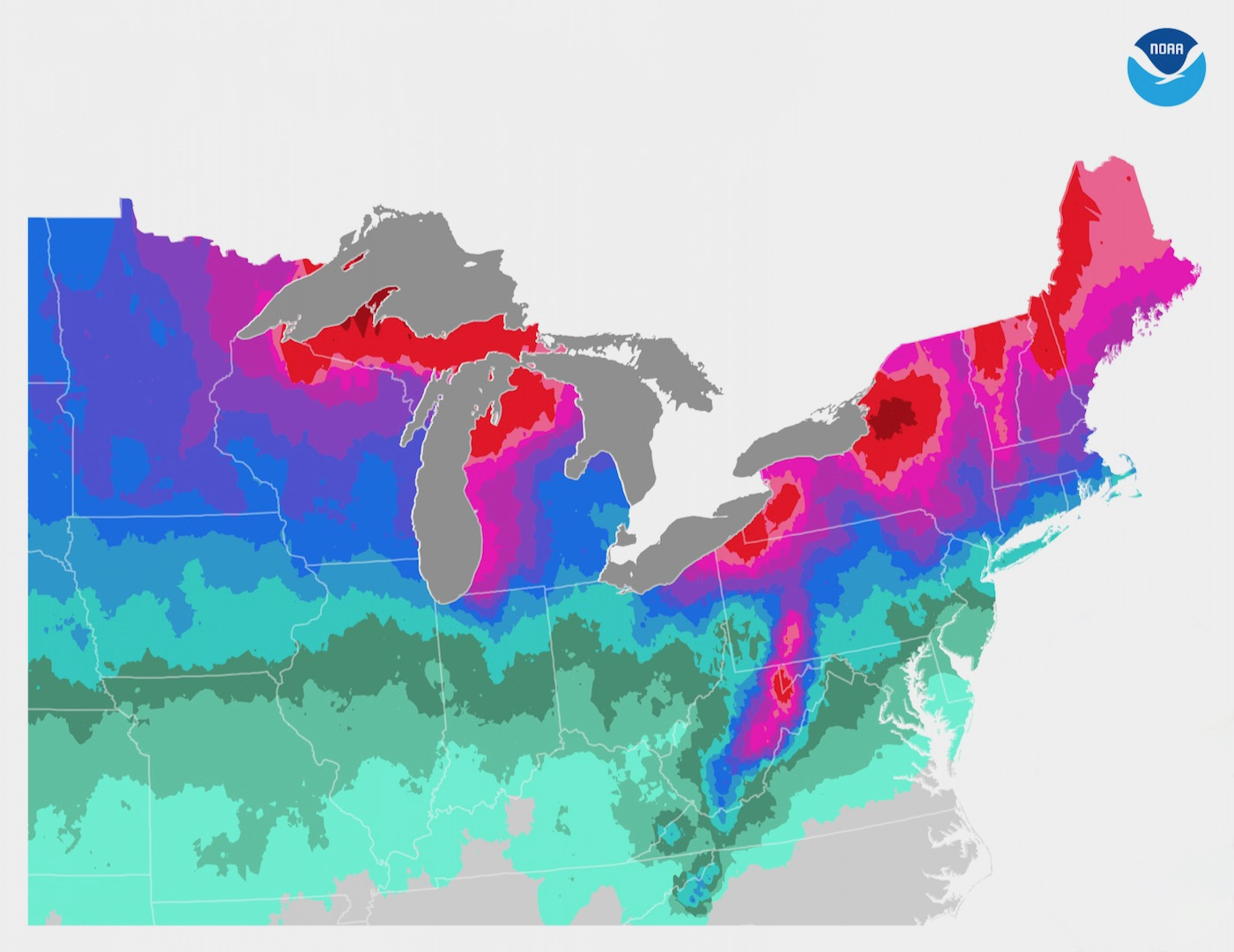
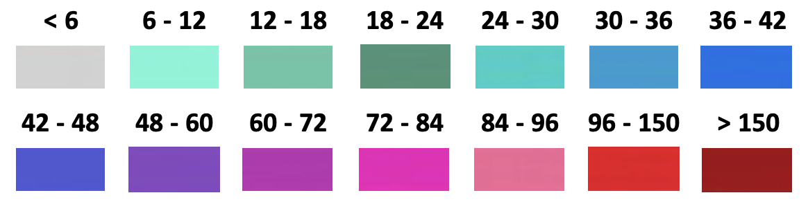
Great Lakes snowfall is dramatically influenced by lake effect snow. Common across the region during the late fall and winter, lake effect snow occurs when cold air from Canada moves across the relatively warmer open waters of the lakes. As the cold air passes over the unfrozen bodies of water, warmth and moisture are transferred into the lowest portion of the atmosphere. The air then rises and clouds form that grow into bands that can produce 2-to-3 inches of snow per hour.
As the lake effect snowfall map shows, wind direction is a key component in determining which areas will receive the most snow. Heavy snow may be falling in one location, while the sun may be shining just a mile or two away. The physical geography of the land and water is also important. NWS meteorologists consider all these factors when forecasting lake effect snow.
Even late in winter, the lakes often have no icepack in the middle. Lake Erie — which provides snow to Western NY Ski Areas — is the shallowest of the lakes and often freezes over by February, shutting down the lake effect for those ski areas.
Lake effect snow can be very localized. Lake effect “snowbelts” receive regular snow fall from this localized weather pattern, especially along the eastern shores of the lakes. Snowbelts are found in Wisconsin, Michigan, Ohio, Pennsylvania, New York, and Ontario Canada.
Sources:
• www.ncdc.noaa.gov/
• www.weather.gov
• en.wikipedia.org