
Low pressure moved north from coastal North Carolina to Long Island on Wednesday, December 16th and into the early morning hours of Thursday, December 17th. Abundant moisture was lifted over a dome of cold air over the Northeast, allowing snow to spread into eastern New York and western New England during the afternoon and evening hours of the 16th.
Heavy snow bands of 1 – 2″ per hour were common in this early stage. The heavy snow bands slowed their northward progress and pivoted, resulting in incredible snowfall rates of up to 6″ per hour after midnight on the 17th through the late morning.
Impact on New York
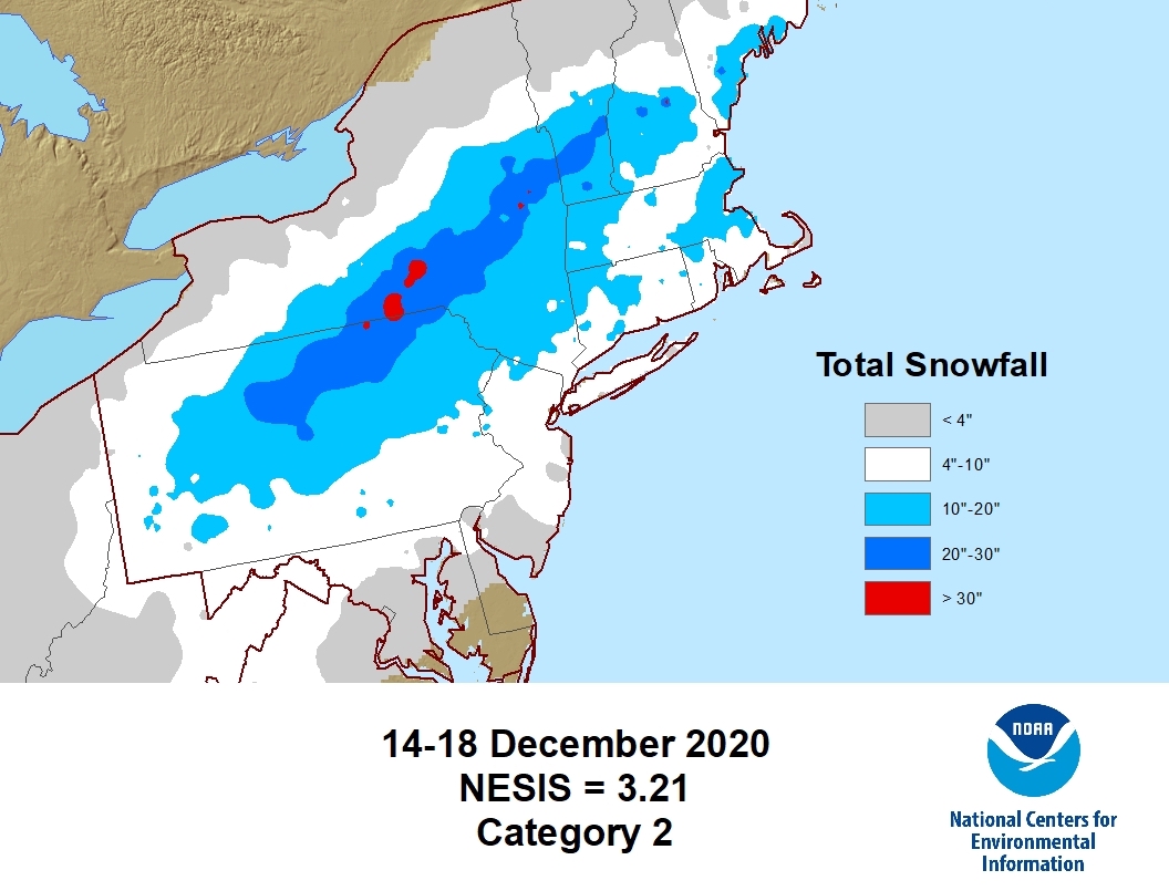
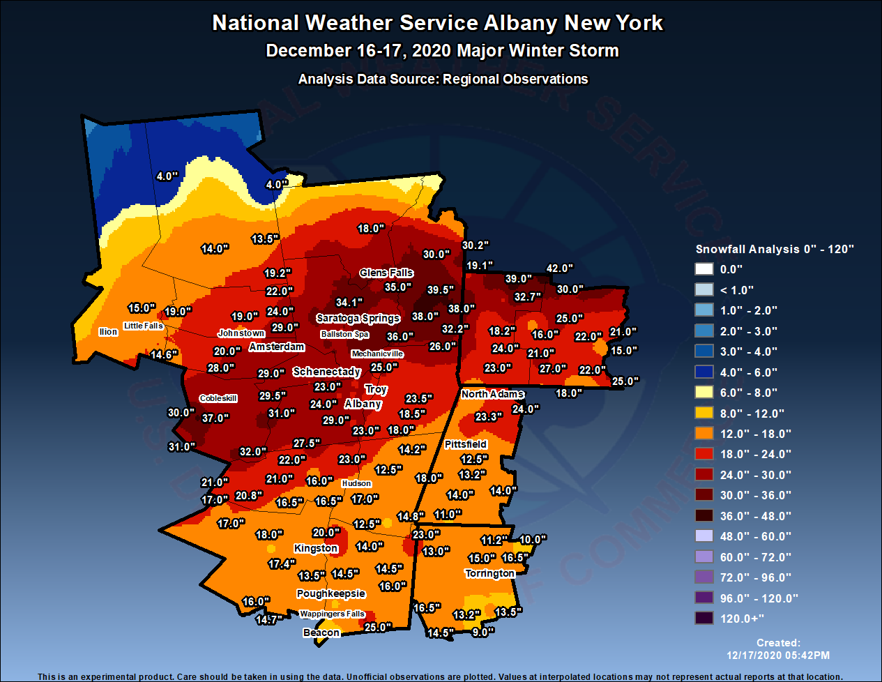
The December 2020 Nor’easter — named “Winter Storm Gail” by The Weather Channel — had a dramatic impact on New York. A swath of very heavy snow fell across Schoharie, Schenectady, Saratoga, southeast Warren, Washington, and northern Bennington Counties. Snowfall amounts of 2-3 feet were common in these areas before the snow ended around noon on the 17th.
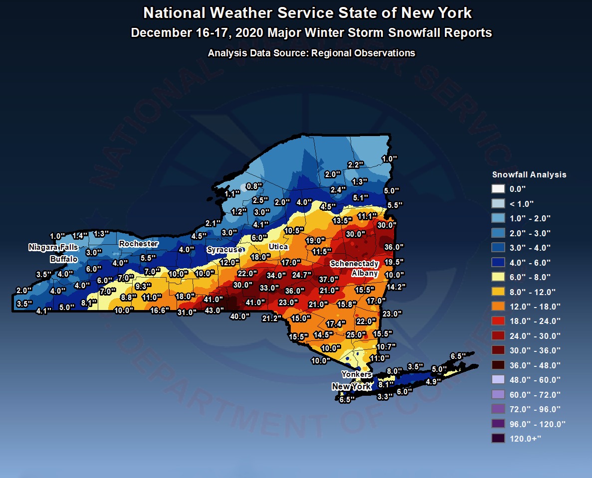
Elsewhere in the region, snow amounts of 1-2 feet were common most places aside from the southern Adirondacks which was on the edge of the storm. Officially, 22.9″ was measured at Albany International Airport, making this storm the 8th largest snowstorm on record at Albany, and the 4th largest in December.
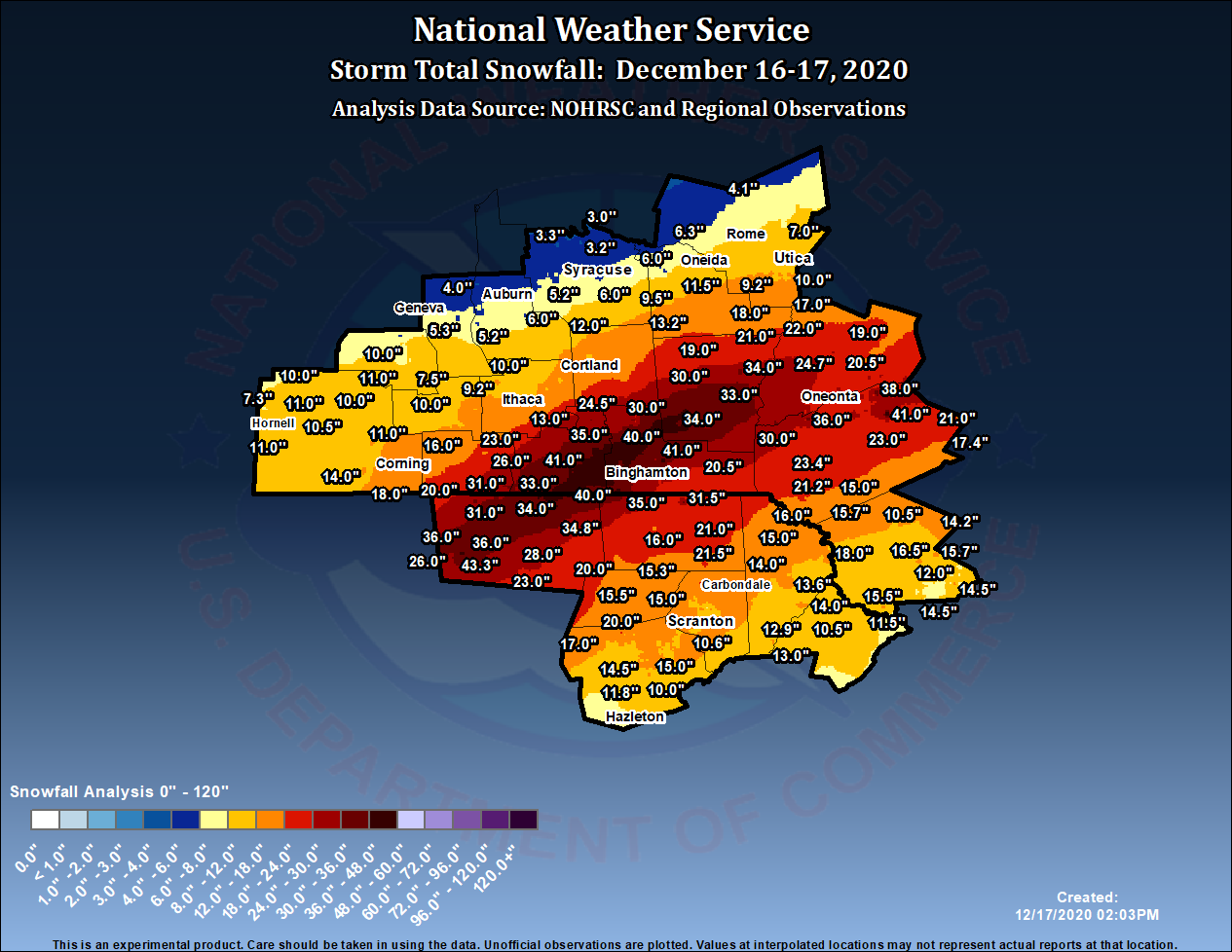
The NWS county warning areas most effected by the storm were Albany and Binghamton. Maps were produced with regional observations.
Sources:
• www.ncdc.noaa.gov
• www.weather.gov/aly/