
In the Adirondacks, fall is a special time. The bugs have disappeared, it’s comfortable outside, and the trees in the valleys turn a brilliant mix of yellows, oranges, and reds. It’s a great time to hike and sightsee, and crowds make their way to Lake Placid and the surrounding areas to witness the most beautiful time in the Park. Nearby hikes and High Peak summits become congested, which, for a reclusive slide climber is less than enjoyable.
The ideal plan for the weekend was to climb a low elevation mountain that also had a slide. This way, we could avoid crowds as well as have exceptional views during peak foliage.
Not many mountains that are under 4000’ in elevation have slides because of their low-angled slopes — and I didn’t want to repeat a climb from past endeavors — so we decided upon a remote bushwhack to Moose Mountain, which lies northwest of Lake Placid and reaches 3898’ elevation.
A small slide is located on the mountain’s northwestern aspect, creatively named “Moose Mountain Slide.” Unlike the last undertaking on Santanoni, this slide would be an arduous ski descent due to its remoteness and terrain, so the objective was to just have a memorable hike during the best time of the year.
The night before our hike, my brother and I slept in our Subaru at Moose Pond, a small clear lake in the McKenzie Range Wilderness. We were with our best friend Abe, who’s no stranger to bold endeavors, having climbed the infamous Trap Dike with us a few years prior. He slept in a tent at one of the multiple primitive campsites that lined the shores.
Luckily for us, he snagged the best site there, on a small peninsula that would make for a great paddle to our starting point the next day. The forecast was calling for blue skies and temperatures into the 70s, extraordinary conditions for October in the Adirondacks.
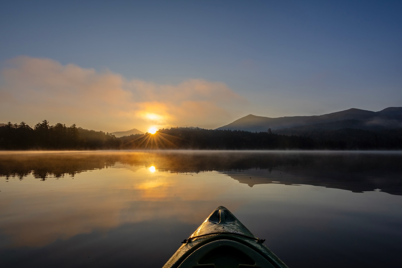
In the morning, I awoke to my alarm which I had set to a half hour before sunrise. My plan was to hike the short distance over to Abe’s site, kayak across the pond, and watch the sun rise over Whiteface and Moose Mountain. It was undoubtedly the best sunrise I had seen this year. While Moose Mountain and the McKenzie Range lay in shadow, the rising sun illuminated Whiteface from behind while the mist from the pond lit up like gold smoke across its surface, an awesome sight.
After paddling back to the campsite, Bailey and Abe were already up preparing for the day’s journey making breakfast and packing. By nine, Abe and I started the short paddle on our kayaks to the starting point on the east side of the pond where we would meet Bailey, who had to hike around since we couldn’t fit three kayaks on the car.
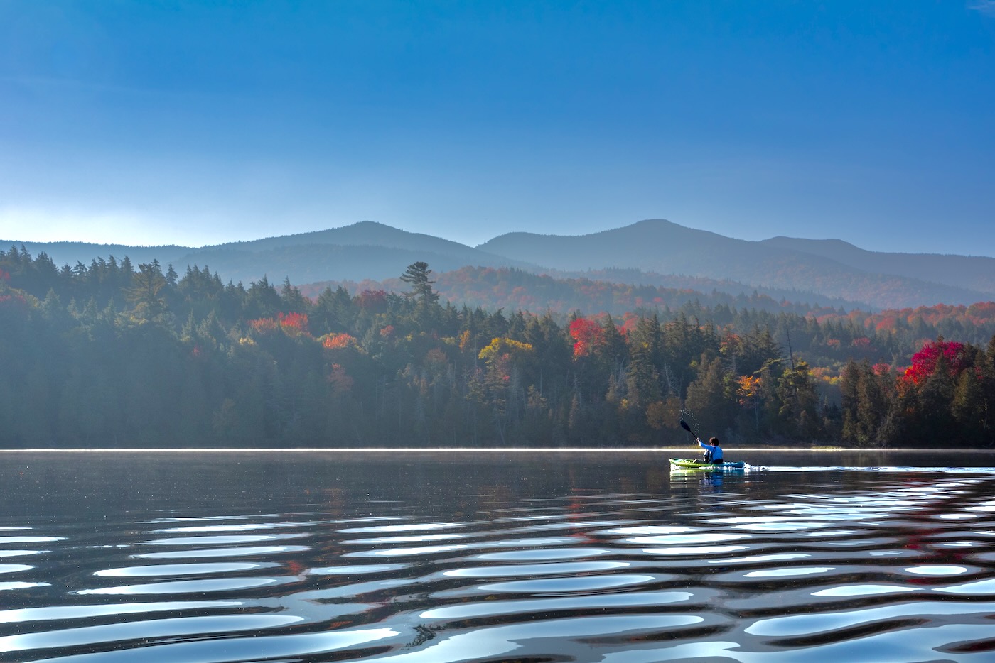
The temperature was in the 50s, but the sun’s warm rays along with paddling kept us in t-shirts and hiking pants. As forecast, there wasn’t a gust of wind. The reds and yellows along the shoreline looked picturesque.
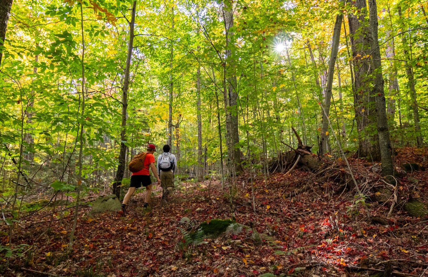
Within ten minutes, we beached ourselves on the eastern shore where Bailey was waiting for us. After marking the location on my GPS, we began our bushwhack towards the slide. The forest consisted mostly of open hardwoods, so it was already leagues easier than navigating through the tight krummholz in the alpine of higher peaks.
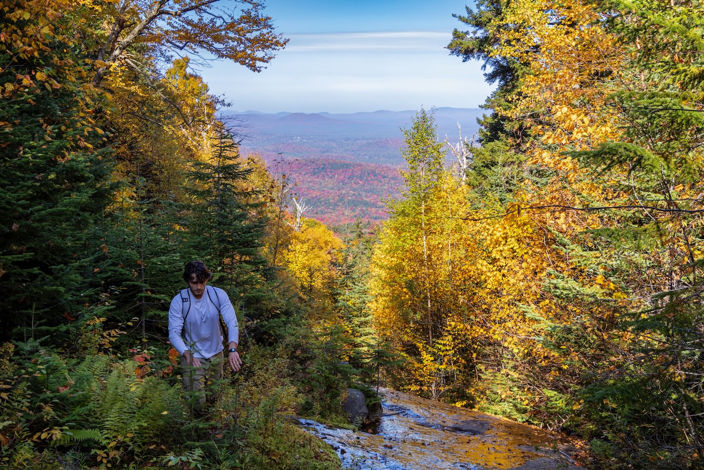
Since we weren’t following a trail, the going was a little slow, but this far outweighed being stuck behind unprepared hikers on one of the Forty-sixers. I attempted to keep us on a straight path towards the slide’s drainage by constantly checking the GPS, which proved difficult with the rolling terrain in the shadowed forest.
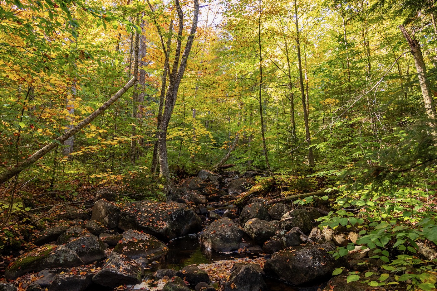
It wasn’t long before we came upon our first of many stream crossings, which we leisurely hopped across. Leaves blanketed the ground and crunched under us as we trekked along. The fragrant smell of fall engulfed us every second of the bushwhack. For a while, we followed faint deer paths as they disappeared and reappeared, all the while trying to stay on course towards the slide’s drainage. I took the lead, constantly surprised by cobwebs and slippery logs as we made our way.
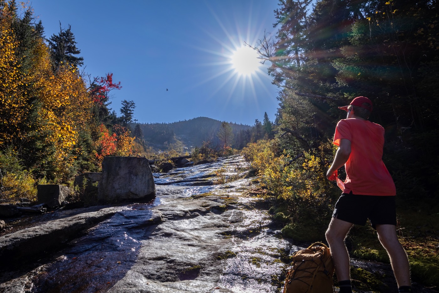
Around forty-five minutes in, we arrived at a large brook and decided to refill our water and have a short snack break. This brook would serve as our grueling descent later on in the day. After a lackluster hike through the shadowed forest, we began to ascend a small hill that I thought might give us a glimpse of the slide.
Unfortunately once at the top, the only thing it gave us was a pungent smell of a bear or moose marking their territory. This was soon confirmed because not long after we ran into the feces of what seemed to be a juvenile black bear. I would have loved to see a bear and possibly get the chance for a photo, but my companions thought otherwise.
After a short descent of the hill, we quickly approached the slide’s drainage at approximately one and a half hours into our hike. It was nothing more than a small brook covered with moss and leaves. Several log jams averted us into the neighboring woods. As we gained elevation, the red valley behind us began to appear; only a taste of what was to come.
Before long, we reached the slide proper at 2845’ in elevation, exactly three miles into the hike. A short snack break ensued, and as I stood there glaring up at the slide, it became apparent that this climb was going to be a lot different than the Autobahn. Not many slabby sections were noticeable.
The slabs that I did spot were in the shadow and covered with red slime. Most of the slide seemed to be a mixture of rubble and dirt patches. There were also “islands” of trees/brush scattered about the landscape that have had time to grow in since the landslide occurred, a clear indicator that it most likely formed during Hurricane Irene or earlier.
As we began to climb, I couldn’t help but notice the abundance of birds in the area. They were constantly flying overhead from tree to tree. Every twenty feet or so we would notice bird droppings splattered into the rocks. I had never seen bird activity like this on a slide before, so we had to be careful where we placed our hands! The ascent was slow going since the rocks beneath our feet would constantly give way and come crashing down beneath us. As we increased in elevation, the slope steepened to the point that some of the rocks would barrel down hundreds of feet until smashing into boulders that created a cloud of smoke. We climbed beside each other to avoid any accidents.
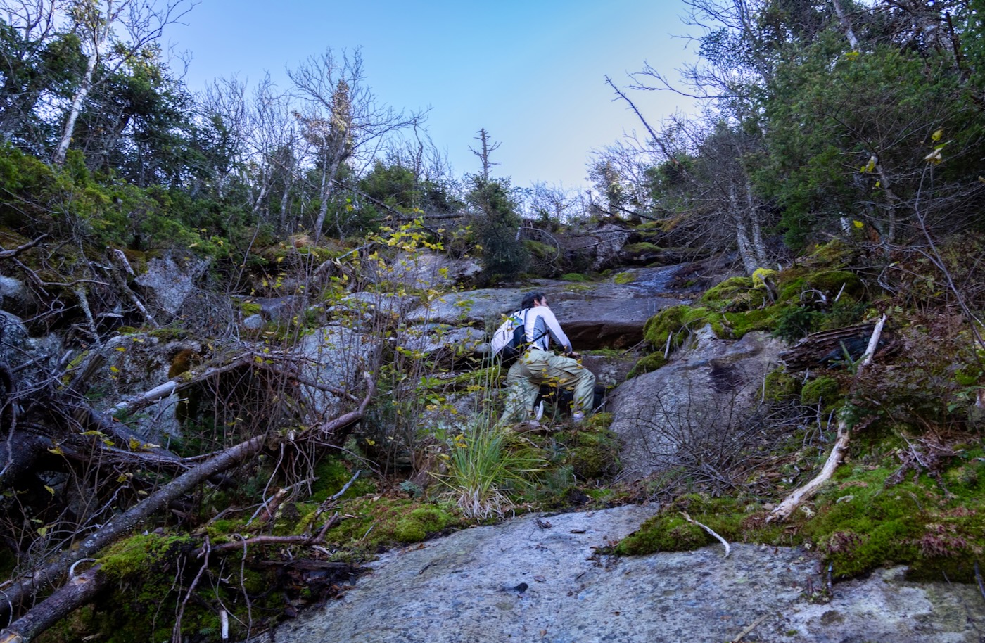
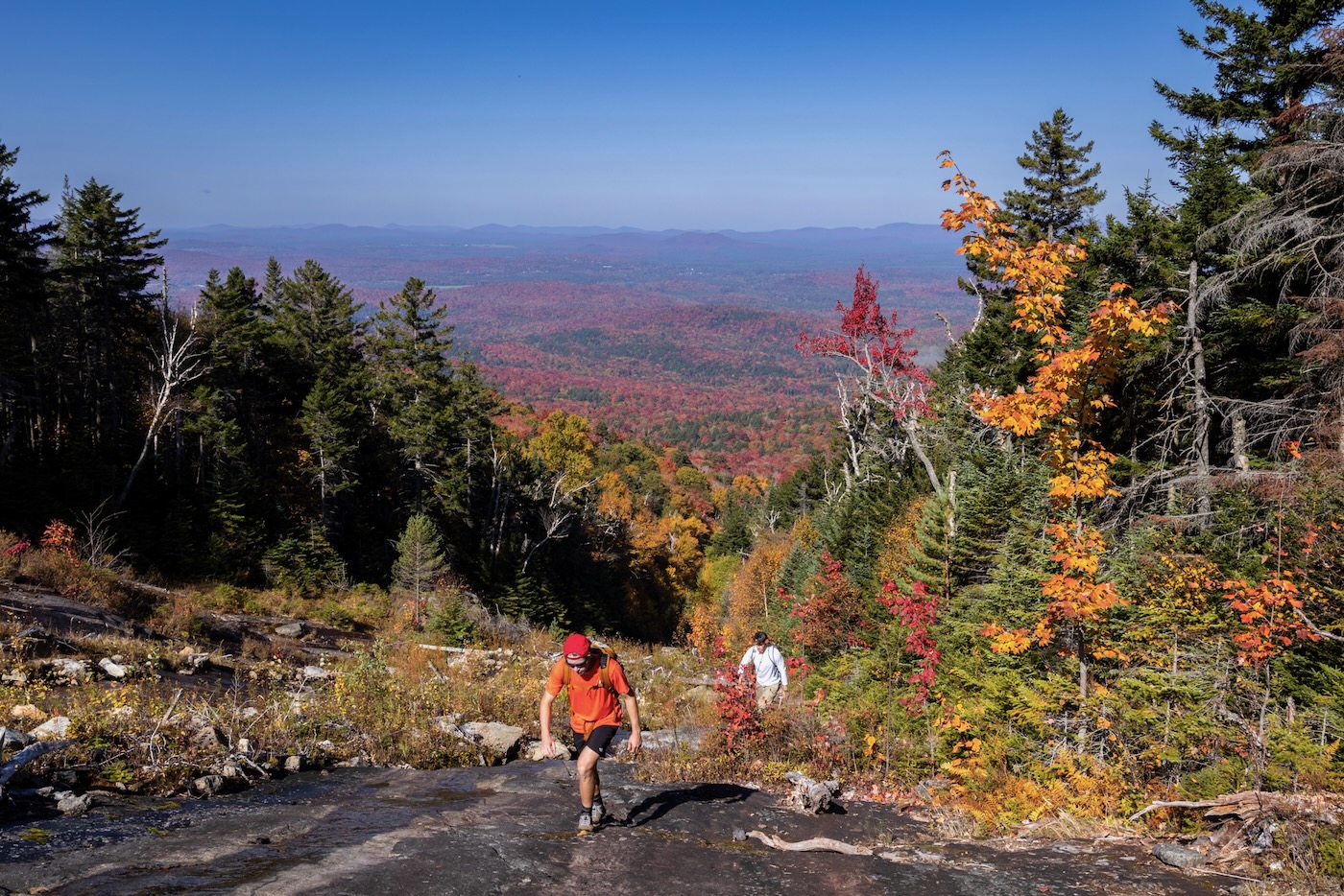
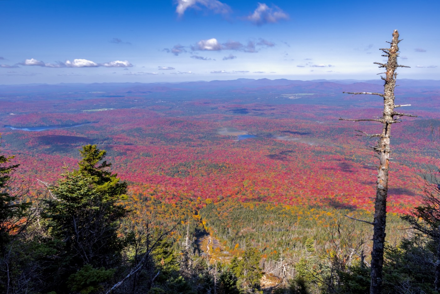
Every so often I would glance behind me to see the landscape. The valley of colors was stunning; like a sea of red with specks of orange and yellow mixed in. Combined with the bluebird sky, it was very tempting to turn around every minute or so and gaze at the scenery. Before I knew it, we were closing in on the headwall, which featured a very steep section of mossy, wet ledges of anorthosite that proved unclimbable after multiple attempts. Instead, I stuck to the trees on the left and hurriedly made it to the top of a wide, flat ledge. Joined by my companions moments later, we had finished the climb at an elevation of 3800’ and three and a half miles from where we began our day at the kayaks.
The view was spectactular as expected. With little wind and high visibility, it was like looking at a painted landscape. The abundance of autumn colors seemed stretched for miles. I felt very grateful to have shared the moment with the people I’m closest to. From reading online reports, I knew the summit wouldn’t have much of a view since it rests below the treeline, so we took our time to relish the moment.
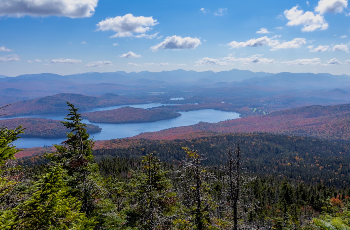
Like most other slide climbs, we now had a short bushwhack to the trail. The birch forest was not as thick as expected, so within five minutes we exited onto the narrow trail. The summit was less than a quarter of a mile to the left, and after a brief walk we had made it to the marker-less summit at 12:35pm, roughly three and a half hours since we had beached the kayaks earlier that morning. The only view was from a small lookout that offered a unique glimpse of Lake Placid. I could see many boaters going for one last cruise under the sunny sky on this superb weekend.
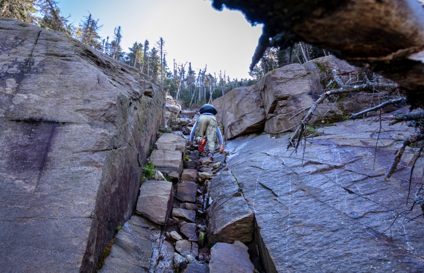
Following a short lunch and discussion of the torture that awaited us, we headed back down the trail until we reached a drainage to the west of the slide. This was going to be our descent route since there was no trail that led back to the pond. An exhausting hike preceded through dense forest accompanied by a grown-in talus field covered with moss and filled with spruce traps.
A fair amount of expletives and shrieks were shared as our feet would unexpectedly plummet into the earth below. It wasn’t until we got much farther down, that the drainage formed a small stream and eventually into the brook that we came across hours before.
Once we reached the brook, it was just a matter of retracing our steps and keeping a close eye on my GPS so that we didn’t wander off course. Finally, after over seven miles of bushwhacking, we concluded our day at the kayaks at 3:30pm. This journey will undeniably live in my memory as classic “Type 2” fun that couldn’t have been more perfectly timed.
Paddle-Shwack-Climb. Love it! This is a first class NY adventure.
What an adventure! Great photos too.
Gorgeous “Russ”!
Great job! My dream is to do the same route you took but in winter; skiing in as much as possible.
What a great adventure. Sounds like a super trip. Outstanding photos too. Nice work.
I tried this, about the same time of year, in 2016. I canoed across the pond, hiked in and camped near the bottom of the draw you descended. Then, next day, in the pouring rain, I summited via that same drainage. I need to actually find the slide next time. Only benefit, I heard the lonesome whistle blow, perhaps one of the last times that train ran. In winter, another potential access may exist from near the forest boundary…Good report. Thanks