
After two weeks of shuttling back and forth between states, I’m finally settled in my new place in Saranac Lake. It’s still unsettled, as I have more books than shelves. As many guitars as chairs. That can be easily rectified with the acquisition of additional guitars. Fear not, gentle reader: I have more skis in than guitars. I’ve set up the wax station in the basement.
Although the weather was sketchy, I’d be returning to NJ for band practice for the weekend. Wednesday seemed the day for an excursion to Big Crown and Little Crow mountains in Keene. Early October in the Adirondacks isn’t as benign as back in NJ. In the morning, I frittered away time rooting around for micro spikes, mitten shells, and other items that would come in handy above treeline.
On Hurricane Road, I drove back and forth looking for a trailhead that had been there 20 years ago. Finally, I gave up and drove up O’Toole Lane, a dirt road that meandered uphill to a little parking lot. I double checked my ADK guidebook. The Hurricane Road Trail head should have been there. My guidebook is 11 years old. Perhaps landowners had revoked access across their property to DEC land.
From O’Toole Lane, the Crows were just a mile away. Instead, I chose to hike Hurricane Mountain. At 3694 feet, Hurricane isn’t one of the 46 High Peaks. However, with a bare summit, views abound in all directions. I’ve hiked Hurricane from Route 9N a couple times; this would be my first trip heading there from the north.
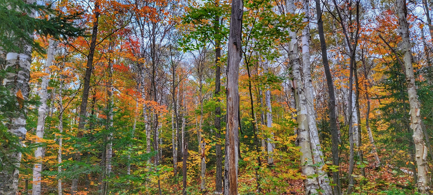
Heading into the woods, the trail was easy going. Covered with pine needles, it was wide enough in places that it may have been a road at one time. Although autumn was past peak, there were still some nice displays of color.
At 1.1 miles in, I veered right and crossed Gulf Brook. It’s a wide, fast-moving body of water, without stones placed for an easy crossing. Had I not found a nice-sized downed branch for balance, I might not have made it without wet feet. I left the branch at the other side the brook and continued.
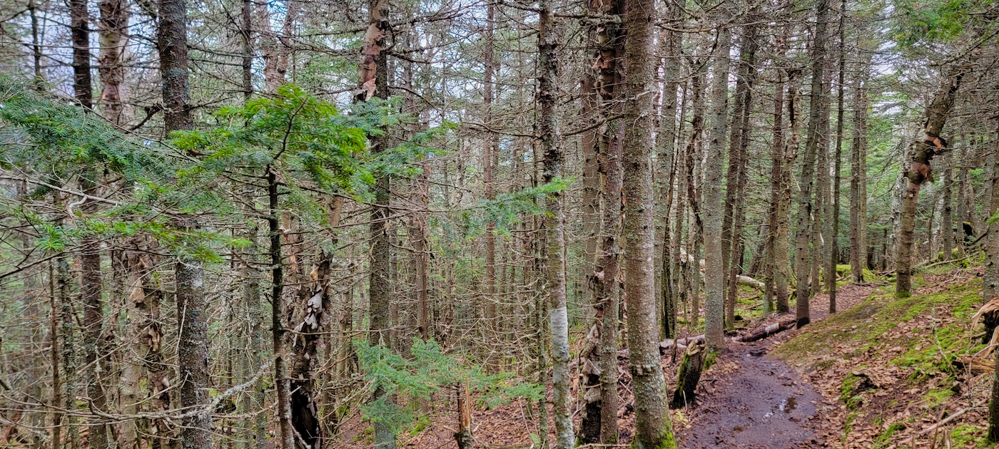
After another half mile, the trail kicked up steeply. The guide book characterizes this approach to Hurricane as easier than coming from Route 9N. Perhaps it’s the lack of a lot of time in the Adirondacks in the last few years, but I beg to disagree. I clambered over rock ledges and picked my way over roots. The trail just seemed to continue going up and up.
Birches and maple trees gave way to evergreen dominance as I gained elevation. The constant breeze that had blown all day grew stronger. Finally, I came to the junction with the trail from Route 9N. Another three-tenths of a mile, and I’d be there. The final push was easier going than what I had climbed from Gulf Brook.
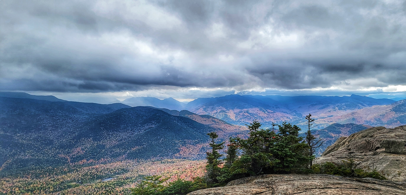
The trees receded, and trail markings changed from red DEC disks to yellow paint blazes on rocks. I went around a corner and up a last rock step, and I was on the summit dome.
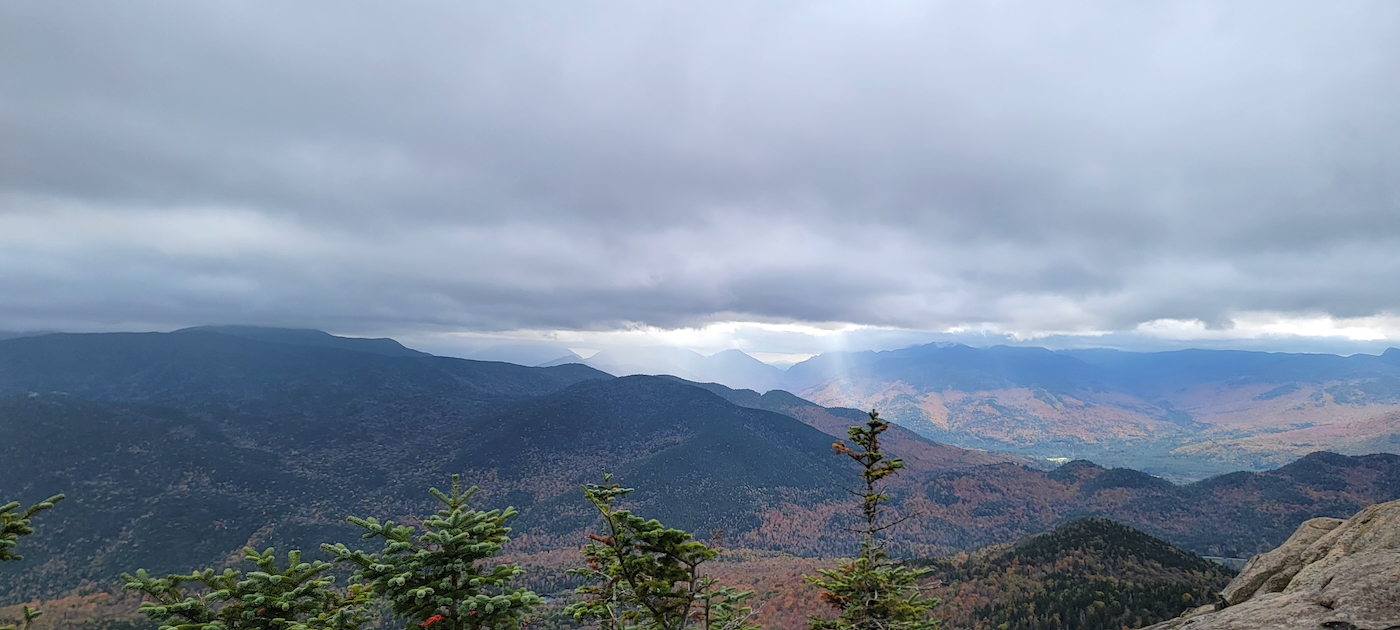
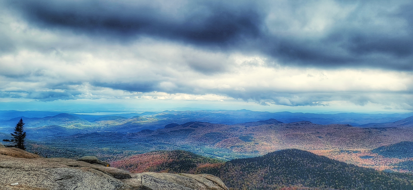
The wind gusted hard and I put on almost everything that I brought with me before walking the last few hundred yards to the summit. Low clouds obscured the summits of the high peaks to the west. Lake Champlain lay east, with Vermont beyond. On a clear day, you can see Mount Royal in Quebec, but that wasn’t happening today. With the high winds, I decided to skip climbing the old fire tower.
I stayed on the summit long enough to take a few photos and chat with another hiker who’d driven from Virginia. Then it was time to bail out.
It was a fun ramble that taught me a few things. I needed to pack warmer clothing. Mitten shells only work if you remember to pack them. On a 3-hour run, I generally only bring water or sports drink; today, I should have packed food. I can’t be casual about not having all the 10 essentials in my pack.
The place in Keene where I’d planned to get a post-hike sandwich was closed. Another lesson: up here, some businesses close mid-week due to low tourist traffic. By the time I got back to Saranac Lake, my stomach was screaming. I stopped into Owl’s Head Pizza for a couple of well-earned slices just as the sky dumped a metric shit-ton of rain. A fine end to the day.
Nice report on what sounds like a good hike and low-consequence learning experience. Note that if a shit-ton was metric, it would ne a shit-tonne.
Nice report with a personal story; you’re a fine writer!
Nice hike and photos. Thanks.
Glad you have escaped New Jersey. Should stir up some envy on the forum. Little Italy = better pizza IMO. Thanks for the report.
Great story once again, Peter. And the pics are pretty cool too, especially that last one.
Well done Peter. Robert and I are familiar with afore mentioned trails. Great hiking in that neck of the woods. We are also in a move and will be seeing more of you this winter at Prospect. Start your snow dance. The Quigleys
Home sweet home. Chapeau!
Killer opening paragraph. I love your priorities.
@capt_planit, most excellent pizza can be had in suburban NJ also. And Owl’s Head pizza here in Saranac Lake is nice.
@Robert Quigley: where are you guys moving? I will be closer to Prospect, but drive time is the same because secondary roads.
Congrats on the move, looking forward to more!