
On Saturday, I had to drop off Junior at a school far from home, and was scheduled to come back and pick him up five hours later. It was a structured academic thing so there was no way to stick around the school, nothing to watch. It was either spend that time reading a book in my car, or find something to do in Sussex County, New Jersey.
Some quick research revealed that the school was not far from the High Point State Park Monument. After failing to find my New Jersey Atlas/Gazetteer around the house I printed a trail map from the park’s website instead. As the name implies, High Point State Park is the highest point in the Garden State. Don’t be too impressed; it’s 1800 feet above sea level at the summit.
The park is one of those eastern parks that host a portion of the Appalachian Trail. It seems everywhere I turn, I stumble across more of the AT. It’s the trail to everywhere. Bonus: using the AT trailhead parking lot on the edge of the park would allow me to dodge the entrance fee.
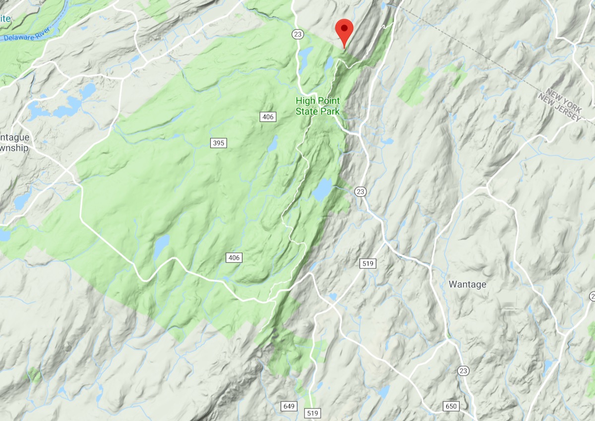
I got Junior where he needed to be, punched High Point State Park into my phone, and I was off. Twenty minutes later, I turned from Route 23 onto Route 519 and started looking for the AT parking. I found it, threw some water bottles and bug spray in a my pack and set out.
From 519, the trail climbs right away. It was a nice day for hiking, cooler then it’s been lately, still I got a good sweat going. I’m either out of shape or I still haven’t learned to pace myself, or maybe both. After a few switchbacks the trail leveled out. It was typical of maintained trails in this NY/NJ border area: hardwoods everywhere with a few conifers mixed in, rocky, with very few wet spots. Whoever maintains this section does a great job. There were a lot of white marks on trees to reassure you.
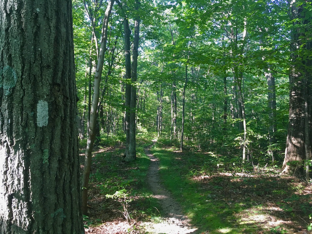
Also typical for the area, I spotted multiple old rock walls snaking their way through the woods, reminders that the entire eastern seaboard, had been deforested at one point in time. Seeing those rock walls in the forest gives me hope for the future.
When I finally came across a muddy section I slowed down to look for sign. Hoping for a bear track I came up empty with nothing but boots, deer and a dog.
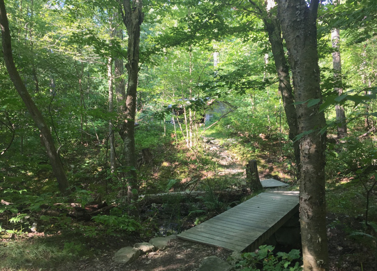
Along the way I bumped into few people, two or three with big packs and a couple day-hikers like me. I stopped to check out an overnight shelter and chatted with a through hiker eating his breakfast. After that I continued pushing on up the second steep section to the junction with the trail that would bring me the last little bit to the High Point Monument.
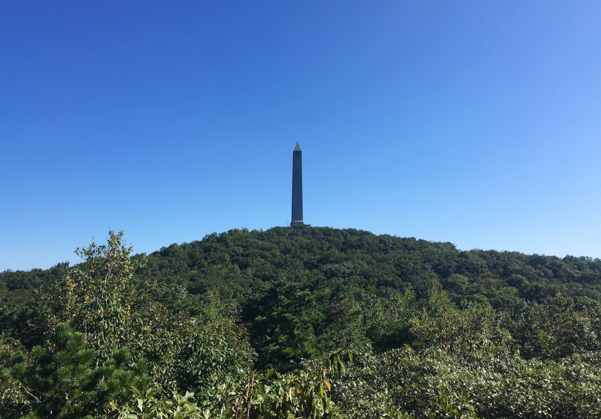
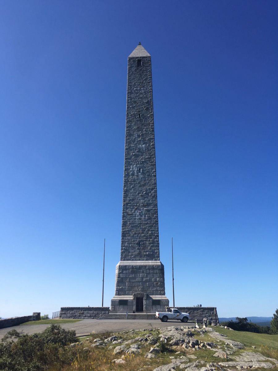
A few more twists and turns and there it was, the pinnacle of New Jersey. There is a veterans memorial — an obelisk — that is about 200 feet tall. If it were open, I could have gone inside and climbed to the top but I was early and the doors were still locked. I didn’t see anyone in the ten minutes that I lingered. The only car in the lot was a Ford Ranger that belonged to the state of New Jersey.
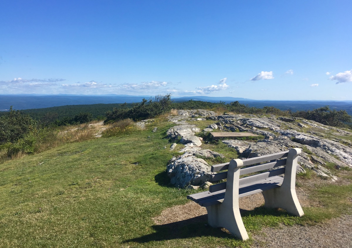
The view was great. On one side I could see Mountain Creek, New Jersey’s greatest ski resort. To the west I could see bits of the Delaware River and some of the cliffs nearby. I’m sure some of the green to the north was New York.
I headed down and was back at my car three hours after I started. I made it to the school where my son was doing his thing with enough time read to a book after all. I’m pretty sure the vert of my hike was eight hundred feet or less. Not much mileage, just a walk in the woods.
Nice piece, thanks. I’ve yet to make it to High Point and good to know about how to avoid the entrance fee.
Regarding the AT: I stumbled upon an interesting article from two years ago, about an African-American woman through-hiking it solo:
https://www.outsideonline.com/2170266/solo-hiking-appalachian-trail-queer-black-woman
I went inside the Obelisk, decided to walk up, climb to the top. It’s all open staircase, open tread stairs. I remember it’s 200 feet up, quite the experience, if you don’t like heights don’t go. Have fun.
If you like to hike do the AT you can do it in sections or all the way. NJ has a lot of great places to hike and MT bike. email me and I can tell you a few in North Jersey.
Great piece. Once, I roller skied from Port Jervis all the way up to the monument…. won’t do that again, the traffic was a bit much.
Lots of nice hiking to be had in that northwest corner of NJ.
My AT moment: 20 years ago, my friends and I hiked from the Delaware Water Gap to High Point over a weekend. My old hiking boots chose that weekend to give out and I finished Sunday night with quarter sized blisters.
Sunrise mtn, Yards creek, and Kittatinny gap cool too. My old stomping grounds.
Thanks for the comments and tips guys. Peter, you roller-skied from port Jervis to High Point? Holy crap bro. That is amazing. I can relate to the blisters though.
Yea 23 south up the mountain is steep grade in a vehicle neverless biking, hiking or roller blades
Would love to ski down 23 to PJ in a foot or two
Check out lost ski areas of NJ book
Think Roy Rogers skied NJ near High point
High Point State Park had alpine skiing and a ski jump in the late 1930s to the 1960s. I have photos of the ski jump and the alpine skiing.
Still has great cross country skiing in the park complete with a lodge and rental equipment. Some trails are groomed too!
There were 3 other alpine ski areas in Montague., NJ.
https://nyskiblog.com/connect/writers-wanted/
🙂
Thanks for the info, guys – can’t believe I missed the skiing connection. I am usually more attuned to the area’s history and actually have a book written in the 30s called “Skiing in the East”. New Jersey only gets a very brief mention but right there on page 241: “High Point Park is one of the better known centers… it includes 20 miles of ski trails and runs… also a 500 foot bobsled run.”