
This winter season has been, at times, difficult. Especially for a skiers who earn their turns in the backcountry, relying on Mother Nature to make it possible. After a March Nor’easter pummeled New York with 2 feet of snow in some places, it seemed like a fitting time to head back into the High Peaks wilderness in search of soft snow.
My friend Jack and brother Bailey and I decided upon a couple classic lines within the MacIntyre Range: Algonquin’s northeast bowl and the historic Wright Peak Ski Trail.
Our skin began at 7am at the Adirondack Loj, a popular summer trailhead which grants access to over a dozen High Peaks. It was 15 degrees and cloudy with light snowfall.
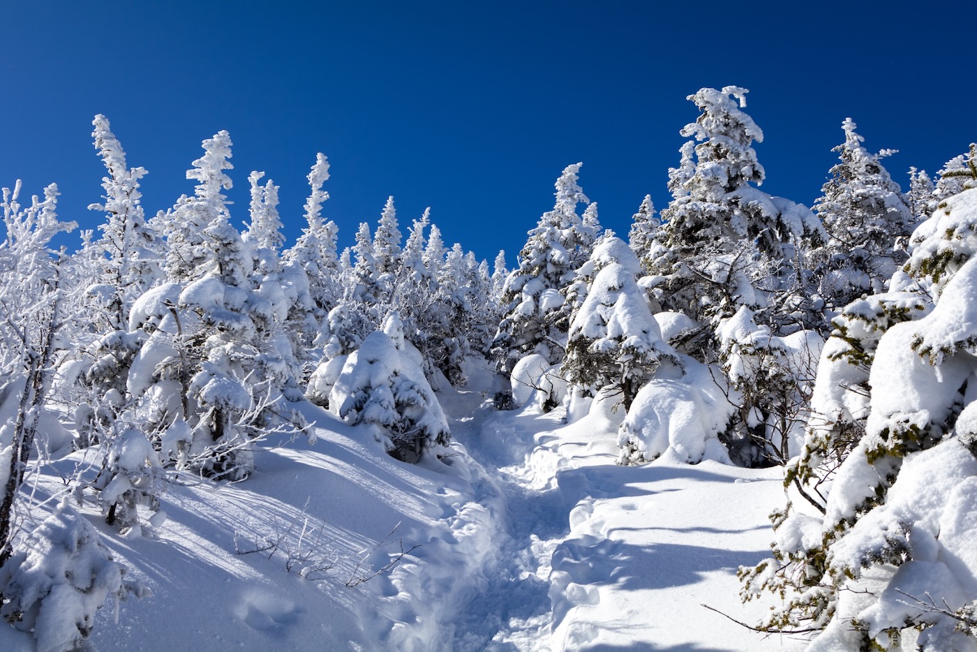
The trail was covered in enough snow to allow us to skin the entire way up, which was not the case many times this winter. The sun had risen just ten minutes earlier, so no need for headlamps.
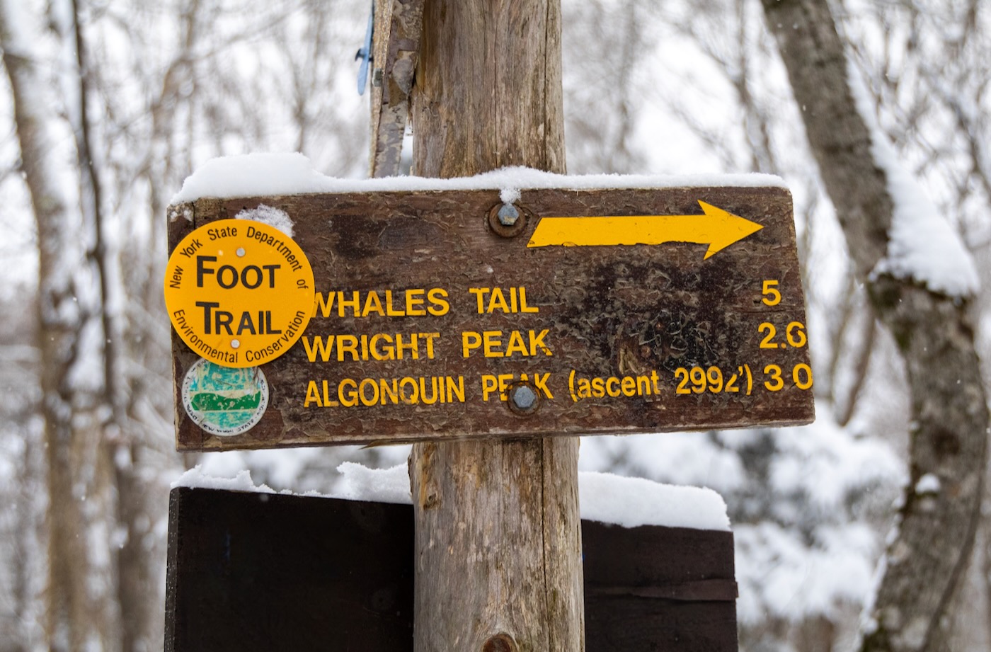
Within 20 minutes, we’d covered a mile of trail, which placed us at the intersection between Marcy Dam and the trail up Wright/Algonquin. We continued on after a short break and didn’t stop again until we reached the base of the ski trail on Wright Peak.
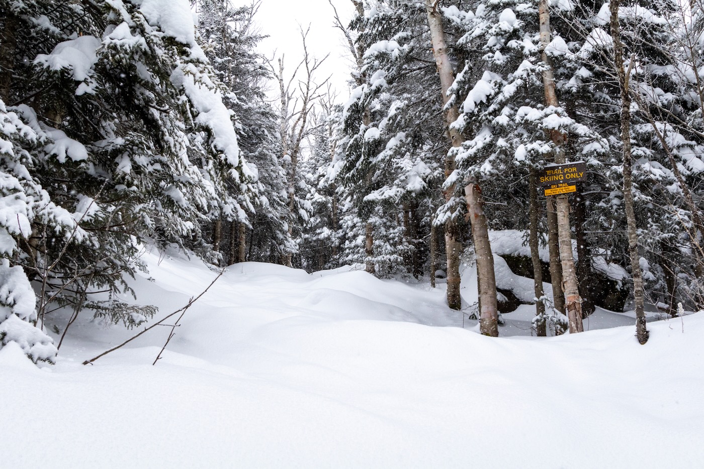
By this time, the trail had changed from a flat traverse to a gentle climb and the snowpack was noticeably deeper, maybe a foot or so. The ski trail appeared untouched since the storm had passed, so with luck we’d be able to get first tracks on the descent.
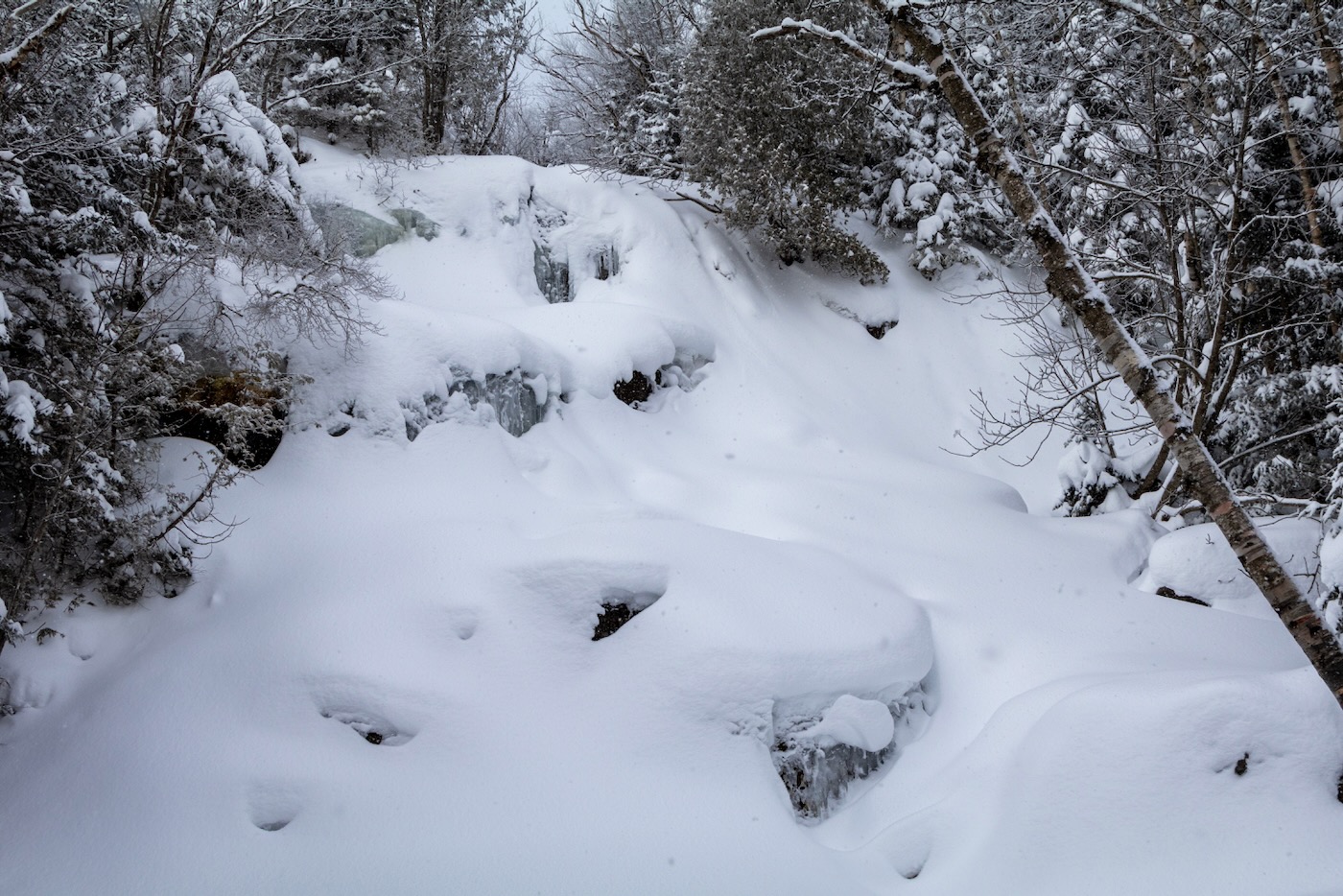
We approached MacIntyre Falls, a prominent waterfall that comes from a drainage off Wright and crosses the hiking trail. In the summer, it is a popular waterhole to rehydrate and cool off, and in the winter it looks like it could be an enticing pillow line with enough snow.
At this point in the ascent, the snowfall had diminished and there were blips of blue sky through the cloud cover. I began to feel excited. If we were under a cloud inversion and once we gained elevation the views would be phenomenal.
By the time we reached the Wright/Algonquin fork — 3 hours since our start — the sky was blue and the sunshine was intense. We were now above the inversion and awaited a break in the trees so we could see the view behind us.
As we ascended the trail, the surrounding forest was covered in multiple feet of fresh snow that reflected the light so intensely I had to put my sunglasses on. A couple snowshoers had passed us along the way, but there were no skiers or tracks to be seen, which meant fresh turns up in the bowl.
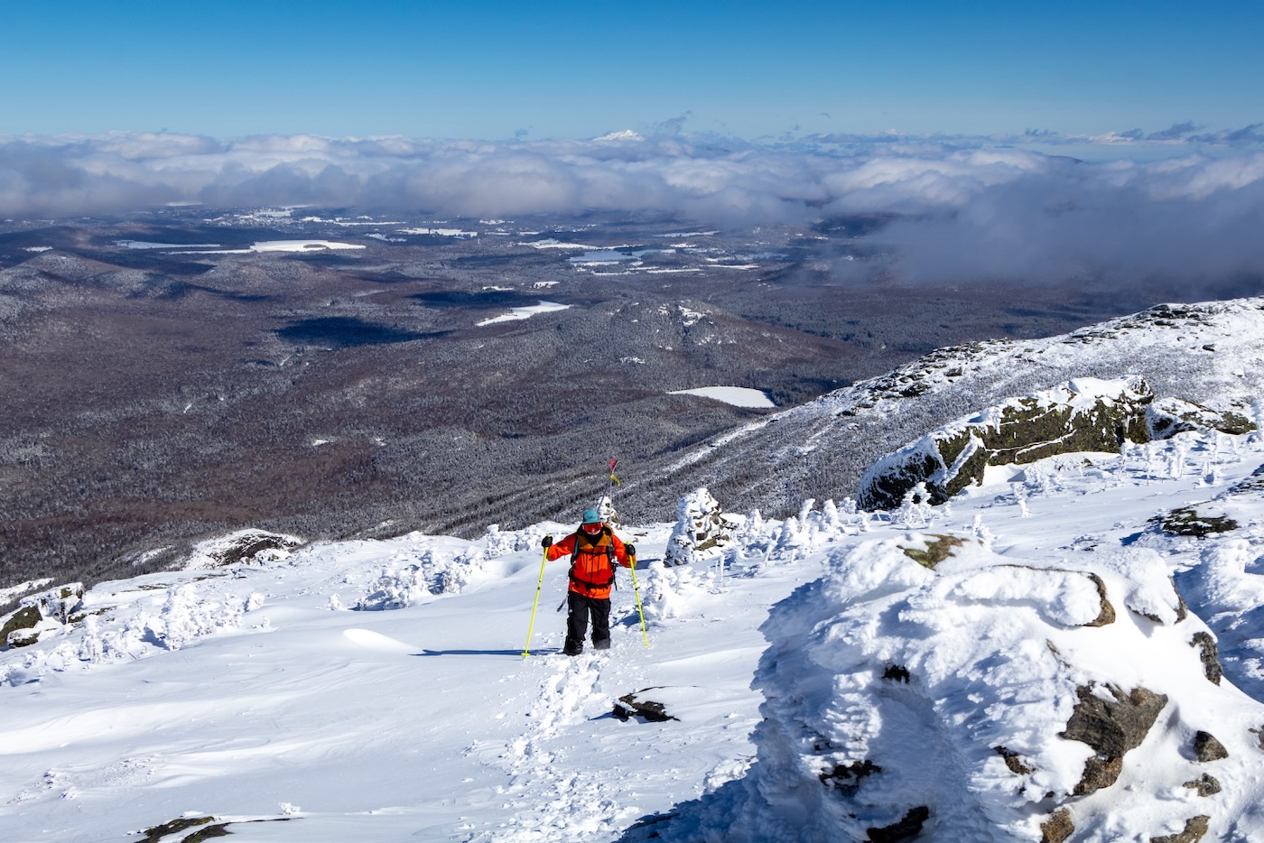
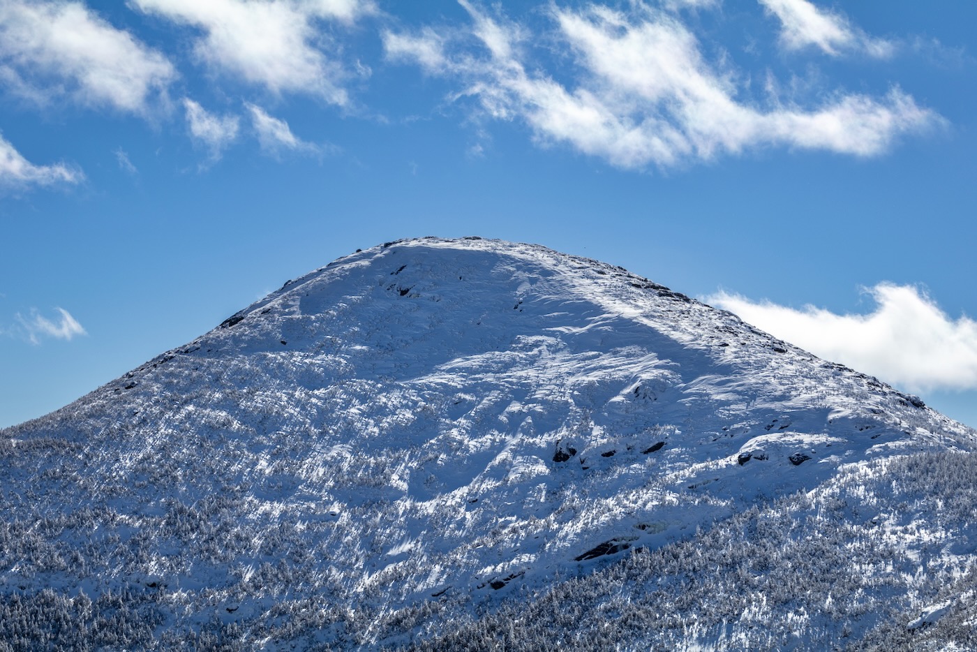
As we reached the treeline, the panoramic views were remarkable. A layer of clouds from sat at 4000 feet and covering all but the highest peaks. Far in the distance over Lake Placid sat Whiteface, with only its rocky snow-covered summit peaking through the inversion.
Wright’s summit, our subsequent destination for the day, sat in clear view to the east. “Tahawus” — a name granted Mount Marcy the highest point in New York — prominently displayed its snow-cone-like summit to the southeast.
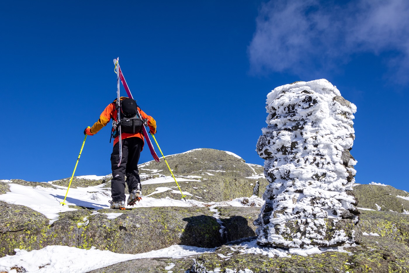
Although the air was still, the winds the day before had scoured the land above the treeline, making the snowpack thin and crusty on its surface. I put on my crampons for better grip and continued towards the summit.
The trail was a narrow track of holes from snowshoes that meandered next to the rock cairns. The surrounding trees were scarce, short, and covered in rime, making the landscape look otherworldly. Large boulders were strewn about the summit area that sat bare besides some ice on their shadowy crevices.
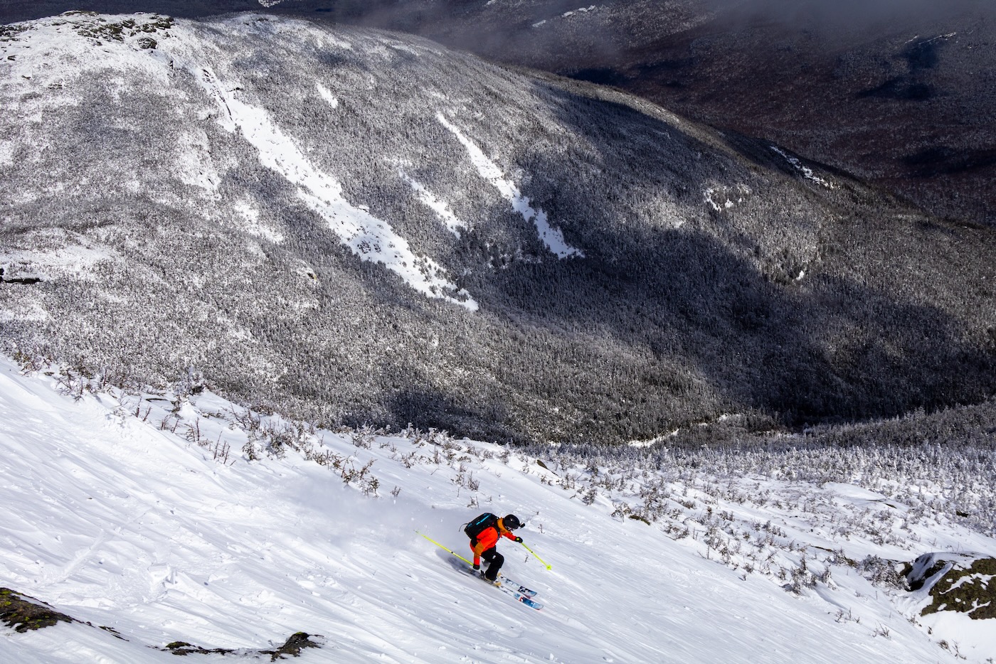
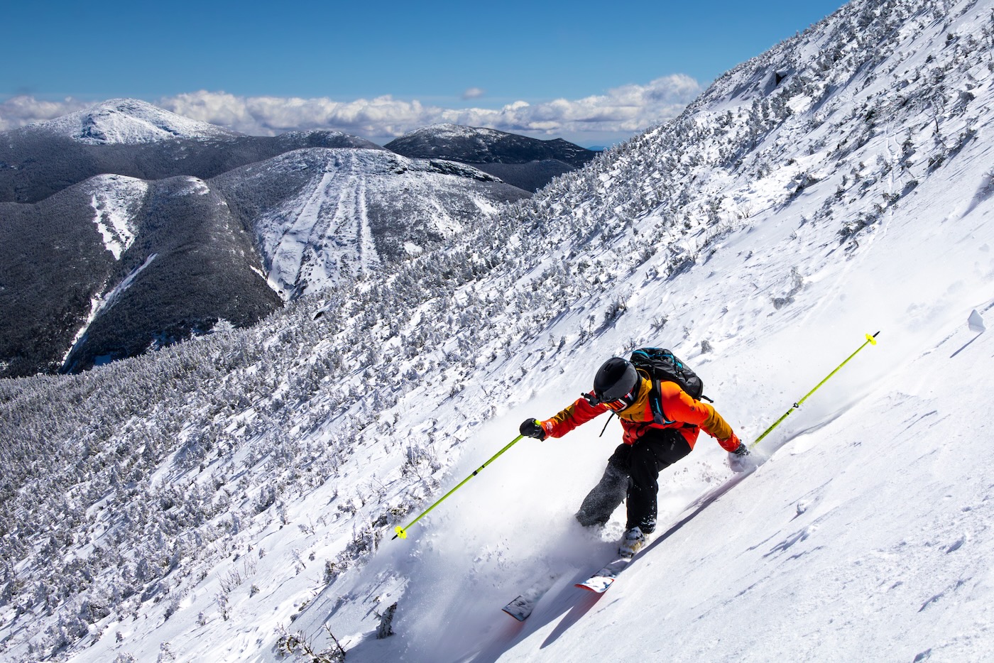
After 4.5 miles and 2,900 ft of elevation gain, we reached the summit marker. We enjoyed a needed break with food and water. With the sunshine, it felt warm despite temperatures in the twenties. After discussing our descent, we put our skins away and changed into downhill mode. We made our way towards the top of the bowl and scoped out a line I hadn’t seen before. It looked like a lot of snow had been deposited during the storm because there were big “ripples” of snow across the surface.
My brother and Jack made their way down first while I captured photos from above, then it was my turn. Once I began to ski down, it became obvious that the snow wasn’t exactly powder, but had the consistency more like styrofoam.
This made it difficult to turn and led to some frustrating moments. When I reached the bottom of the line, we decided to do another lap in a different area to see if it held more promising snow.
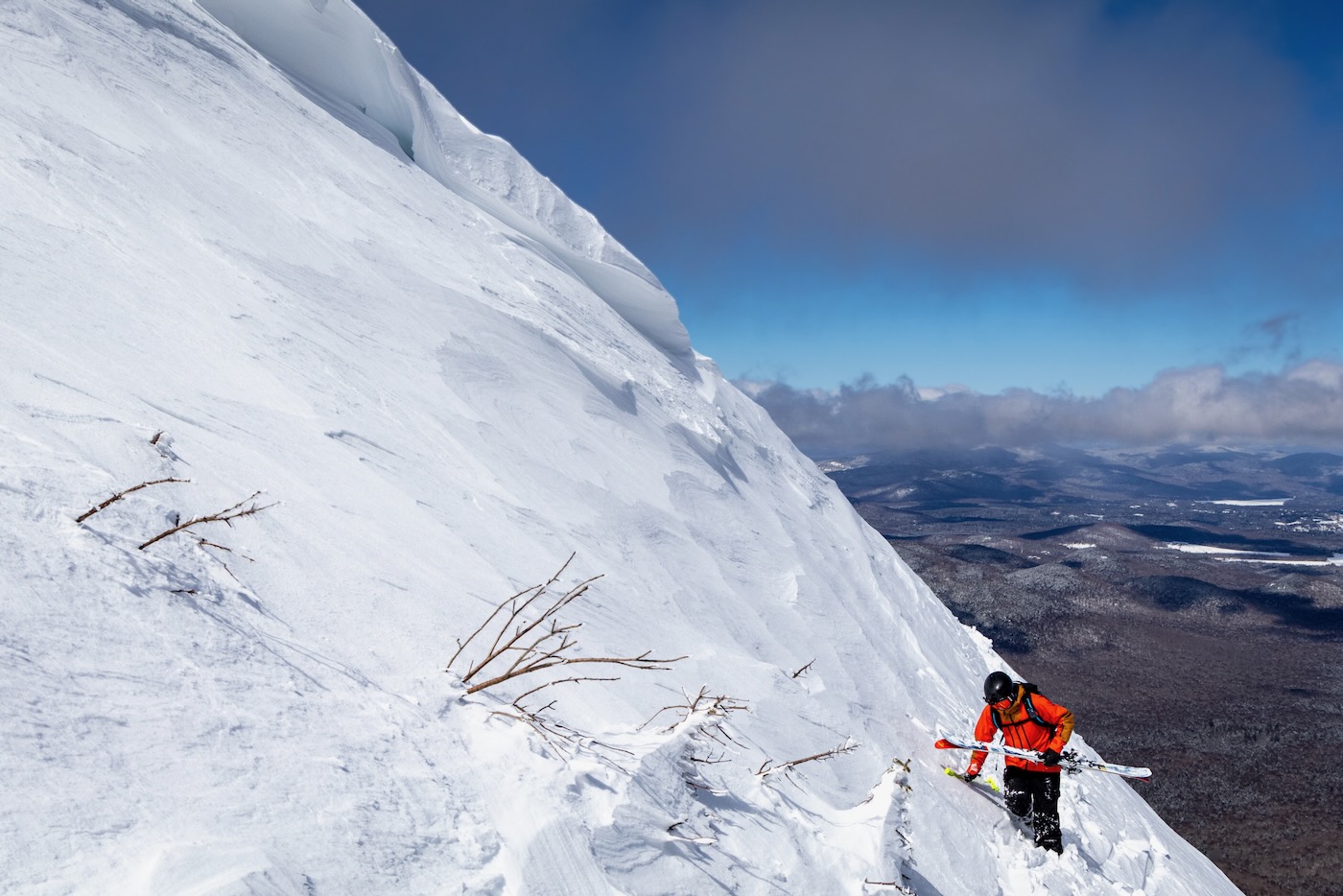
Next we headed to was on the northern side of the bowl. This pitch was much steeper, but retained a styrofoam consistency. A wide cornice sat across the top of the ridge which was fascinating to see. Although I wasn’t worried about the snow sliding, I decided to dig a pit and perform a compression test to get a better look at the snowpack.
Once dug, I could see that there was about 8 inches of new wind-affected snow on top of a very hard crust. Certainly not ideal, but not dangerous either.
Jack made his way down methodically as I lined up for a shot with my camera. Bailey was next. I positioned myself better for the shot I wanted. Once he reached the point where the trees were poking out of the snow too much, he stopped and they both waited for me to hike up for my second lap of the day. By this time, the cloud inversion had vanished and I was left with 360 degree views of the High Peaks.
After tightening my boots, I started to descend the waves of snow ahead of me. This line skied about the same than the first due to the wind that blew it all away the day before. In the middle of a marginal winter, there wasn’t much to complain about.
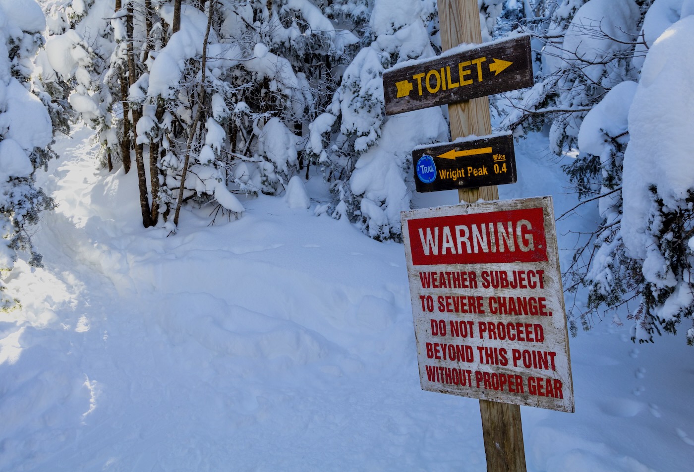
When I finished skiing my line, we headed back to the hiking trail and skied down the narrow chute to the Wright/Algonquin fork. We all knew better turns were to be had on the ski trail, so after another break to refuel we donned the skins and started up Wright Peak.
After about an hour of skinning we scrambled over icy rocks with our skis on our packs, and made it to the summit. The time was already 3:30, so after gazing at what we had just skied in the bowl, we wasted no time in finding the ski trail.
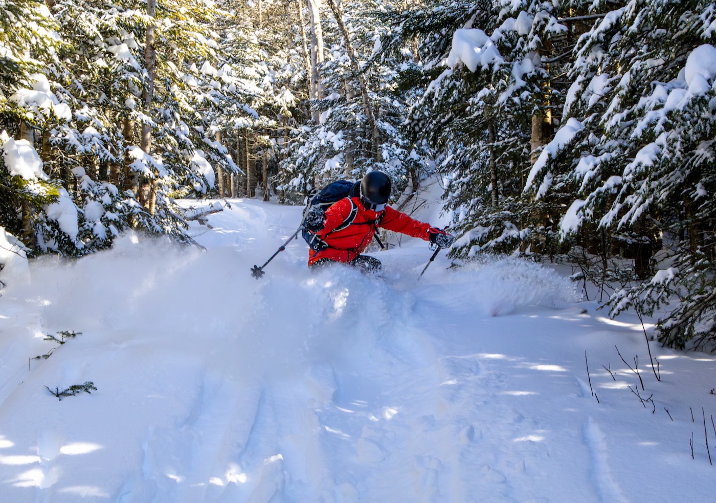
Cut in the 1930s and then cleared again in the 1980s, the Wright Peak Ski Trail is a classic backcountry descent in the Northeast. It does not reach all the way to the mountain’s summit to discourage hikers using it as a hiking trail, so one must head a small distance northeast of the top to find the summit. Once found, it drops for about 30 feet then makes a long traverse along a ridge line until making a left turn and then snaking left and right for about a mile until dumping out onto the hiking trail.
Unfortunately for us, skiers dropped into it right as we summited, so first tracks were no more. The snow was deep and soft, which made a much better ski down than the laps on Algonquin. By the end of it, my thighs were burning from the turns.
If you ski quickly like I did, you could miss the exit and continue to ski down the hiking trail. It’s pretty clear once the ski trail ends because the ground is covered in large rocks that become scraped off easily. With the recent snowfall, we were able to ski down about another half mile until deciding our skis had had enough. With skis on our backs, we hiked down the rest of the way in our ski boots.
After the day’s hiker traffic and temperatures now in the 30s, the trail had multiple spots of running water and muddy sections. We reached the Marcy Dam intersection after 45 minutes since exiting the ski trail and did our final transition to skins for the last mile.
Tired and hungry, we slowly skinned the tottering path until finally reaching the trailhead a little over 10 hours and 10 miles since we began that morning. Despite the fact that the snow didn’t make for the most ideal turns, a day on skis was still better than a day at work, especially this season.
Beautiful! The descent looks STEEP! Intense, great story.
Great shots. Beautiful wilderness.
Looks it was an awesome day. What avalanche precautions do you use? Do you carry beacon/probe/shovel? Did you dig a pit? How did you know if it wouldn’t slide?
Beautiful photos and a great story. More, please.
Great stuff. Pretty sure I was on Marcy that same day, I remember seeing that same crazy wind crust. Below treeline was phenomenal though
Anytime I’m in the bc I carry avy gear. I dug a pit that day and did a compression test. The slope is definitely steep enough to slide given the right conditions but there wasn’t much snow and it was sunbaked and hard. My compression test didn’t collapse, as it was so compact.
Wow great photos and write up. I was just on Wright April 22, 2024 and I have to say that bowl on Algonquin looks super steep from there. Unfortunately, most of the snow was gone too, so it was crampons for me. The Wright Peak ski trail appeared completely burned off, so I skipped it entirely. Did I miss a trick? Does the ski trail hold snow better than the bowl?