
200 years ago Three Rivers Point was one of the most happening spots in Central NY. Here the Oneida and Seneca Rivers form the Oswego river and flow north to Lake Ontario.
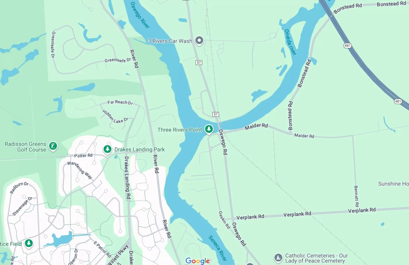
It was a prominent meeting spot for Native Americans and when the colonists arrived they made camp at the same location. An inn was soon erected and trade on the rivers expanded with salt mining operations on Cayuga and Seneca. The peak of Three Rivers Point rose and fell with the Erie Canal, and these days it’s a quaint park in the town of Clay.
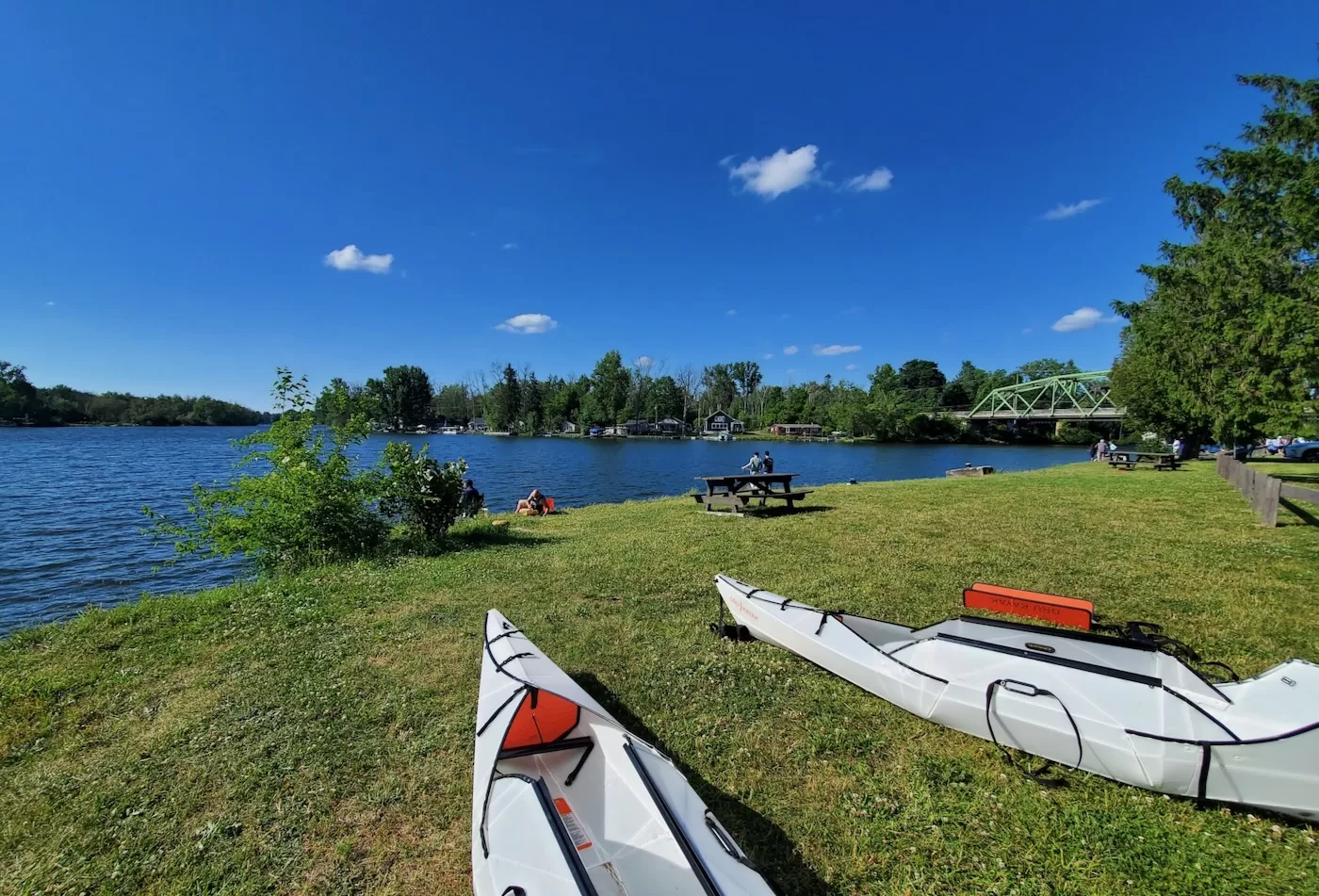
The shores of Three River Point Park were lined with fisherman on a warm summer Saturday in mid-August.
Farah and I pulled into the park and made our way to the far end of the lot to park right next to the water. Less than 50 feet of grass separated us from the mixing of the three rivers.
We set up the kayaks, grabbed our supplies and made our way to a cut in bank at the southern end of the shoreline. Here a shallow footpath led to about 15 feet of mellow shoreline perfect for launch paddle craft. We were off, but were faced with a tough decision: Which river should we travel?
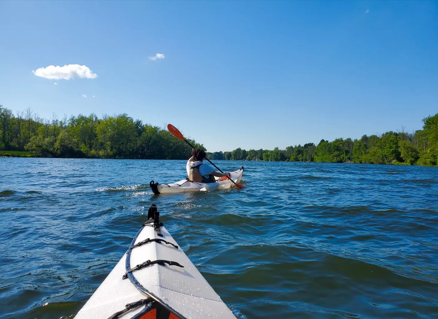
Without any research or background knowledge we chose to head north on the Oswego River. There’s still some recreational boat traffic on the rivers and we stuck to the sides as a mix of pontoon boats and cabin cruisers passed us. For the first mile of the paddle I almost forgot we were still in suburbia.
The heavily forested river was lined with cattails and lily pads and I saw a few ospreys fishing overhead. The more we traveled north the more the wind whipped the water chopping it up. All the more reason to stay on the sides
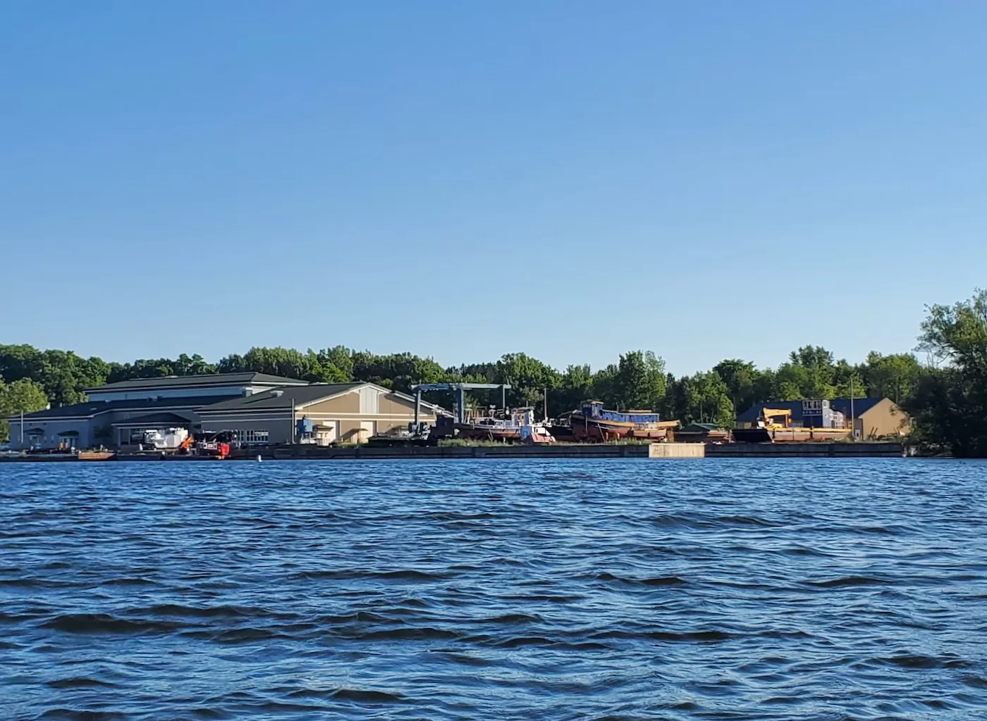
Soon a more industrial sight filled our vision as the NY State Canal Corporations headquarters came into view on western shore. Here a fleet of tugs and other boats lay in the dry docks, some looking as old as the canal itself. On the other side of the river the treeline gave way to beautifully manicured yards and some large homes. We were definitely still in suburbia.
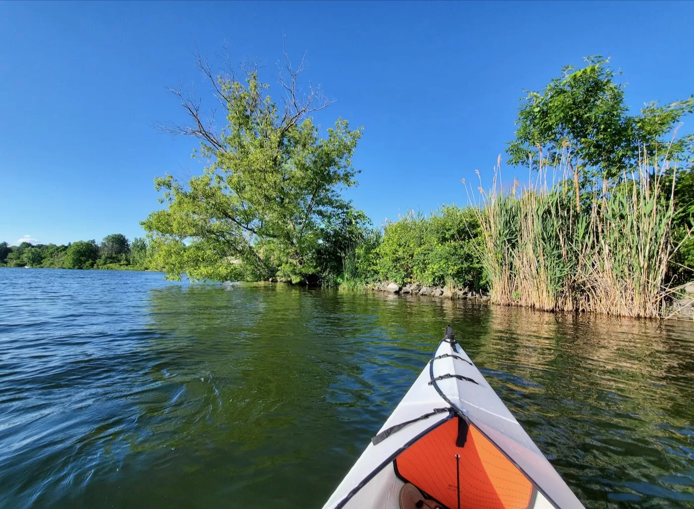
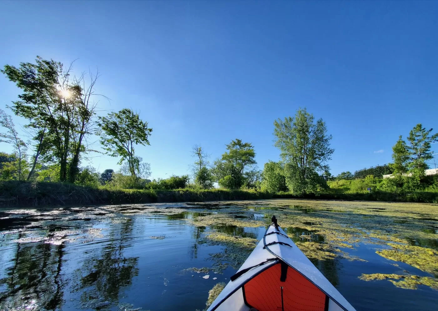
About half a mile north we found some reprieve from humanity. Along the East shore we ventured into a small cut out in the river that led to a pond. The water was blanketed in lily pads and a plethora of water fowl waddled along the banks. Perhaps a remnant of the river’s former path or an outcome of human involvement, the pond offered calm waters compared to the river.
We were content to float for a bit, eat snacks and rest. Feeling less than ambitious this was a good turn around point and we headed south as we exited the pond.
Back at the park the banks were still filled with fishermen. We returned to the spot we launched from, hauled our gear onto the grass and dried out in the sun. The park has recently come back into the spotlight. With the town of Clay rapidly expanding and large amounts of economic development in the area like Micron, there’s been an increased focus on developing the waterfront.
The park definitely could use a facelift and some additional facilities, but I hope they forgo major commercial development. It’s cool to think the shoreline hasn’t changed much in 200 years.
I think I remember that area being mentioned once or twice in a podcast on Iroquois history I used to listen to. It’s amazing how much history happened in upstate New York. Looks like a pretty cool area and a great day for a paddle.
Looks like a nice place to visit or live. New York has it all.
When I was a kid in the 1970s there was a hotel complex down there and tugboats tied up down there along the cement shelf.People even had there personal boats tied to a dock nearest to the bridge.This was way before it was a park.Lots of history down there.