
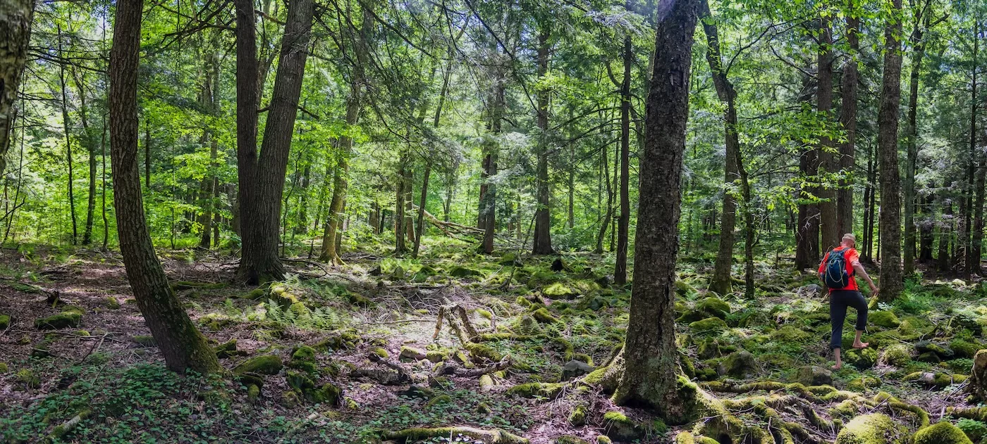
Ski season gave way to hiking season in April for me. After a few local hikes to stretch out the legs, in late April, my dog Stella and I joined my friend Ken for a hike up Wittenberg Mountain in the Catskills. This was my first “big” hike of the season, with the goal of meeting up with my daughter Alison and her friend Alice as they completed their Catskill 3500 peaks on Wittenberg.
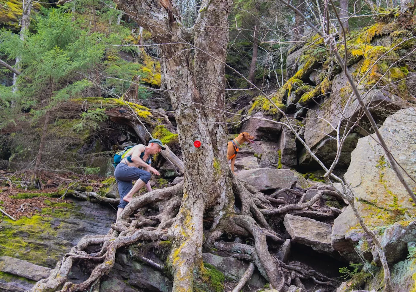
Ken, Stella and I started at Woodland Valley, trudging along to the base of the steeps of Wittenberg. The climb up the steeps was a great challenge so early in my hiking season and it went well for all three of us. There was one spot where I had to hand off Stella to Ken to pull her up a tall, steep section.
After that, Stella decided no more human help was needed, and she effortlessly flew up the other steeps, with Ken remarking she was showing off.
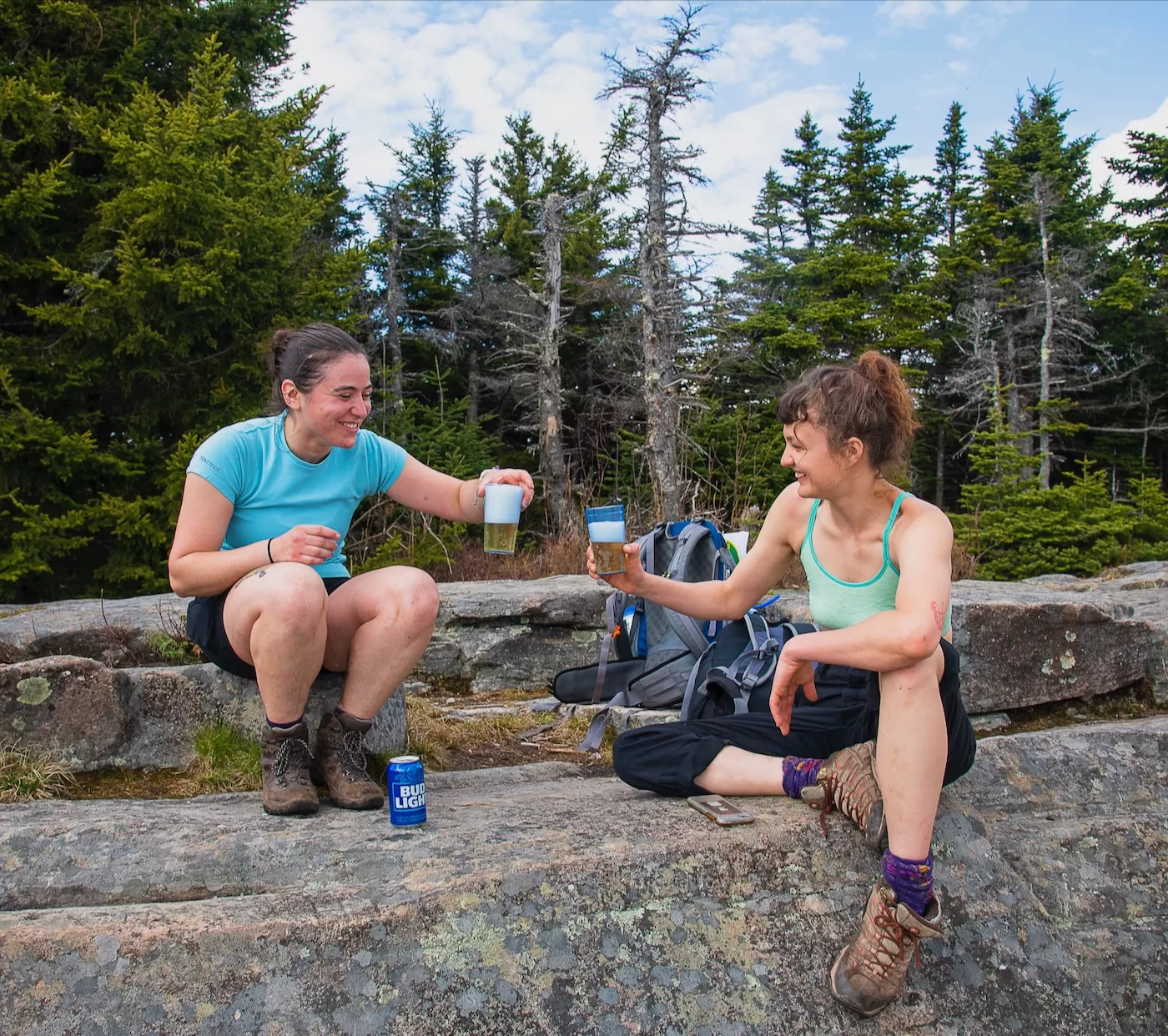
At the summit of Wittenberg, we met up with Alison and Alice with great timing just as they approached the summit from Cornell Mountain completing their quest to join the Catskill 3500 club. Alison and Alice celebrated their accomplishment enjoying the spectacular view on Wittenberg.
Ken went on to summit nearby Cornell, in his quest to scale 1000 mountain peaks barefoot. He’s now approaching 400 peaks in that effort. The ladies headed down at their quick pace, while Stella and I took our time descending for awhile and then stopped to wait for Ken to meet us. It was a great day in the Catskills.
In early May, my friend Mike invited me on a bushwhack exploration of a remote section of the northwest Shawangunks. Having hiked through the area, I knew my way around and remembered that bushwhacking in the area is particularly challenging due to thick stands of mountain laurel and fallen trees in the stream beds. Our goal was to follow a brook deep into the Shawangunk Ridge to find the waterfall at the head of the ravine.
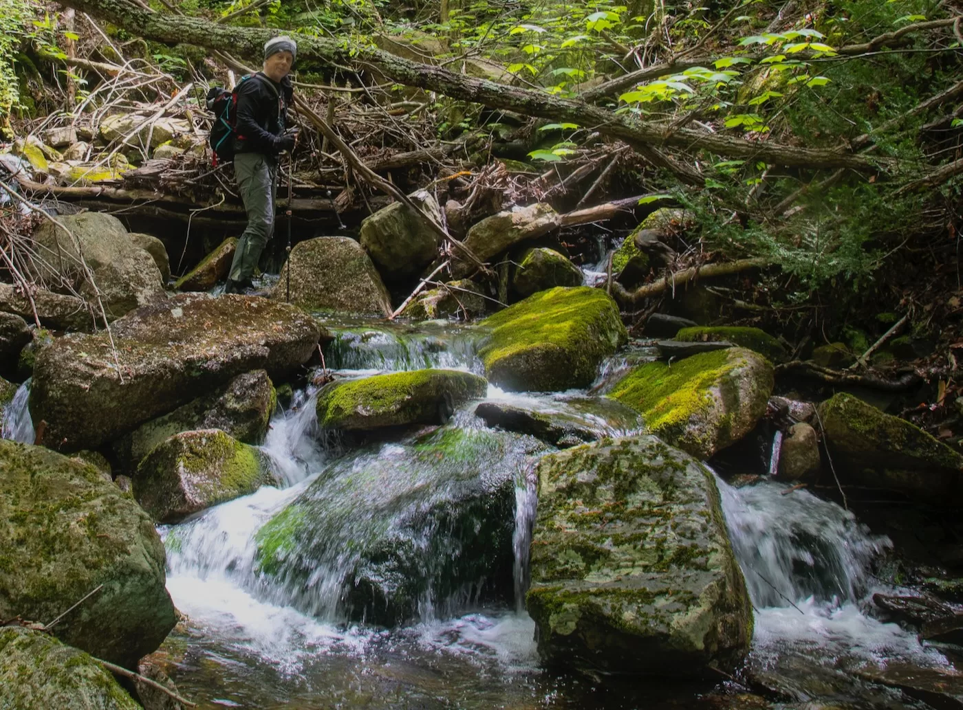
We made our way up and across the ridge and found the brook we planned to follow. At the start, the brook was pretty clear and easy to hike through. As we made our way further upstream, things started to get a little gnarly with many fallen trees and branches all through the stream bed, slowing us down and requiring us to proceed with care and caution.
Eventually, we made it up to the junction with an intersecting brook, and continued along the faint path blazed years ago by the former landowner of this state forest. Following the old trail was a bit easier than the pure bushwhack we had been experiencing, but it was still tough sledding to the waterfall.
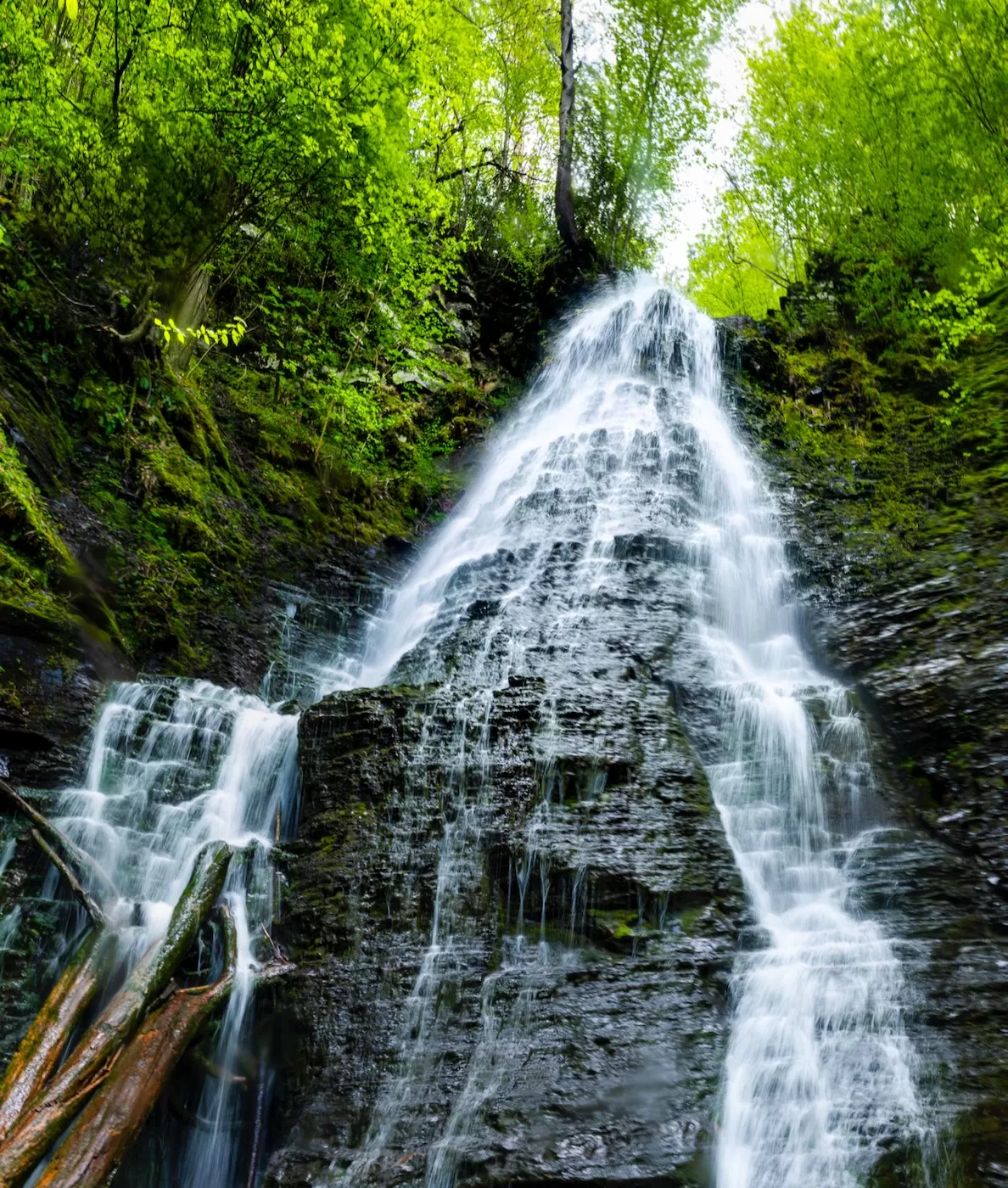
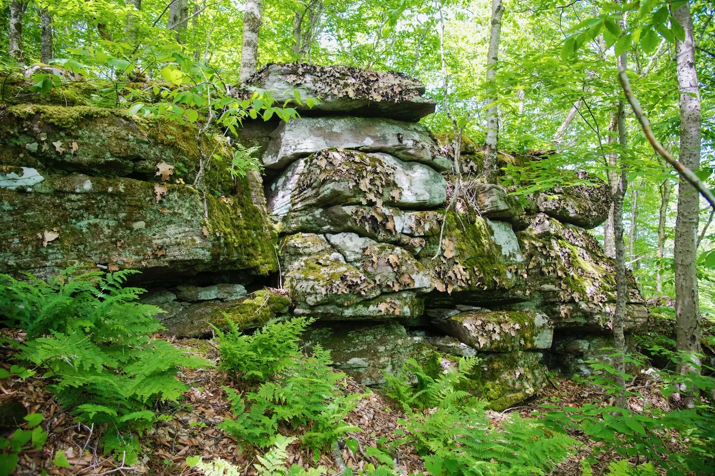
We eventually made it to the falls, to enjoy the rare view of this waterfall deep in the Shawangunk Ridge. The falls is located so deep in the ridge, the water was falling over the shale that underlies the ridge, rather than the quartz conglomerate found in most Shawangunk waterfalls.
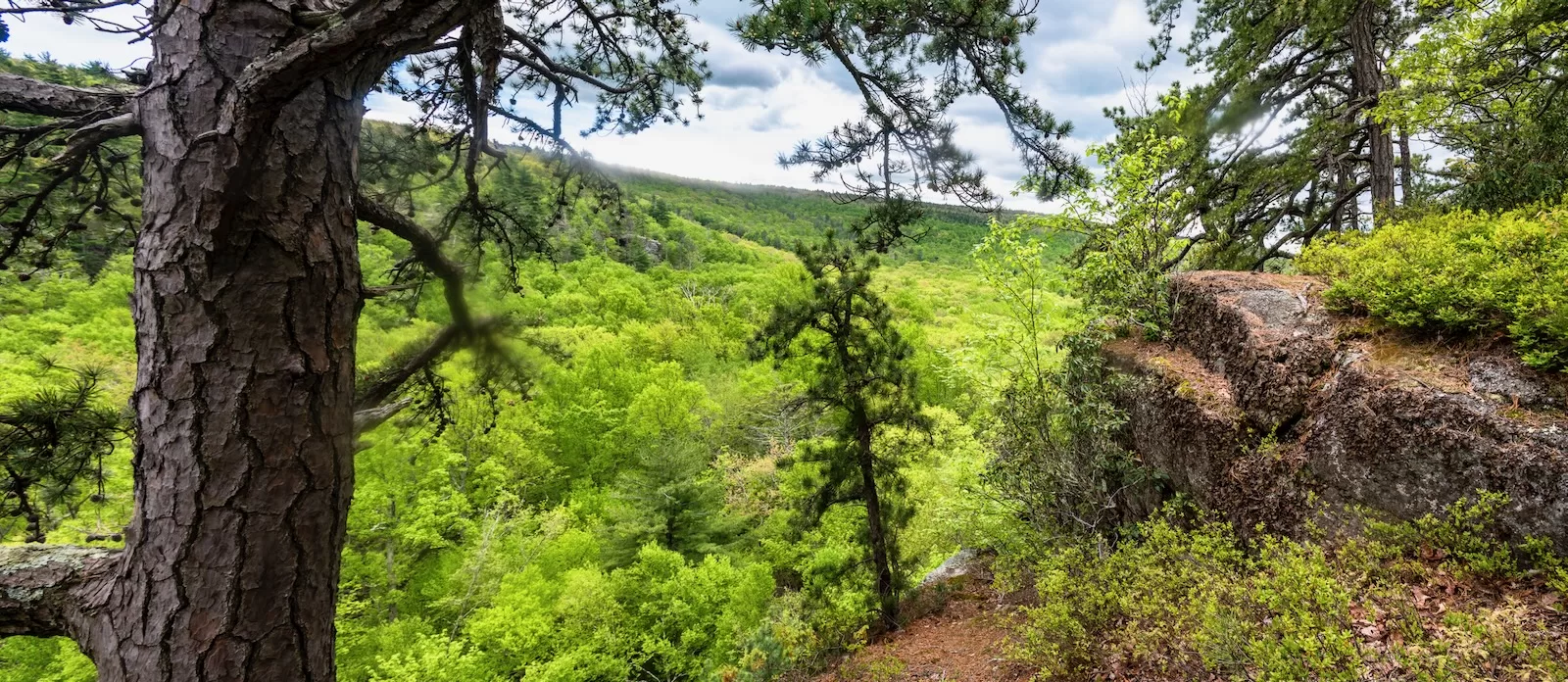
We made our way back following the old trail enjoying the scenery of this wild and rarely visited part of the ridge. On the return trip, we stopped to take in the view from the inner escarpment, overlooking the valley that runs parallel to the ridgeline.
As Memorial Day weekend approached later in May I joined my ski buddy Vinny for a hike in Mohonk Preserve in the Shawangunks. Our goal was my first visit to the Undivided Lot Trail. We spotted a car at the end, and then started at the Peterskill section of Minnewaska State Park, quickly joining the Shawangunk Ridge Trail to take us down into the Coxing Clove (valley).
We then detoured over to the Lost City Trail to check out that spectacular formation on the western side of the valley. The trail provided a great look at the Coxing Clove, the cliffs of Lost City and Mohonk and Skytop in the distance.
After exploring the Lost City formation we made our way to Split Rock, the site of a former mill and current popular swimming location. Split Rock was interesting, but we had some miles to travel, so we crossed the Coxing Kill and continued along the Old Minnewaska Trail.
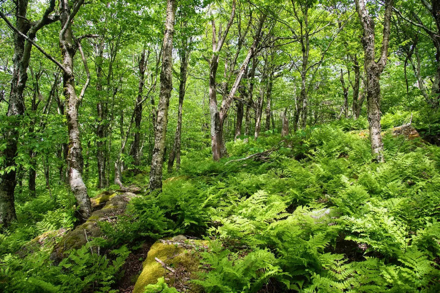
This trail is an old woods road and it wasn’t particularly exciting except for the first mountain laurel sightings of the season and the spongy caterpillars all over the place. The caterpillars were hanging from their single strand webs, Landing on our heads, shoulders and backs and doing an overly productive job in defoliating the forest.
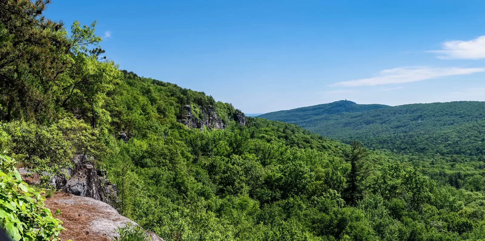
The Undivided Lot trail was more of a hiking trail than Old Minnewaska, with exposed Shawangunk Conglomerate slabs and great views off to the Catskills to the west. We encountered a few black snakes — very big, but not dangerous to us. The trail was great, especially when it switched back into a cliff, to rise one level higher on the ridge.
We continued along the trail, enjoying the classic Shawangunk scenery — scrub pine, mountain laurel, conglomerate slabs and views to the Catskills. It was a nice hike – pleasant and relaxing, and we realized this trail opens great opportunities for some loop hikes in the northwest area of Mohonk Preserve.
Saving the biggest, for last, in early June, Barefoot Ken and I went out to tackle a bushwhack to Van Wyck Mountain in the Catskills. Van Wyck is a prominent peak in the southern Catskills, making up a portion of the Catskill Divide south of Table and Peekamoose Mountains. The Catskill divide separates the drainage to the Hudson in the east and the Delaware River in the west — kind of a local version of the continental divide. We decided to approach Van Wyck from the west, starting from the Denning Trailhead.
After heading up the Peekamoose-Table Trail for a bit we took off into the forest headed for the col between Van Wyck and Table. Walking through the thick forest, we crossed the Mill Creek and other wetlands before heading up to the col and the ridgeline.
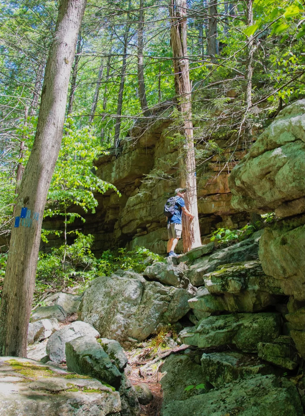
From the wetlands we climbed up to the ridgeline and the divide and turned south towards Van Wyck. Generally the woods were pretty thick up here, and on occasion we’d come across a bit of herd path to ease the way. Continuing on, we came across several bands of ledges, and made our way up and through them. We finally got to the summit of Van Wyck, paused for a minute and turned around to head northeast to Table Mountain.
This section of the hike followed the Catskill Divide between the summits. In a straight line, Table Mountain was 1.65 miles to the northeast. Via the bushwhack route through this thick forest, our journey was easily 2+ miles to the summit of Table.
Things started to get tough through here for me, and the hike became a mental exercise in perseverance, because there was no alternative. It’s good to be pushed by your hiking partners — it builds character and mental and physical strength.
We continued on, with the terrain getting steeper as we approached Table’s summit. Eventually the hardwood forest gave way to the boreal forests found on Catskill summits, and a few minutes later wet joined the Peekamoose-Table trail near the summit of Table Mountain. I was happy to see the trail.
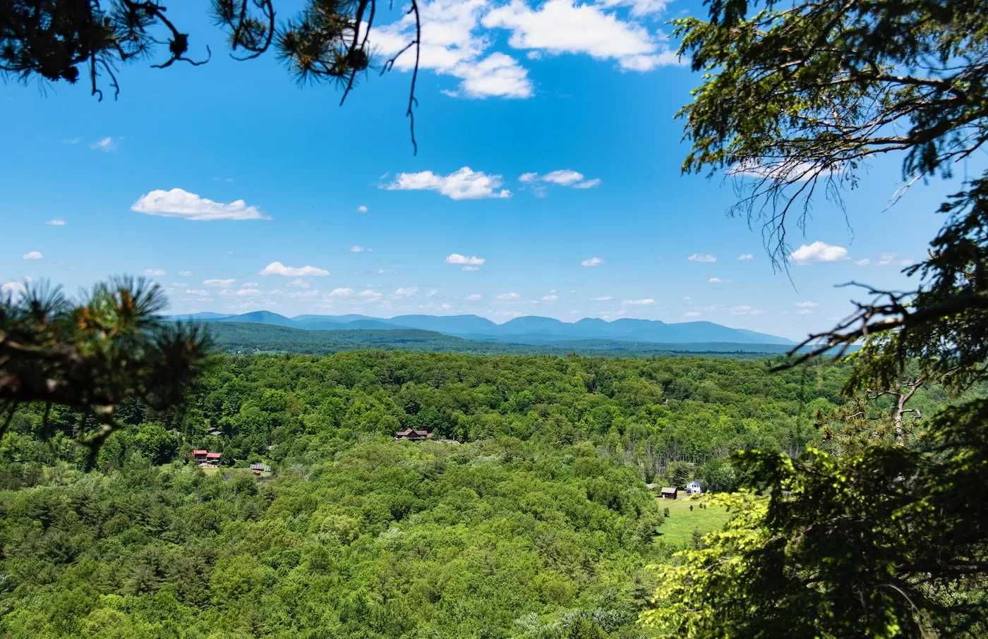
From the summit of Table, we made our way down the trail back towards the trailhead with just 4 miles to go to the finish. I stopped off at the viewpoint just below the summit, and took in the fantastic views of the Catskill Divide running south from Table Mtn. From there we continued further down, stopping at an even better viewpoint. The fantastic view from here shows the entire ridgeline from Van Wyck to Table, enabling us to see what we just hiked.
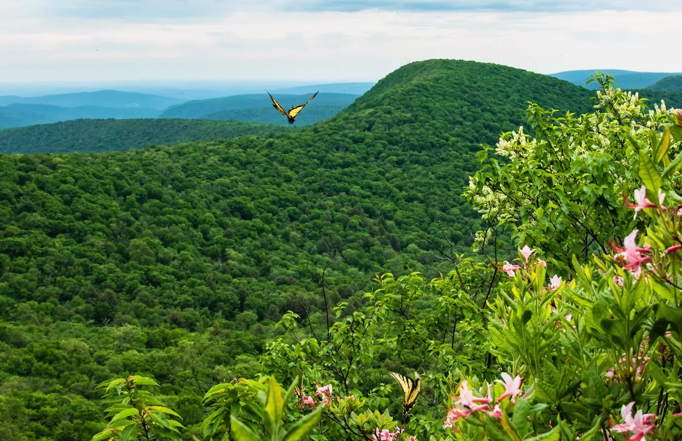
In addition to the ridgeline view, this spot had a few Pink Azaleas still blooming, with a small collection of butterflies enjoying the flowers and their natural perfume. The butterflies made for a very nice scene at 3000 feet above sea level.
We finally made it back to the trailhead and called it a day. The hike was quite a challenge – 10 miles total, half of that was thick bushwhack terrain which definitely tested my endurance. I was wearing hiking boots all day. Ken was barefoot!
It was a great spring for hiking. I really got the old legs working hard, had a great time with friends, took some nice photos and got to see my daughter complete her Catskill 3500 challenge. I miss skiing, but I really like spring.
Great adventure. The photos made it real. Thanks!
A great series of adventures. Likely better not to give away the exact location of that ‘Gunks waterfall. And chapeau on your bushwhack. Friends and I went up a few trailess Catskill peaks back in the day, my recollection is that trailess Catskills are much harder to follow than those in the ADK. Great fotos as usual. More, please.
Nice write up. It sounds like you frequent a lot of the areas I like up there, though I think I take the more casual approaches most of the time. All the pictures are great but that one with the butterfly is especially interesting to me. It messes with perspective a little. Your eyes could be forgiven for thinking it was a Mothra style monster swooping over that far ridge.