
With the ski season over, I figured it was time to get back my other passion, slide climbing. The large slabs of anorthosite are a fun and adventurous way to reach the summit of an Adirondack peak. Of course, combined with a good amount of snowfall, they become a thrilling descent on backcountry skis.
Almost every High Peak in the Park has at least one slide, while a few have more than a handful. Giant Mountain is one of these select few, boasting roughly 9 separate landslides on each of its flanks. Each has their own unique characteristics and difficulty, with the hardest one being the Eagle, a Class IV climb that doesn’t require rope but is steep enough to send a careless climber hundreds of feet down the mountain.
I didn’t feel this should be my first slide climb of the year, so I opted to go with the less intimidating Bottle Slide, which is appropriately shaped like a water bottle and sits on the west side of the mountain. This slide was formed during an isolated downburst in June, 1963. Although not as steep as the Eagle, it ranks as a Class III climb, meaning there’s enough exposure to make a fall have potentially severe consequences.
The plan for the day was to hike up the Roaring Brook Trail until reaching a rock cairn, signaling the point to exit the trail to the slide’s drainage along Roaring Brook until reaching the slide. From there, it would be a simple bushwhack to the summit. My companions for this hike included my brothers Bailey and Riley as well as two friends Jack and Abe. Our journey began at the Roaring Brook Trailhead around 8:15 in the morning.
It was sunny and warm with a slight breeze, so the parking lot was nearly full. Although the DEC deemed it “mud season”, the trail was dry with only a couple patches of mud here and there. Within 15 minutes, we reached a short turnoff to the top of Roaring Brook Falls, which is a must-see being so close to the hiking trail. At the top of the falls, the view was surprisingly pleasant, showing the backside of the Great Range. Armstrong Mountain’s new slide gleaned white in the sunlight, beckoning to be climbed in the future.
After relishing the last views we would get until reaching the slide, we headed back to the main trail. Roaring Brook itself crossed the path not long after, which was a quick rockhop to the other side. The trail then became steeper until it almost felt like walking up a flight of stairs at some points. This yielded numerous water breaks until we reached the rock cairn on our left at a little over an hour, or 1.9 miles into our hike.
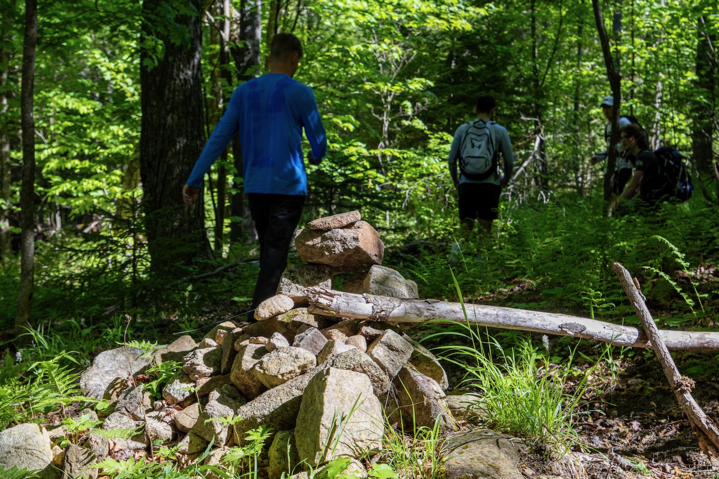
I’d read in various trip reports that there’s a herd path that leads directly to the drainage, but it was faint at best. Fortunately, since we were only at about 2600’ in elevation, the woods were not very thick. Fifteen minutes later after crossing Roaring Brook a second time, we reached the slide’s drainage. This drainage is shared with several other slides as well, so we had to be wary when to traverse in the right direction when the time came.
The herd path along the drainage was becoming easier to see, so we chose to follow it rather than rock-hopping the brook. It meandered across both sides of the drainage through increasingly-thick forest. The flies were out in full force, but they didn’t seem to be biting. Eventually, after about half of a mile of following the path, a slide came into view ahead of us. It appeared to be very steep from a distance with wet, dark lines running down its face.
Jack pointed out that that didn’t seem like The Bottle, so I checked my GPS and sure enough, he was right. We had mistakenly taken the herd path for granted and missed the left turn-off to follow the Bottle drainage, instead heading on the approach to the Eagle slide.
I figured it would take too long to backtrack down the drainage, so instead we entered the now very thick woods and bushwhacked our way north to the correct drainage. This was the thickest woods we had seen yet, which made the going very slow. The forest rose to a small hill and then descended into another valley. It took us 20 minutes to move just .2 of a mile until we eventually met the small brook below the slide.
This drainage was a bit tighter with almost no running water. We hopped from rock to rock, climbing over large boulders as we slowly ascended. After a small wall of trees gave way, we found ourselves right at the foot of the slide on a pile of rubble and dirt, which seemed to be where debris has collected after falling over the years. The slide loomed above us, appearing dry and formidable but nothing we haven’t climbed in the past.
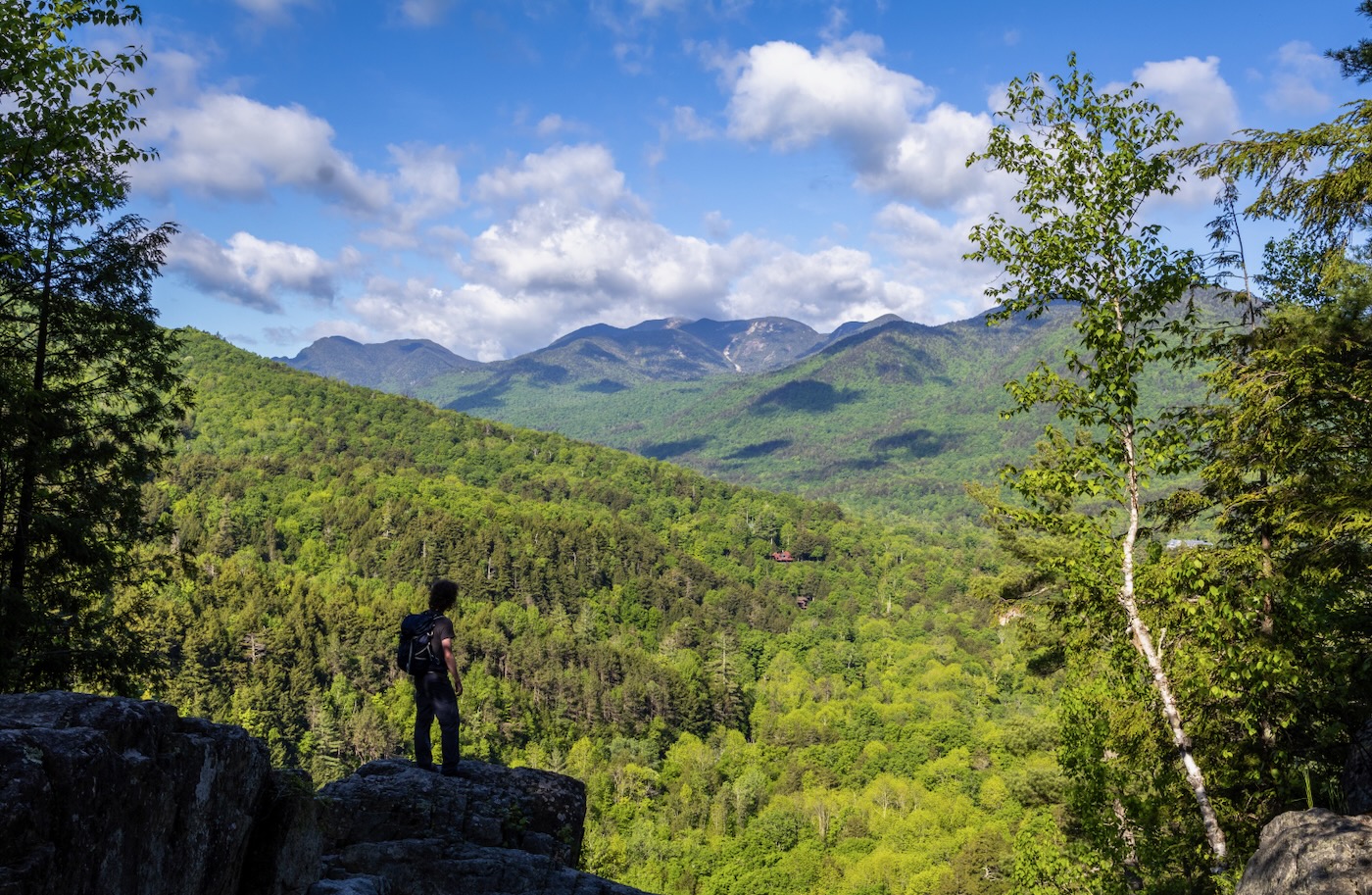
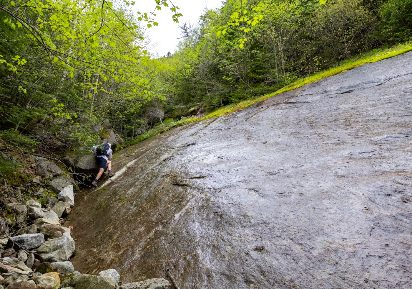
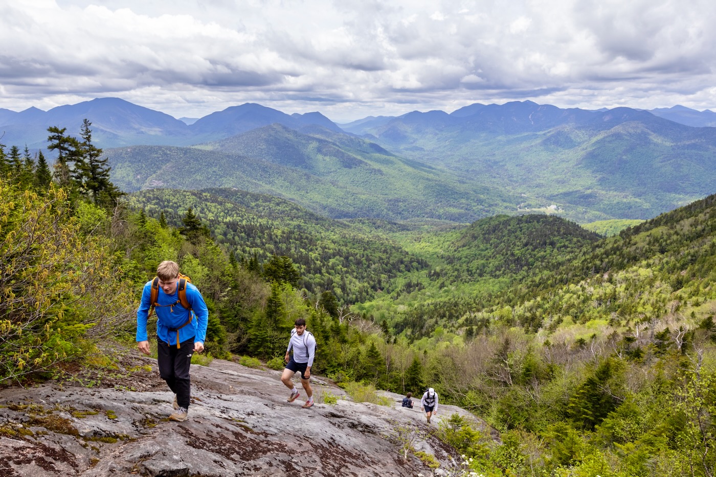
We took a quick break to recharge with food and water before beginning the real mission of the day. Within seconds of ascending, we reached the slide proper at 2,622 elevation, roughly 3 miles from the trailhead. Although it was dry, much of the surface was covered in small patches of black moss which crumpled underneath our feet. The rock was fairly smooth but our shoes still gripped the rock quite well. I even ran up most of the bottom half of the slide since its angle couldn’t have reached more than 35 degrees.
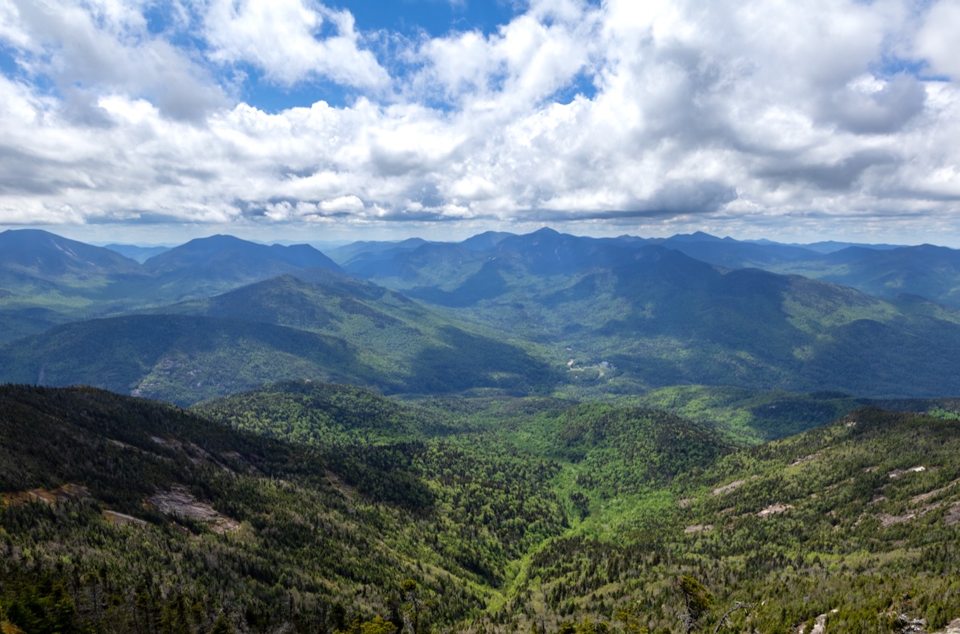
The views from behind us were some of the best I have ever seen from a slide. The entire Great Range lay in front of us with Marcy barely peeking over them. I could even see some remaining snow on its north face. To the south was Colvin, Blake, Nippletop, Dial, and the Dix range with its countless slides that beg to be climbed. Slide climbing almost seems like a scavenger hunt to me; once I’m on a slide and see others in the distance, it practically points me to my next adventure.
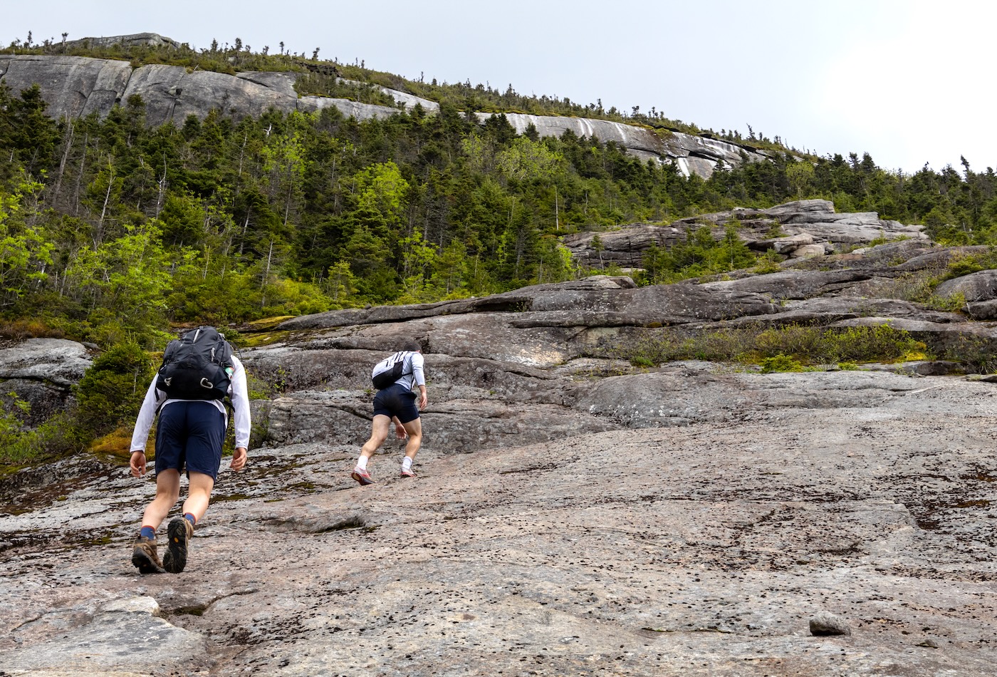
Upon approaching the last hundred feet of the slide, the cliffs above grew larger. There was a prominent crack that split it near the middle, a rock climbing route appropriately named “The Bottleneck”. On the slide above me were numerous ledges that seemed to get steeper as I climbed up. Some even forced me onto my hands and knees due to their increasing slope. The final headwall of the slide was a smooth slab about 20 feet long that measured around 45 degrees.
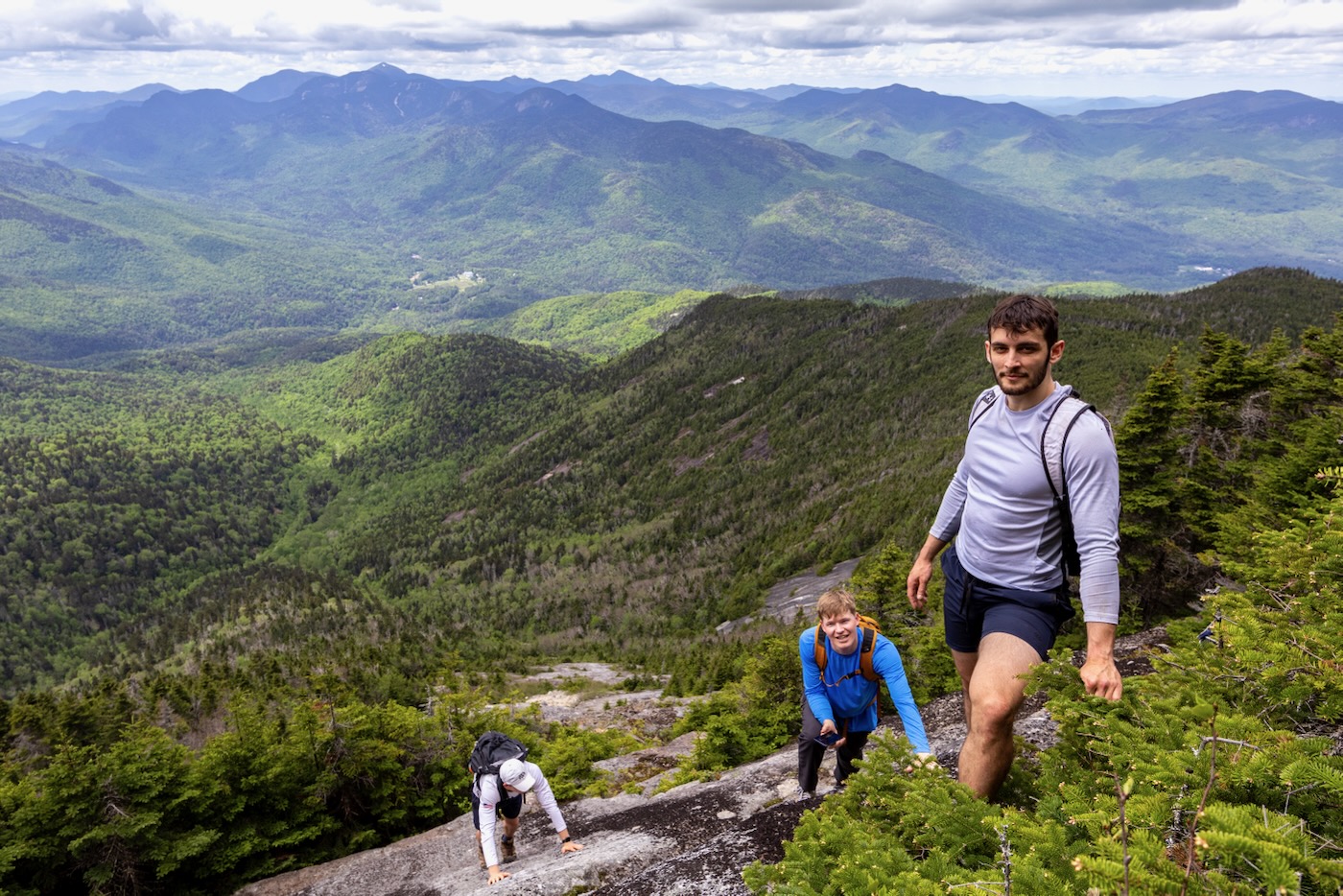
I carefully made my way up it, stepping onto whatever small protrusion in the rock I could find while clawing into the surface to maintain some kind of friction. Shortly after reaching the top, my companions gave it a go. Bailey and Abe seemed to have no problem while Jack went a different route to capture photos. My brother Riley on the other hand struggled to gain traction because with each step he took, his other foot would slide down. He eventually opted to take a safer route next to the trees while we watched.
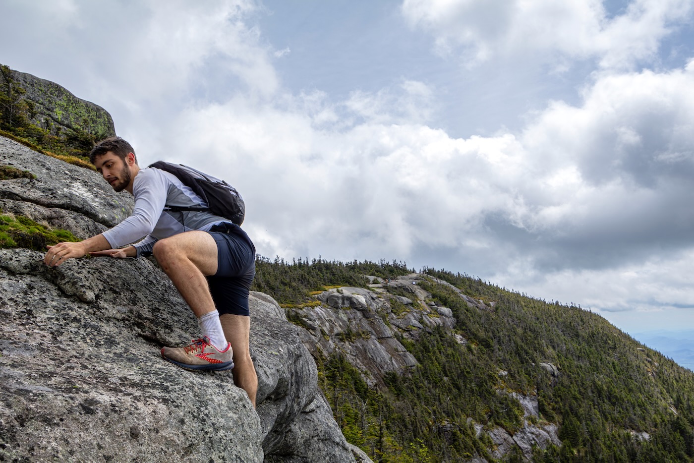
The entire slide climb took 50 minutes with an elevation gain of 711 feet over .25 miles. Now we had to reach the summit. There was a faint herd path that meandered through the dense forest below the cliff until it seemed to disappear below a set of vertical ledges about 10 feet high. These few ledges proved more difficult than anything we encountered on the slide.
I’m sure we could’ve avoided them by continuing to head right towards the summit, but where’s the fun in that? After some technical climbing involving wedging our feet into open cracks in the rock and using what little vegetation we could to hoist ourselves up, we quickly made it to the top. Once standing on the top, it seemed we had an audience over on the summit who were watching our struggle.
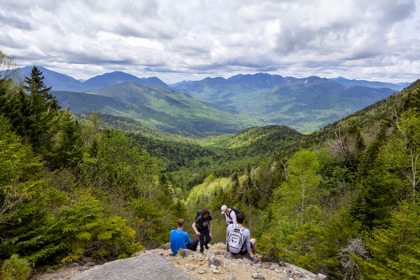
Within feet of bushwhacking, we came upon the trail that brought us to the summit. It was 1:00pm, about 5 hours and 3.5 miles since we started at the trailhead that morning. The sky was partly cloudy but we could still see for miles. The Macintyre Range was now in view, as well as the Ausable Club way down in the valley. There was a small breeze that thwarted the flies from joining us for lunch, which we took our time with since the panoramic view was incredible.
After half an hour, we decided it was time to head back down. We went down the Ridge Trail that soon connected to the trail we started on, the Roaring Brook Trail, which was a steep and rocky descent. Once we were close to the parking lot, we decided to make a final stop at the base of Roaring Brook Falls to cool off and relish the day.
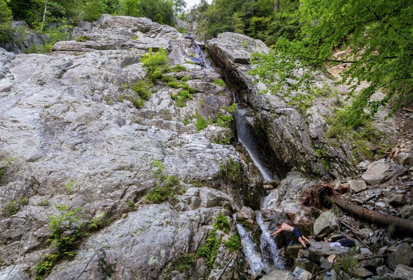
This is a popular rock climbing ascent that requires gear and looks steeper than anything I’ve ever attempted without rope. It was a short walk from here to the car and wrapped up our 7.5 hour and 7.5 mile excursion. The Bottle proved to be a fun and scenic route up Giant, but I know I’ll be back for more slide climbs in the future.
Those fotos tho. Daaaaaaamn.
Great adventure. Awesome photos.
What a great way to climb the high peaks, and a great tale!
Tremendous work. And such nice pics. I am never sure what slide I am actually on in that area….