
With the temperatures dropping and the summer’s rain finally coming to an end, my brother Bailey and I figured it’d be a perfect time to head back up to the Adirondacks in search of adventure on another landslide. The recent dry weather intrigued us to look for something that would give us a good challenge.
After much discussion with Bailey and another slide climbing connoisseur — Brian Hikes All Day, as he is known on YouTube — we decided upon a daring day on Dix Mountain (4857’). Much like Whiteface, Dix is consistently steep, tall, and scarred with landslides on almost all of its flanks.
Two slides that have caught my attention on past trips include the Beckhorn, a consistently steep slide that resides on the broad northeastern side of the mountain, and Hunter’s Pass slide, a wide landslide on the west side which begins at roughly 4000’ and plummets 2,000 feet down into Hunter’s Pass. The approach to each slide is long and normally done by themselves for most, but our eagerness to explore surpassed the fatigue that I would have to suffer through late in our journey.
Our day started at 6:20 am at the Boquet Forks Trailhead. Bailey and I dropped our car off at the Round Pond lot and carpooled with Brian to where we would begin our hike. The air was a mild 55 degrees and the final hour of dawn was slipping away as the sun rose up behind the smaller mountains across the valley.
With no time to waste, we set off on our journey. The flat trail meandered next to the North Fork of the Boquet River for a while before we gently started to ascend. After crossing the river, we then began to follow the South Fork for quite a while, still following the narrow trail. A little over an hour later, it was time to begin to follow the drainage which would lead to the Beckhorn, so we left the trail and entered the small brook.
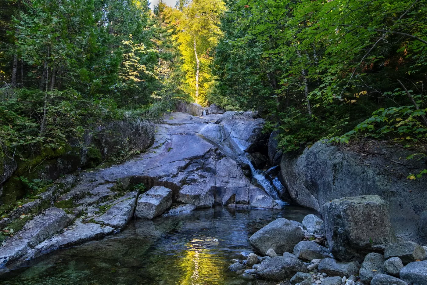
As a frequent slide climber, I have scrambled and hopped across many drainages throughout my adventures, coming across many hidden gems, cascading falls and deep pools of water fed by the mountains. But the start of this drainage had the most magnificent design I had ever seen.
Instead of being composed of slippery boulders covered in moss, this brook consisted of shiny white rock with small waterfalls that ended in the cleanest pools of teal-colored water I have ever come across. The drops and cirques that held the water were shaped like a water slide, elegantly shaped with smooth curves and slow flowing water. As enticing as it was to take a quick dip into one of the crystal-clear pools, we knew we had to keep moving to be off the mountain at a comfortable time.
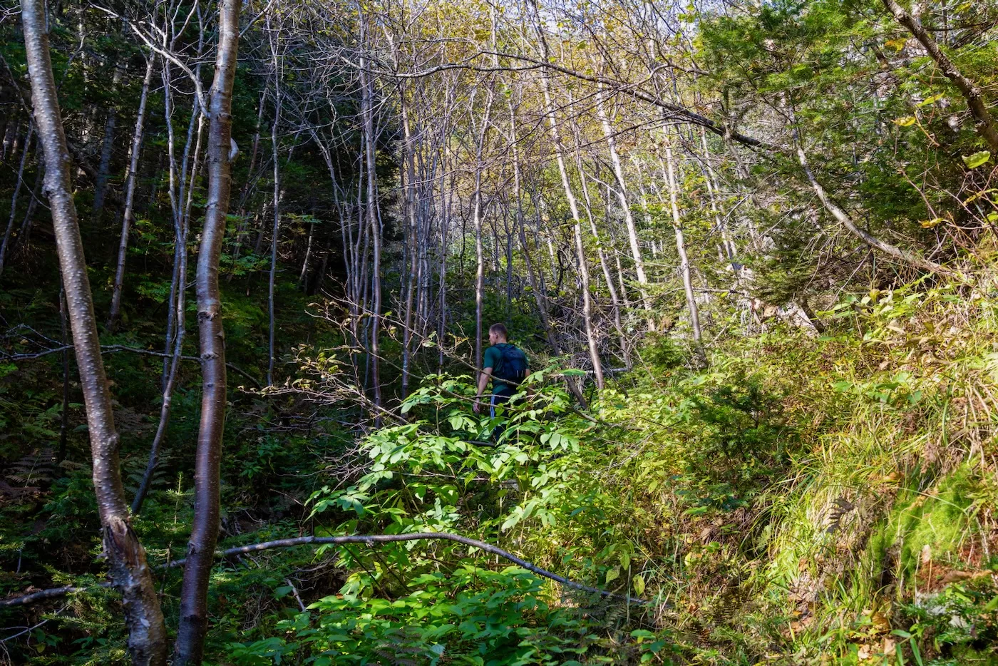
Soon the brook transitioned back into what I expect from a slide drainage: mossy, wet boulders and blowdown. At some points, we had to duck into the woods to avoid the rotting trees that have fallen into the drainage in the past. This can become quickly annoying, especially if the woods are Adirondack thick. At some point I noticed that there was no water flowing underneath the rocks as we climbed higher. I had been sipping water regularly since the temperatures were rising and were forecasted to reach 80 later in the day, so normally I like to fill up again before we reach the slide. I knew this would become a problem later on since the next water source wouldn’t be until the other side of the mountain in Hunter’s Pass.
Once we reached 2500’ the drainage became a narrow, dry streambed so that the trees on each side of us brushed against our shoulders. Brian checked his GPS watch to confirm we were heading in the right direction, and it seemed we were fairly close to the base. Within 100 feet, the drainage was abundant with newly-grown scraggly trees all over — a sure sign that we were close since these trees most likely only grew after the Beckhorn Slide last had a “cleaning” in the summer of 2011. It’s always fascinating to see the new vegetation at the base of slides; it really shows just how much area is decimated when the land decides to avalanche.
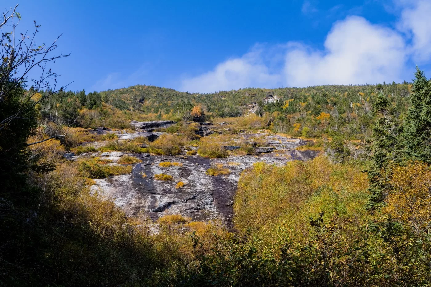
After catching some glimpses of the clean white rock at the top of the slide through the trees, w reached the base nearly three hours and 5.5 miles into our hike. The bottom portion of the slide was covered in dark lichen and a lot of vegetation. From looking at satellite imagery, I already knew that the middle section of the slide was very grown in with small trees and bushes, but hadn’t expected to see this much growth on the bottom. We could also see the top headwall shining in the sunlight, which from a distance looked like a straight-up wall.
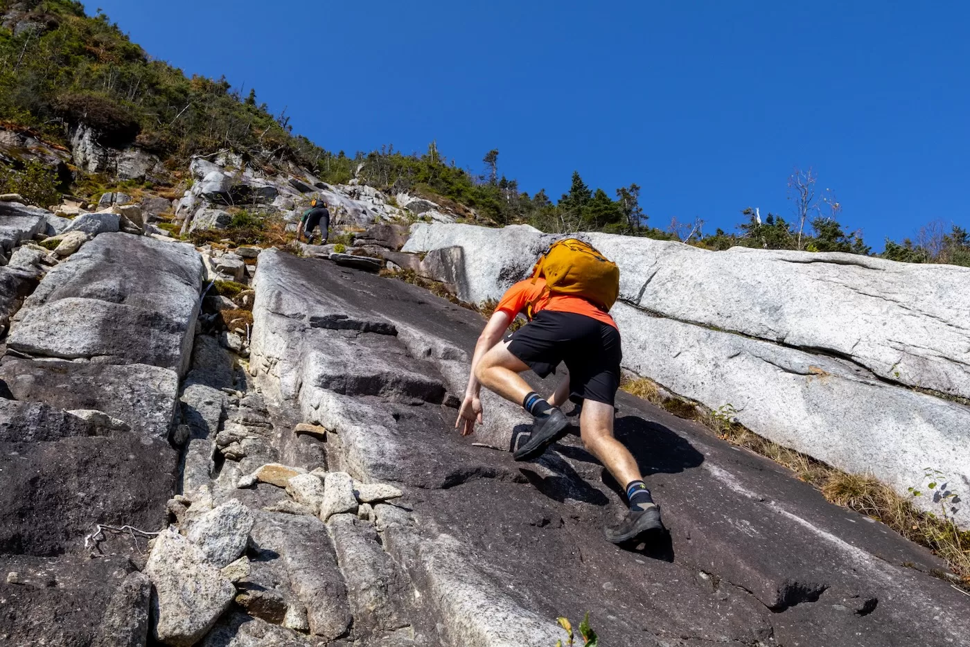
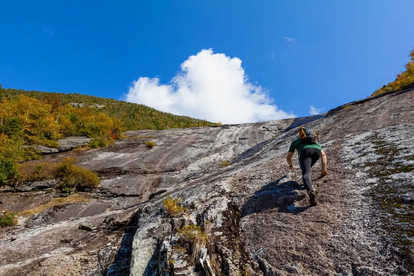
Following a short snack break, we began our ascent. I quickly realized that my trail runners weren’t going to cut it on the mossy slope, so we stopped on a flat outcrop and all changed into our approach shoes. Brian had brought Vibram 5-toed shoes, which seemed to grip the rock better than mine did as he practically ran up ahead of us. On top of being slippery, this bottom part of the slide was around 30-35 degrees in some places, which is a fun angle if dry but can quickly become intimidating without much friction.
After some careful foot placement and small ridge climbing, we were in the thick overgrown middle section of the slide. This only lasted a couple minutes before we popped back out onto the top third of the Beckhorn, which is the section that excited us the most. The rock up higher was “clean” almost white in the light. As eager as ever, we all continued our ascent towards the top headwall.
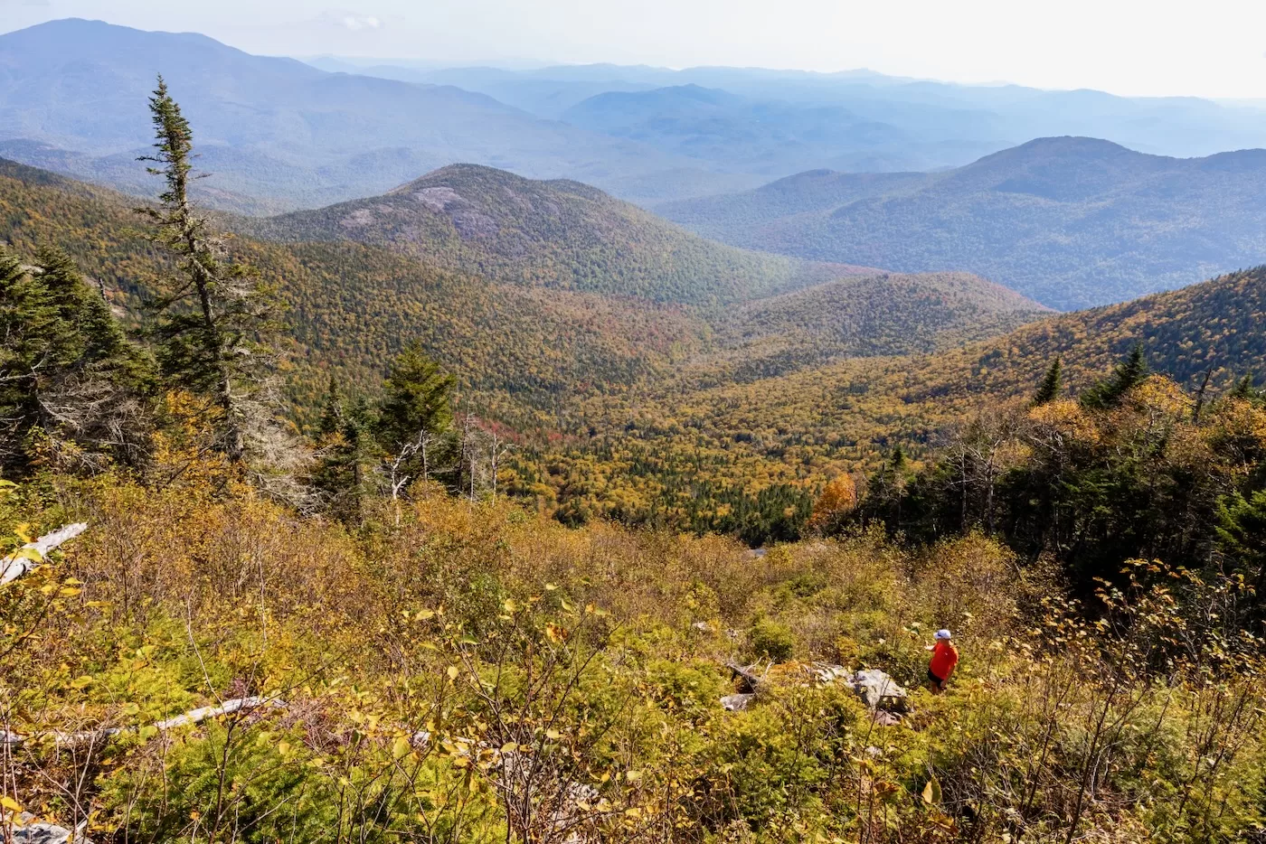
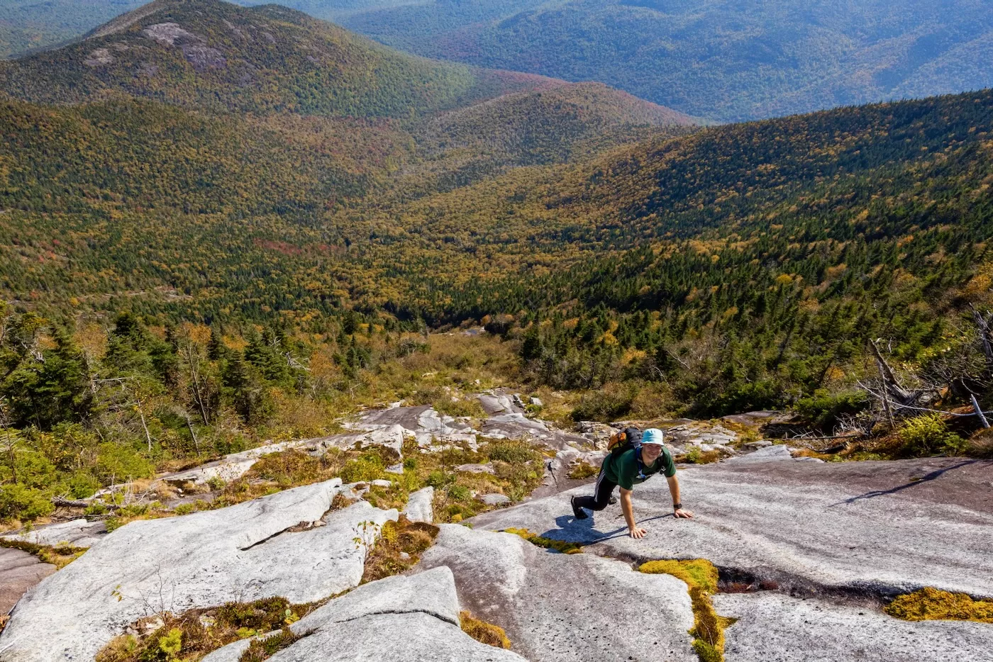
This top section was steeper than the base, but much grippier, which is the best kind of rock to climb. As we made our way up, the view of the valley below us and the mountains in the distance was amazing. The trees had really started their colorful transition in the High Peaks, especially the Maples at lower elevation which exhibited bright orange and reds.
As we approached the top headwall, the slope increased dramatically, some spots too steep to maintain friction. Brian attempted to climb a very clean, crackless slab but to no success as his feet slipped down to the moss a couple feet below. He measured the angle with his phone and it averaged out to 56 degrees. Next to this was another slab that had a long crack filled with moss that ran the length to its top, about 20 feet away. By jamming our hands in the crack and using our arms to keep tension between us and the rock, we were able to ascend this final section of the slide, a no-fall zone that would be rated a class 4 climb on the Yosemite Decimal System.
We topped out just before 11, almost an hour and a half since we started up the bottom of the slide. Our ascent wasn’t over yet as there was now a very dense but short cripplebush herdpath to reach the hiking trail above us. After five grueling minutes of getting cut, poked, and prodded by the endless branches, we popped out onto the trail and headed to the right towards the summit. Within a minute we reached the summit rock accompanied by a couple other hikers, almost 6 miles since we started at the car this morning.
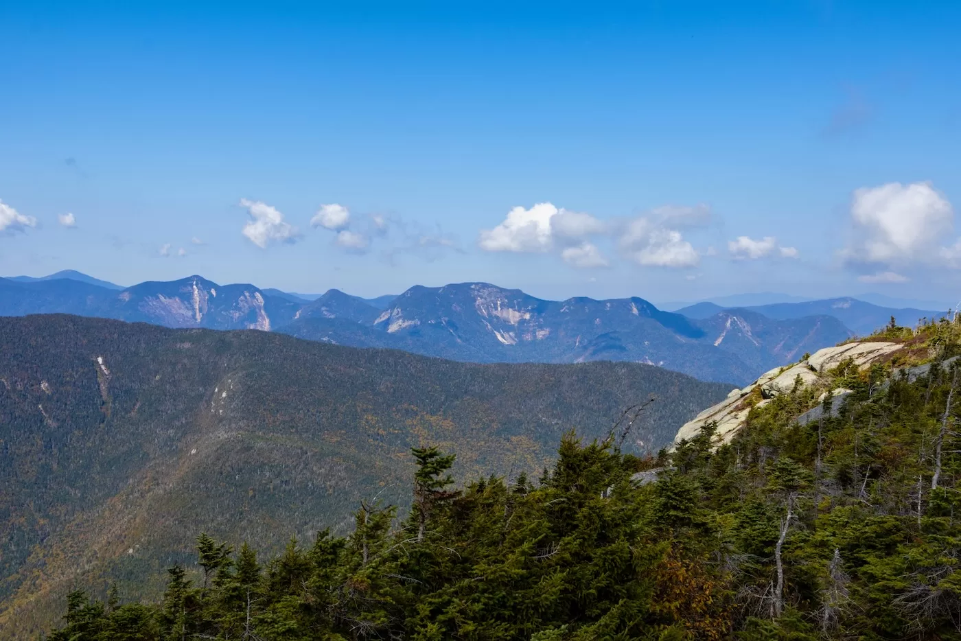
The views from this peak are nothing short of superb as Elk Lake and its colorful foliage laid to the southwest, Giant Mountain with its slide-riddled western cirque to the northeast, and the backside of the Great Range to the northwest, which provided much inspiration for future adventures due to its countless landslides.
Since we had another much longer slide to climb planned for the day, we soon began our descent down the Hunter’s Pass trail. This winding trail dropped down the steep, cliff-riddled western side of Dix and was composed mostly of large boulders. Thankfully it was dry, so we hopped from rock to rock until finding ourselves in the remote bottom of Hunter’s Pass within 40 minutes.
I had been out of water since the top of the Beckhorn, so I began to feel lethargic as we searched for a water source. Fortunately, a small creek ran beside the trail, so it was only a matter of finding a deep enough puddle for a water filter water. Near the base of the slide we began our short bushwhack. I took my time gulping with the cold stream water until I couldn’t drink anymore, then filled my water bladder as Bailey and Brian also refilled their bottles.
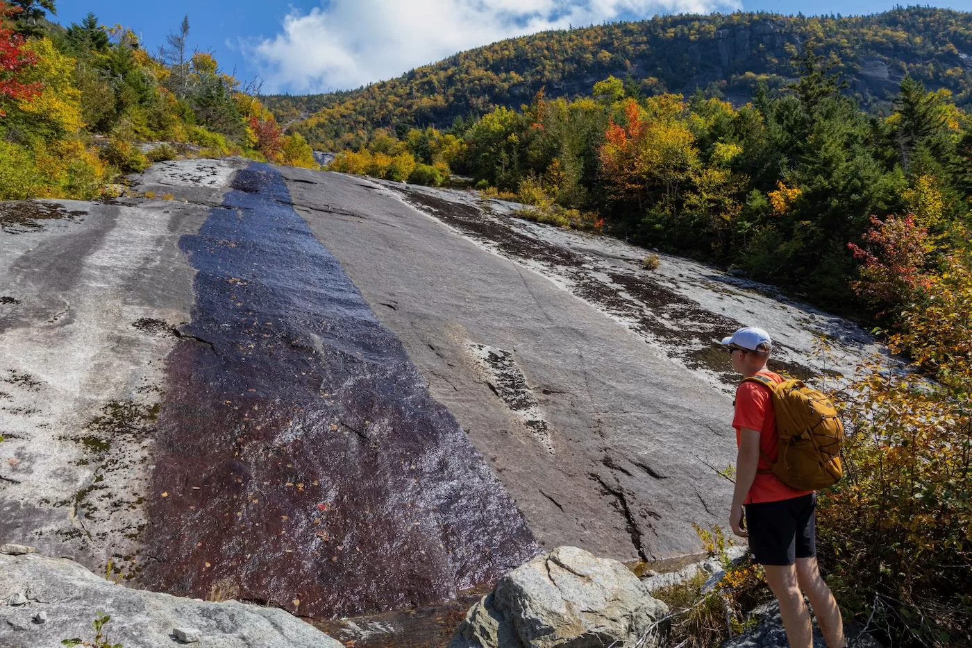
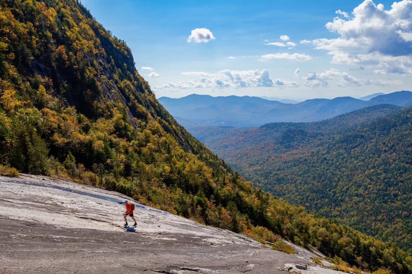
The forest canopy provided great cover from the relentless sun high in the sky. It was a very short walk towards the base of the slide where we came upon a waterfall much too tall and slimy to climb, so after dipping our heads in a pool of frigid water we skirted around to the right in the woods. After a short bushwhack, we headed back towards the slide above the falls. Once on the dry slab, we looked up and marveled at the length of the slide in front of us.
From a distance, the rock looked dry and clean, and we were reinvigorated. We began our second ascent for the day up an interesting slab. One side was covered in lichen, and the other side had a small but wide stream coming down. The middle of the slab looked like it had been recently cleaned from this summer’s heavy rainfall since it was completely stripped of any vegetation or lichen growth. I attempted it first to find that the rock was fairly grippy and around 35 degrees.
After a couple minutes of traversing a mild section, we approached the crux: a bowl-like area that had three options of ascent: climb a near-vertical long crack inside the bowl on the left, climb a steep slab covered in black lichen, or go right and completely avoid climbing by taking a flatter slab up.
After some discussion, we opted on taking the steep slab in the middle. We wanted a challenge but the long crack looked like it hit a dead end 30 feet above the base of the bowl, in a high consequential fall zone. Brian began to climb the lichen-covered rock on all fours. This meant one of two things: it was approaching 45 degrees or the friction was subpar. He confirmed this with his careful hand and foot placements as he struggled to maintain grip.
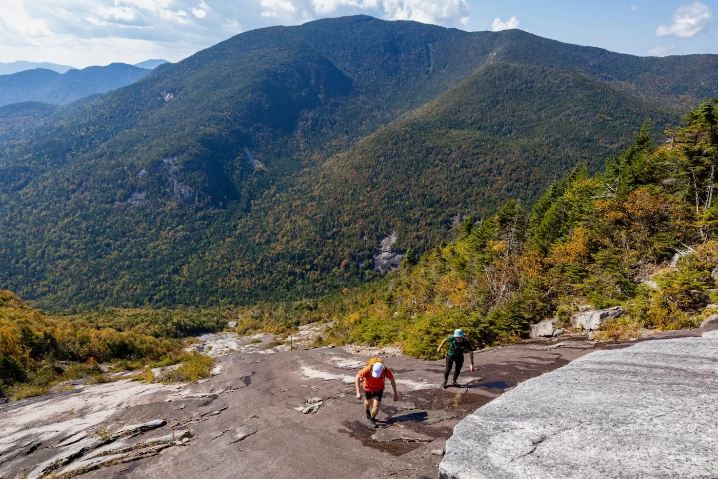
It was slow going as I skirted around the patches of lichen. Normally, I just upright on slides if the grip is good enough, but this section was steep enough to send me sliding down if I wasn’t diligent with where I placed my feet. Carefully, I made my way up the slab and took a break on a shelf above it as I watched Bailey climb. It was hard not to admire the cliffs on the left towards the south with the fall-colored trees below in the pass.
Nippletop Mountain stood prominently, watching us from across the valley. Once we were at the top of the bowl, we walked up the next couple hundred feet, a relatively easy section. The top of the slide split into many different tributaries, or fingers that extended in opposing directions. While the usual route is to take the leftmost finger since it was the longest and ended nearest the trail, we opted to head towards the widest one directly in the center. It would involve a longer bushwhack but the slab looked better on that section from satellite.
As we neared the top, the slope began to increase again, nearing 40 degrees. Thankfully, the rock was grippy since it was covered in golf ball-sized pockets, a common surface on slides throughout the High Peaks. Within a couple more pushes scaling very good rock, we finally made it to the top of the slide at 2:50, 8 miles from our car. We’d been pushing ourselves hard all day, so it was agreed that we all take a thorough snack break as we admired the mountains in the distance.
Looking down a slide hundreds of feet as you sit atop knowing you just climbed is one of the most rewarding feelings I’ve felt. Small slides are one thing, but the Hunter’s Pass slide was a true testament to our endurance and love for the climb, being one of the longest I have ever completed. The serenity of it all can only be experienced in such instances.
A thick bushwhack awaited us, so we took our last glimpses of the landscape below and headed into the forest towards the trail. After a strenuous 20 minute push through the dense alpine, we came across the trail and wasted no time heading back down the mountain. The trail was steep and rocky, and my legs were feeling it. Every so often a different muscle in my legs would cramp up and halt me for a couple minutes until the muscle quit spasming. This became a great annoyance until the trail started to flatten out a couple miles from the end.
At long last, we made it back to the Round Pond parking lot where we had started in the morning, 12 hours and nearly 15 miles earlier. Another memorable day in the mountains to cherish for years to come.
Wow… great adventure! I hiked the Dix slide on the more traditional side two decades ago. Much easier than this one.
Whoa. Great story and photos!
Dang.
Bartender says, “Would you like it straight up or on the rocks?”
The brothers say, “We’ll take ‘em both ways.”
Epic adventure with some cool friction climbing!
Anyone try skiing these slides in stable conditions?
Thank you.
Nicely done, that is some steep stuff. You must have serious stones for that.
Really good, thanks for all these slide write-ups, food for thought (and trip planning)