
When visiting Lake Placid, the long scar that runs down the western flank of Whiteface is hard to miss. Appropriately named the Lake Placid slide, this climb holds some of the best views in the High Peaks. Formed in the 1800s and “cleaned” in 1971 during a torrential downpour, this slide has become a classic route up Whiteface in the summer months and a coveted ski in the winter.
This backcountry ski descent is on my list to check out this next season, but for now my objective was to kayak across the entire lake, beach at Whiteface Landing, and follow the trail up until I needed to bushwhack to reach the base of the slide.
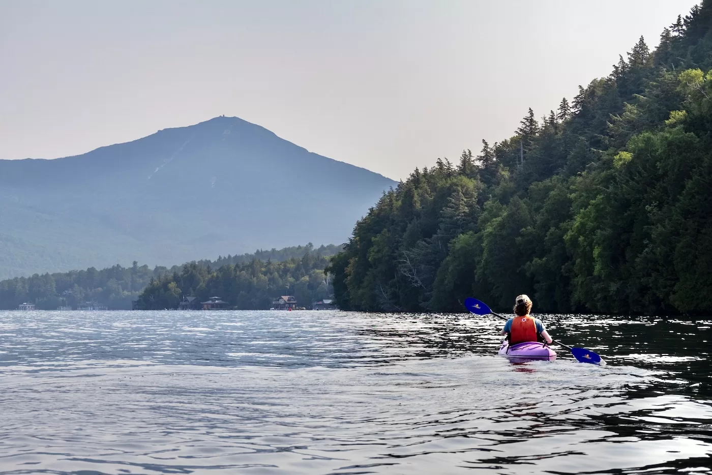
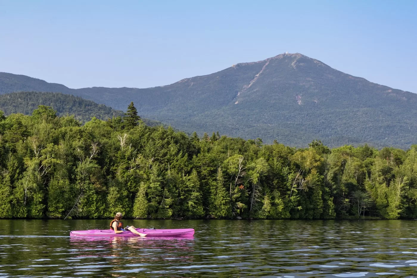
For this adventure, I was accompanied by my brother Bailey and my friend Jack. Bailey and I had climbed this slide in the past from Connery Pond trailhead, but to make it more interesting we decided upon kayaking across Lake Placid. We began our kayak at 9am at the public boat launch on the south side of the lake. It was a cloudless, humid day with minimal wind. The past week was considerably dry compared to the prior weeks of thunderstorms, so I figured the rock wouldn’t be too wet up top. The sky was somewhat hazy, so the mountains looked like silhouettes of themselves.
As we kayaked, I realized just how big Lake Placid actually is. From someone who has only been around the neighboring Mirror Lake, I figured it wouldn’t take more than half an hour to reach the other side. By the time Whiteface came into view about halfway across the lake, my shoulders were burning. Gazing upon the slide in the distance gave me the energy to keep moving forward despite the powerboats constantly passing us. The amount of wildlife in the area is incredible, with us spotting a couple hawks and a loon. A bald eagle, dove in the water right in front of us flying away with a fish in its talons.
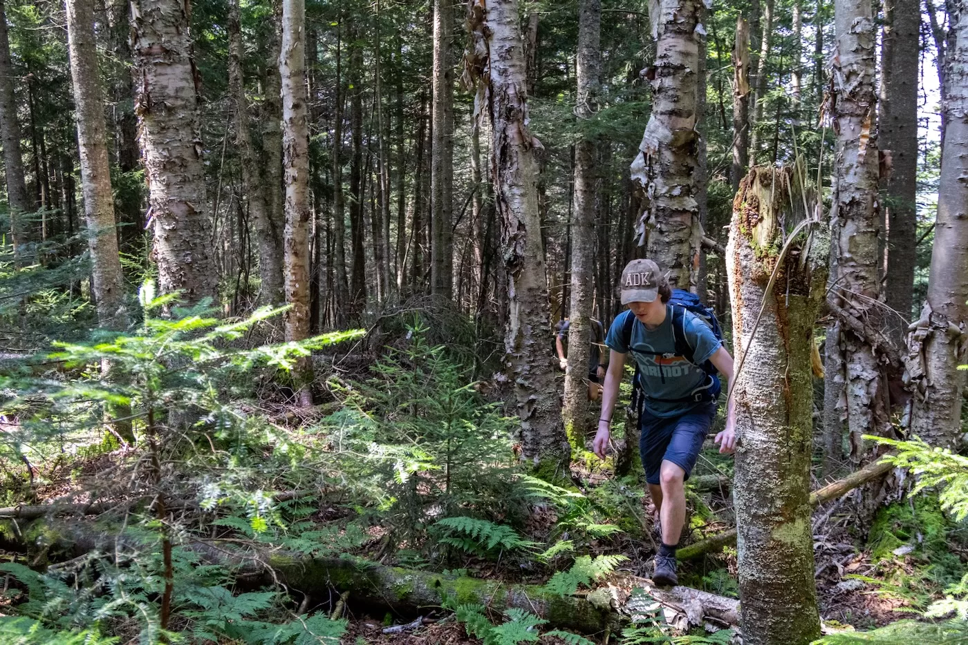
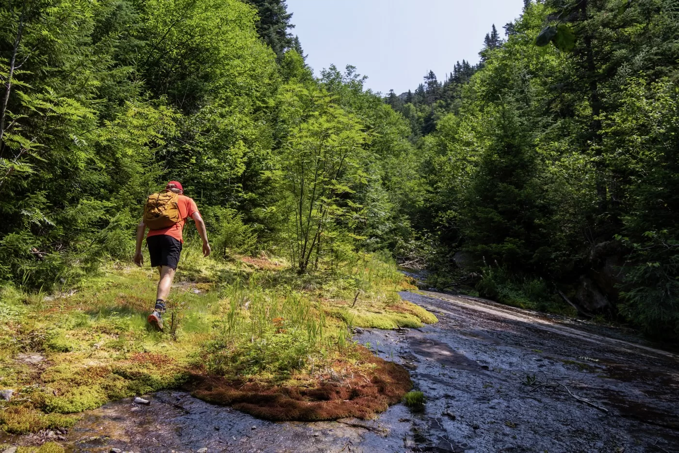
After a little over 3 miles and an hour since starting, we beached our kayaks at Whiteface Landing in Barrel Bay, a secluded cove on the northeast end of the lake where the trail from Connery Pond meets the water. We refueled and changed into our trail runners to start the hike. The trail was flat and soft with a couple sections of mud, which made for a quick walk. It lies parallel to Whiteface Brook, which is the drainage to the slide, so once the trail began to divert away from the brook after 2.2 miles from shore, we began our bushwhack towards the base of the slide.
The forest was surprisingly open for Adirondack standards with the only obstacle being fallen trees and the occasional spider web. Now that we were actually going up the mountain, the slope increased moderately, making the going a bit slower.
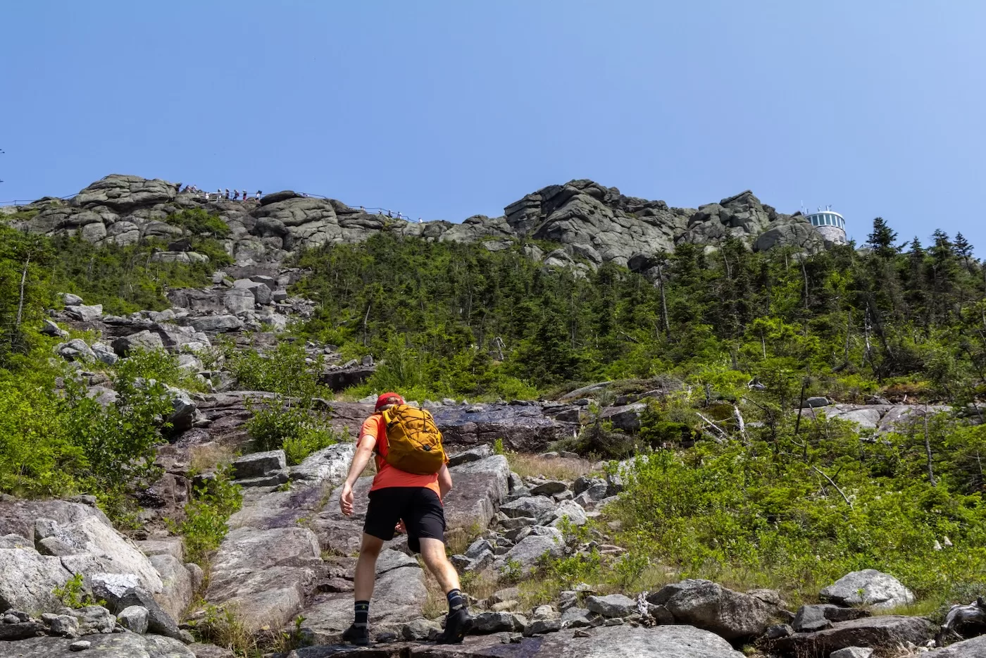
Once GPS indicated it was time to head out of the woods, we descended into the bottom of the slide at 3,400’ in elevation. It was 12:15 and the sun was cooking us in 80-degree heat, so we took a short break to rehydrate. The start of the slide ahead of us appeared slimy and covered in moss. There was water running down its right side that would enter the brook below.
The slab had a double fall line, with its slope falling to the west and south. This forced us to duck into the thick spruce forest to the left and head up from there. This seemed a common occurrence for others who as there was a herd path that meandered next to the slide. After a couple minutes of following the path, I headed towards the slide to see if it was climbable. This section of slab looked drier except for the left half. It was covered in red slime: every slide climber’s worst enemy. My only option was to head back up the herd path until I found a drier section.
After another 5 minutes of climbing the steep, thick woods adjacent to the slide, we popped out onto dry slab at about 3,550’ in elevation. As I glanced up towards the summit, I was surprised to see another person about 100 feet above me on the slide. In my years of slide climbing, I have never seen another hiker on the same slide, so this was quite the shock.
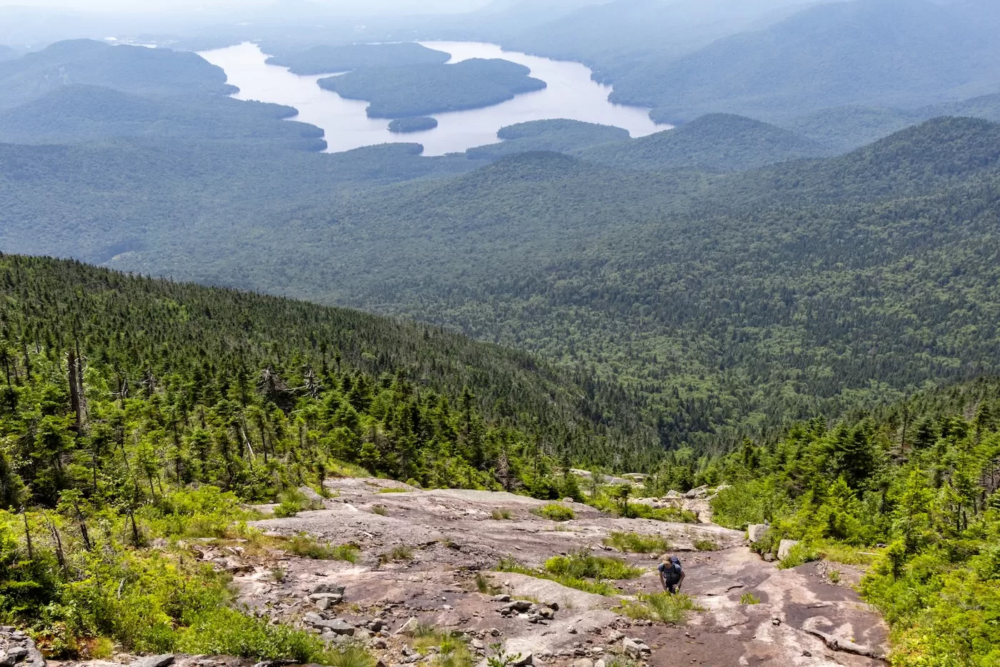
When I looked down to my right, Lake Placid seemed very far away; the dozens of boats coasting across the water looked like tiny white moving dots. Bailey and Jack decided to follow the right side of the wet slab that formed a brook below, so while I waited for them I was able to eat a snack and enjoy the views. Once they caught up and took some photos, we started our ascent up the dry slab. Besides a couple ledges that required upper body strength and leg extensions, the bottom half of the slide was easy for the most part. The rock was fairly grippy in the dry parts, with only a few dark lines stretching down the anorthosite that were reminiscent of dried-up running water from the prior week.
This route hasn’t slid since the 70s, and there were small trees and plants growing throughout the rock as we went up in elevation. This occurs on almost every slide eventually; some even until they’re fully covered again by the vegetation that blankets the surrounding mountains.
More recently-formed slides, such as the Autobahn Slide on Santanoni have little regrowth due to the slow process of the forest reclaiming what was once a part of it. It can take over a hundred years for slides to disappear. The Lake Placid Slide hasn’t had any significant activity in over 50 years, which is why there were many bushes and grasses to accompany us as we made our way up.
The low-angle, slabby terrain continued for most of the climb until about 200 feet from the top, where the ground turned to a mixture of rubble and small ledges. As I looked up towards the summit, I could see dozens of tourists walking the stairway and snapping pictures in front of the summit sign. I could also now see the cylindrical field station, which when spotted from another High Peak summit is a dead giveaway when trying to identify Whiteface from a distance.
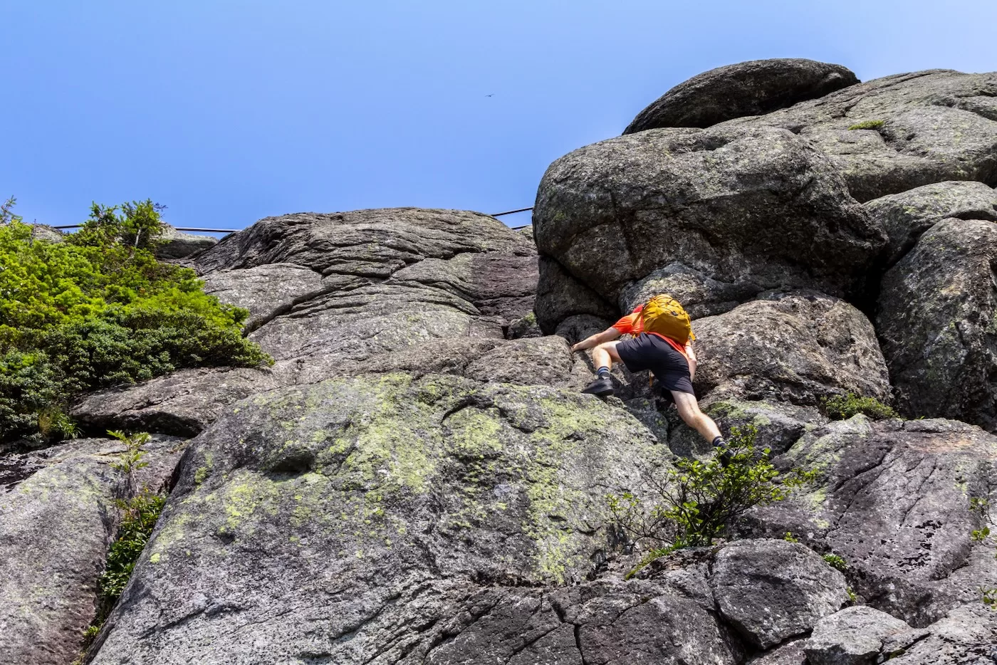
We continued to scramble over increasingly large boulders and around vegetation to find the path of least resistance until we were only a short distance from the headwall. Bailey pointed out that we had a crowd, and as I looked up, it seemed a small crowd had gathered above to watch us partake in the most difficult part of the slide climb.
This particular headwall can be diverted left or right as a safer route, but we wanted to challenge ourselves with the 4th class middle route, which feels like an almost straight-up rock climb that extends roughly 30 feet up to the stairway. Bailey went first as Jack and I took some photos and memorized his route. Once he made it up, it was my turn. Although very steep, it consisted of many large ledges which provided great spots to step and grab onto. As I carefully made my way up, I could hear the tourists mumbling in surprise as I got closer to the top.
Within only a couple minutes, I made my last step up and heaved myself over the metal railing beside the stairway. I then quickly positioned myself to capture a couple photos of Jack as he made his way up the same route. It was pretty amusing to hear the tourists watch in amazement as Jack took his last couple moves, mostly because this was just a typical headwall of the average slide. In fact, I would argue that the main slab sections of certain slides are more difficult than this headwall.
The slide climb itself was half a mile long and took a little more than an hour to complete. We were hungry to say the least, so we took advantage of being on the only High Peak with a road to the summit. We headed down the stairway to the Castle, which includes a cafe, bathroom, and souvenir shop.
During our lunch in the cafe, we debated hitching a ride down to the Connery Pond trailhead, and then hiking 45 minutes across a flat trail back to the kayaks. We opted to complete the hike back up and over the summit and down the trail we started on.
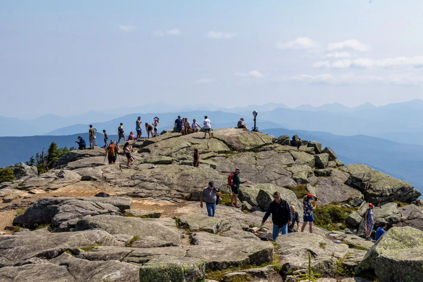
After lunch, we headed back up the .2 miles of stairway towards the summit. We passed at least a dozen people on the path, especially those who were wearing boots, jeans, and even dresses. The summit had no shortage of people, with a couple hikers that I spotted due to their dirtied clothes and backpacks. One tourist was using a drone from the summit deck, which is illegal to launch from a High Peak like Whiteface.
I’ve summited the mountain several times, and it never ceases to amuse me the amount of people on the summit that drive up from the memorial highway. In a way, it feels off that they can pay $20, while hikers struggle for hours under the heat to take in the same glorious views the summit provides.
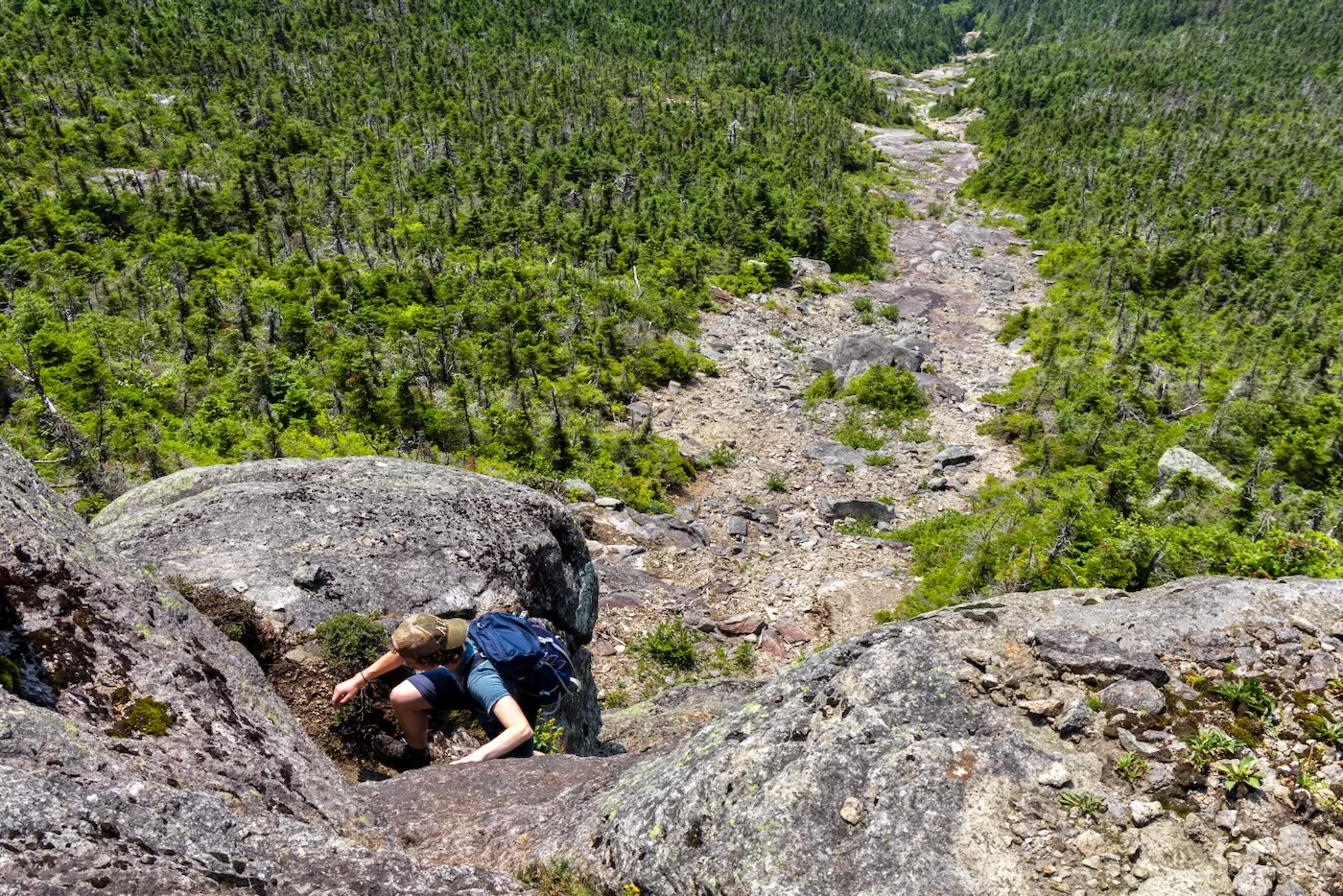
The sky was still hazy, so the mountains in the distance appeared like shadows of themselves. With the temperatures reaching well into the 80s, we left the summit at 3:00 and began to descend the Connery Pond trail on the south side of the mountain to get back into the shaded forest.
The trail winds back and forth across the steep rocky summit area for a while until it finally dips back into the trees at about 4500’ elevation. From there, it was an easy 2 hour rock hop down the ever-flattening trail back to Whiteface Landing where our kayaks were beached. Covered in sweat and mud, we’d be insane not to round out the trip with a swim in the lake, so we stripped off our shirts and shoes and enjoyed a refreshing dip in the cool, clear water for a while.
The trip wasn’t over yet; there was still the 3 mile paddle back across the lake to where we began in the morning at the boat launch. Without haste, we got back into our kayaks and headed off for the final stretch of the day. Once we were a good distance from shore and could now see Whiteface, I kept looking back to see what we had just endured for the past 8 hours. It’s almost mesmerizing to think one could go all that way, up to the summit, and back down within a day, but never underestimate a determined group of hikers.
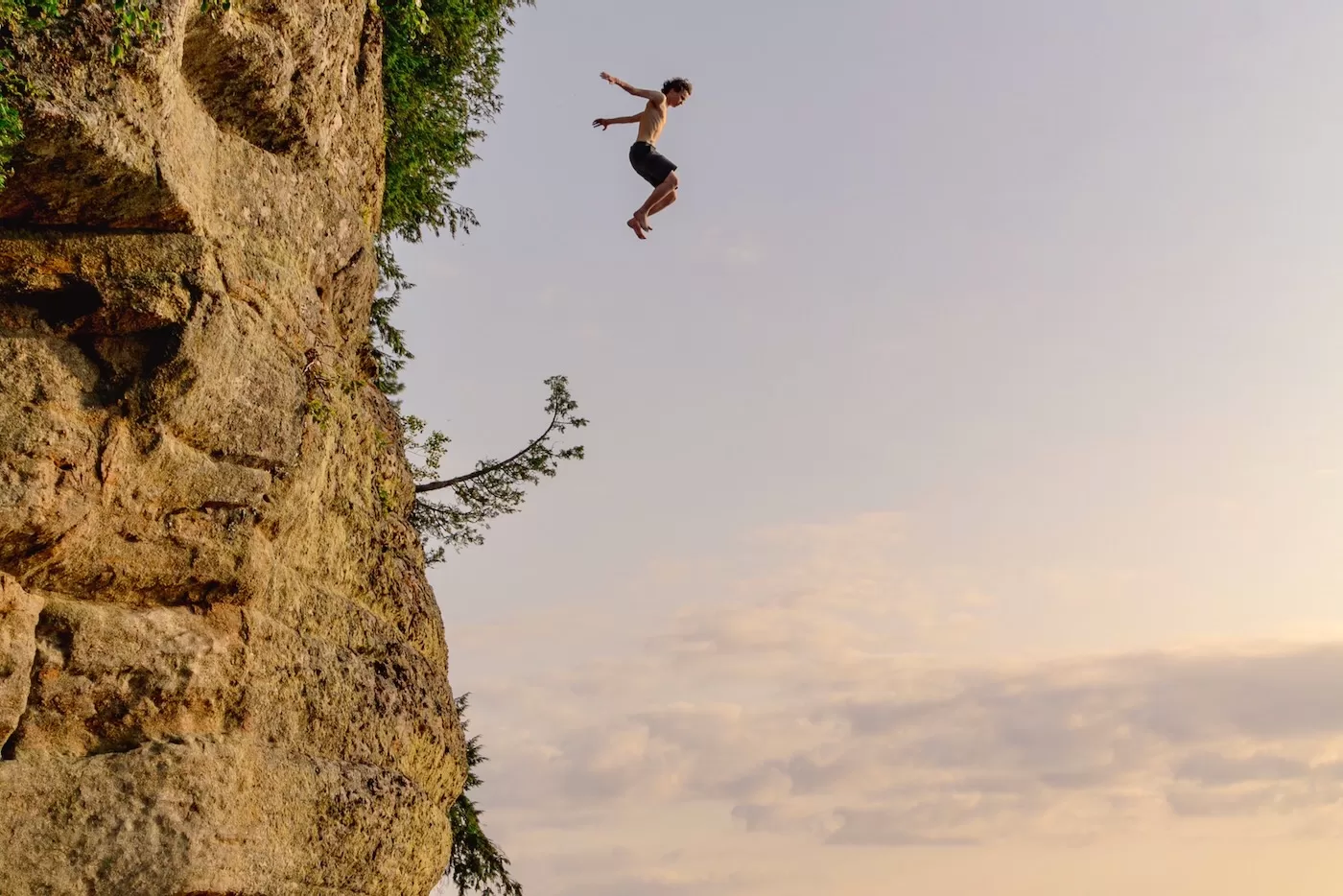
Midway through our kayak, Jack decided to stop and jump off a set of cliffs called Pulpit Rock as my brother and I and a couple boaters watched in amusement. By the time we made it back to the boat launch it was almost sunset, our 14-mile trek took 10 hours to complete. Next time, it’ll be March and we’d be making deep turns down one of the High Peak’s most classic landslides.
I know this red slime that you speak of. Paddle-shwack-climb-swim, I love these summertime scouting missions.
Loved this account and photos, too. Good for you guys for getting out there.
Great write up!
Pretty impressed with this adventure, way beyond what I think I can handle, especially in the heat and humidity, which has seriously been sapping my energy lately. -SPP
I loved this account.
Love the pics, especially the fourth and seventh shots. Great adventure story. Thanks for sharing
Really great share guys. Thank you I really felt like I was there through your excellent storytelling.
Excellent story! Enjoyed reading!
Pulpit Rock eh? I Didn’t know about that one–nice pic. When a bud and I climbed this slide, as we jumped the guard rail to descend, a tourist yelled at us “you guys are crazy”. Tourists have a low tolerance for fun!
Great story. I’m not a slide climber, but I do love playing on Whiteface.
That was me on the slide above you, I was equally surprised to see another group on there at the same time! Can’t think of that ever happening to me either. Such an awesome slide too. Not quite as steep as I was expecting (except for maybe the headwall) and a really enjoyable trip + fairly easy bushwack to get there too. I’ve spent what feel like an endless amount of time looking up at it from LP, skiing it in my mind. Maybe I’ll see you there in March!
What an incredible adventure! The Lake Placid Slide climb sounds like an amazing challenge, with breathtaking views and unique experiences. I love how you shared the journey from kayaking to bushwhacking and climbing—it’s a great reminder of the unpredictable beauty of the Adirondacks. Can’t wait to try it myself!