If you spend time in the Adirondacks, then you know the weather can be unforgiving at times. On occasion, Mother Nature can be so cruel that she’ll alter the landscape. When strong storms blow into the high peaks and drop multiple inches of rain in a short period of time, strips of land can be washed away off the mountains, leaving a “scar” of exposed anorthosite. These rockslides are a fun friction climb in the summer and an even better ski in the winter if conditions cooperate.
One of the more recent slides formed in the Adirondacks is known as the “Autobahn Slide” created after an intense rainfall in October of 2019.
It lies on the eastern flank of Santanoni Peak and has always teased me from afar as I summited other peaks in the region. Since the past couple weeks had been drier than average during this wet summer, I felt it was an appropriate time to climb it with my brother. We’ve both made it a goal to backcountry ski it this winter, and we wanted to scope it out, to see it without snow.
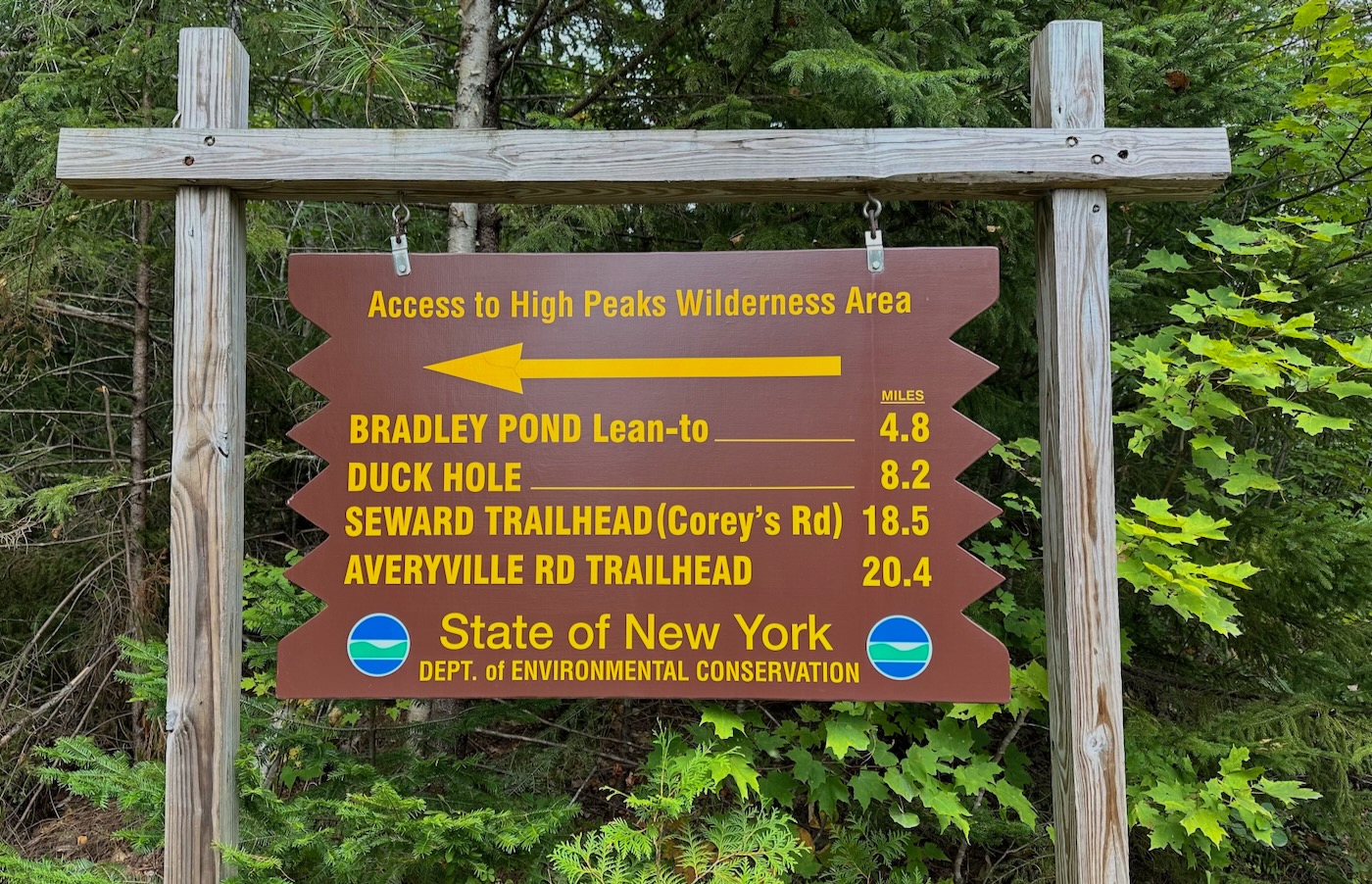
Our day started at 8am when I signed us in at the Bradley Pond Trailhead. It was around 45 degrees and there were yellow leaves all over the trail as we walked, which served as a constant reminder that fall is upon us. Fog blanketed the surrounding forest, but quickly disappeared as we covered more distance. The trail itself was flat, wide, and made of gravel, a rare occurrence in the High Peaks.
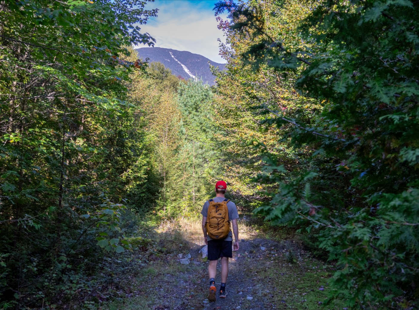
Within thirty minutes, we reached a fork in the trail. While most hikers would continue to follow the trail and go right, we ventured left as it would bring us closer to our destination. This seemed to be an old logging road that was grown in but still an enjoyable hike. After about a mile of walking, we came upon a large brook that, according to my GPS, would eventually lead us to the slide.
Normally, we would just rock-hop since it beat bushwhacking, but alongside the brook there was a very faint, old grown-in truck trail that was barely recognizable. We followed this until it seemed to end, where it was now time to hop the brook.
By this time, the sun had fully come out and provided a nice, warm glow within the dark forest. We took a momentary break to shed our jackets and rehydrate, and then continued on our journey. After what seemed like forever, we came across a split in the brook, which according to my GPS showed the left drainage led to another slide; a future endeavor.
The right drainage led us toward the objective, so we trekked along. This was more narrow than the previous brook so it was a little slower going. Along the way, we encountered multiple waterfalls which allowed us to refill our bottles. I couldn’t help but admire them due to the thought that only a handful of people have seen them in this remote area.
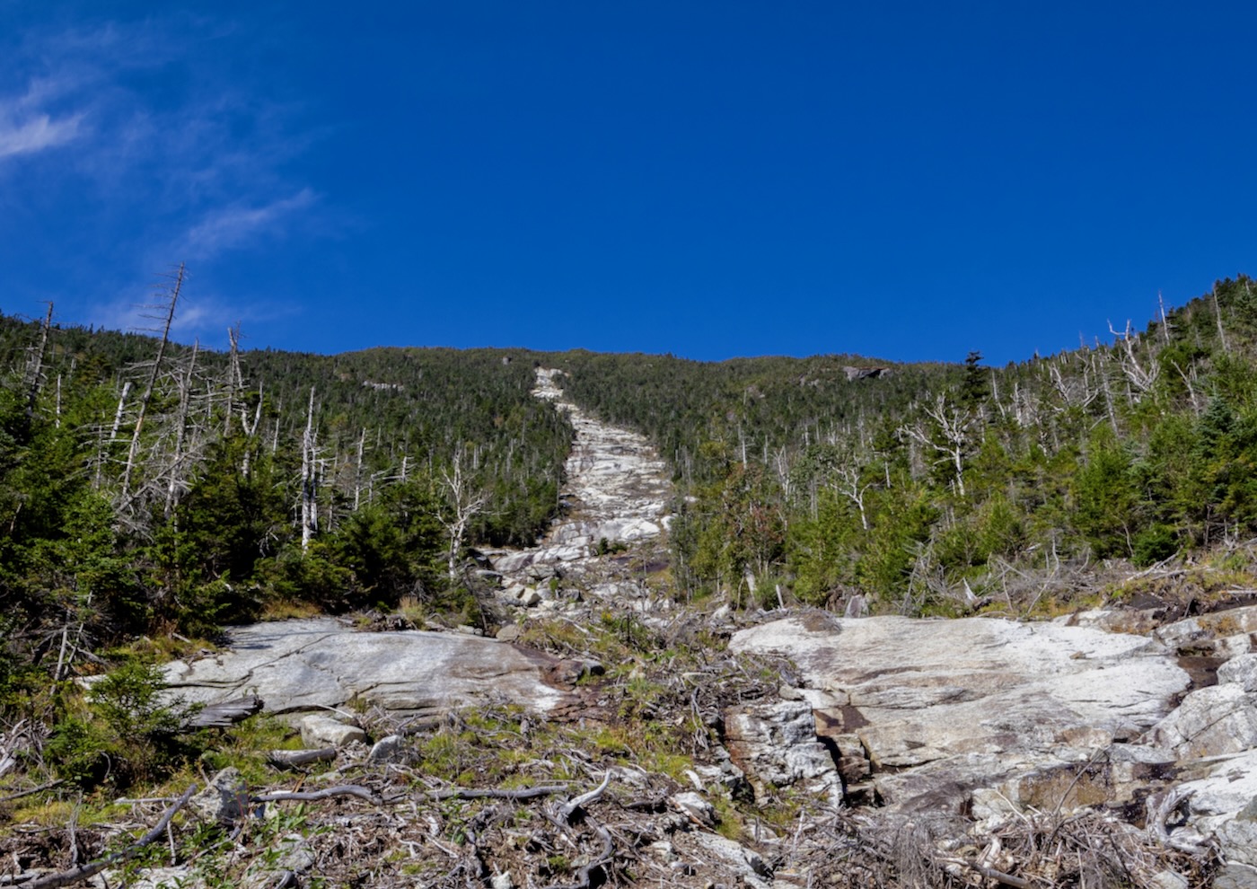
Once we reached 2,600’ in elevation, the drainage became more slabby, a clear sign that the slide proper was close ahead. It wasn’t long after passing some log jams that the forest opened up and we found ourselves at the base of the slide, roughly 3 hours since we started the hike. I gazed in awe at the clean, white slab that seemed to head straight for the summit.
The contrast to the bluebird sky was stunning. Luck was on our side because the slide looked bone-dry all the way to the top. In the case for most slides, friction is your friend, so when the rock is very smooth or has running water, it makes the climb much more nerve racking.
After a quick snack break, it was time to start the ascent. Usually, most slides start with a gentle slope and then gradually become steeper as elevation increases (just like the mountains they reside on), and the Autobahn is no different. It began fairly forgiving at around 20 degrees but would quickly increase in difficulty.
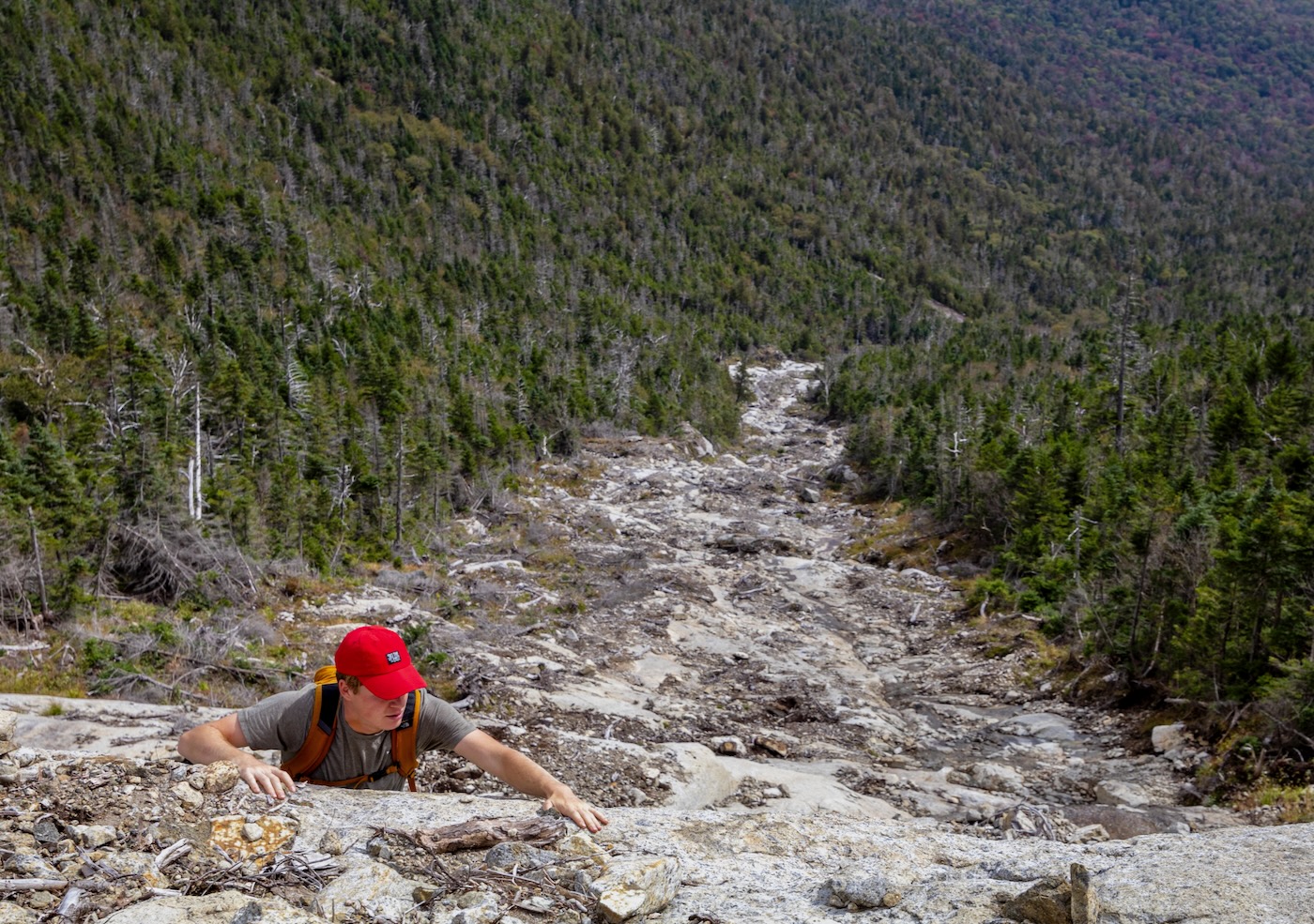
The slab was clean and adequately grippy with numerous ledges and cracks to hold on to. Rocks in sizes ranging from softballs to refrigerators littered the landscape. This humbled me to see just how powerful the forces of Mother Nature can be up in the mountains. Being a somewhat new slide, there were patches of dry mud that had not yet been washed away. I like to categorize this as a “mixed” slide: not very slabby and flat, but also not a complete rubble slide.
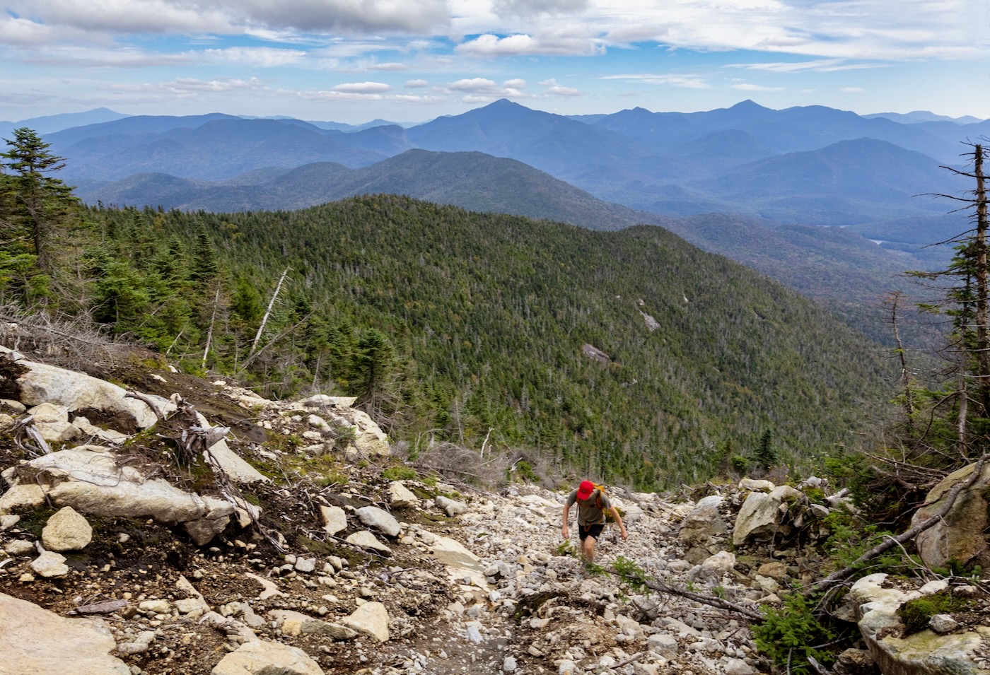
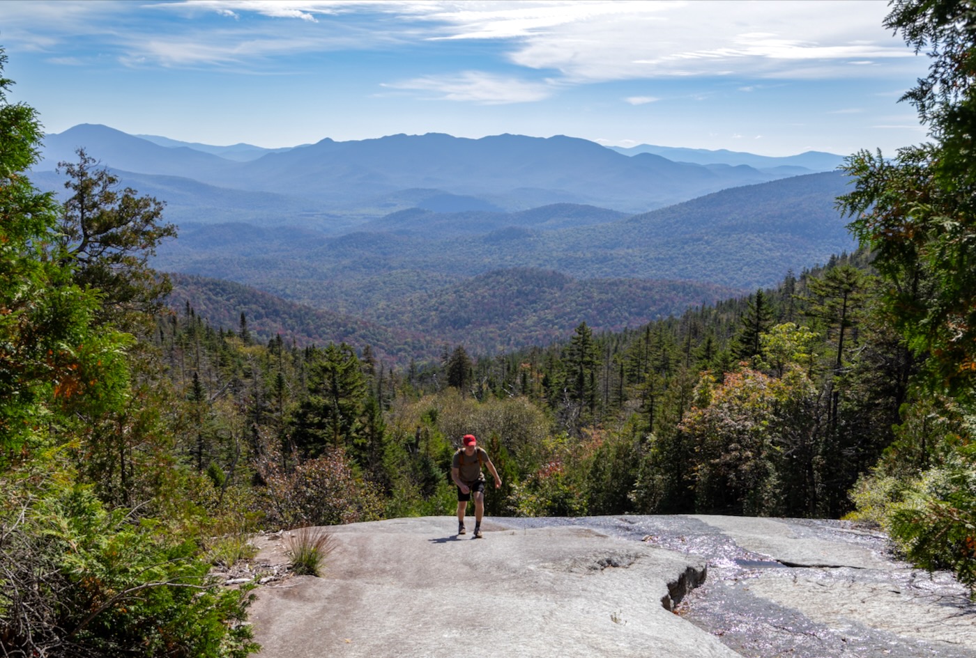
As we ascended, the view of the mountains behind us grew. It became habitual to turn around and gaze at the landscape that made up the High Peaks, from Whiteface all the way in the far distance to Marcy and its prominent treeless peak. The reds and oranges in the valleys were quite a sight.
There are always perks to slide climbing. It just being more fun than sticking to the trails and you enjoy non-stop panoramic views without a soul outside of your group. Combine that with being able to scope out lines for the ski season, and it’s no wonder why we can’t get enough of it.
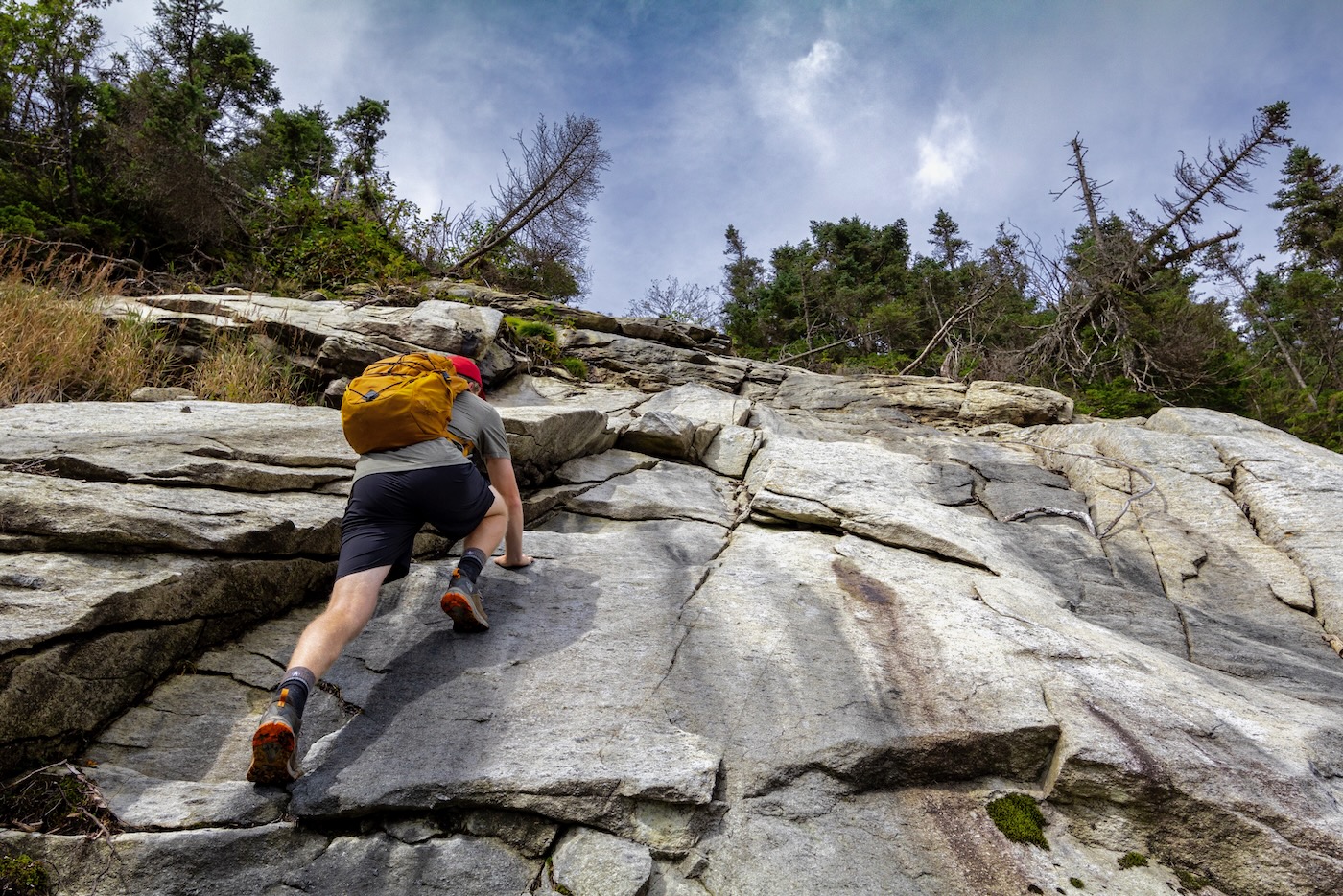
As we approached the headwall of the slide, it was clear that it was frighteningly-steep but luckily dry. Making sure our shoe soles were dry as well, my brother climbed it first, grabbing onto every little hold that appeared while hoping that the friction was enough to hold him in place. He made it to a small ledge at the top, now it was my turn.
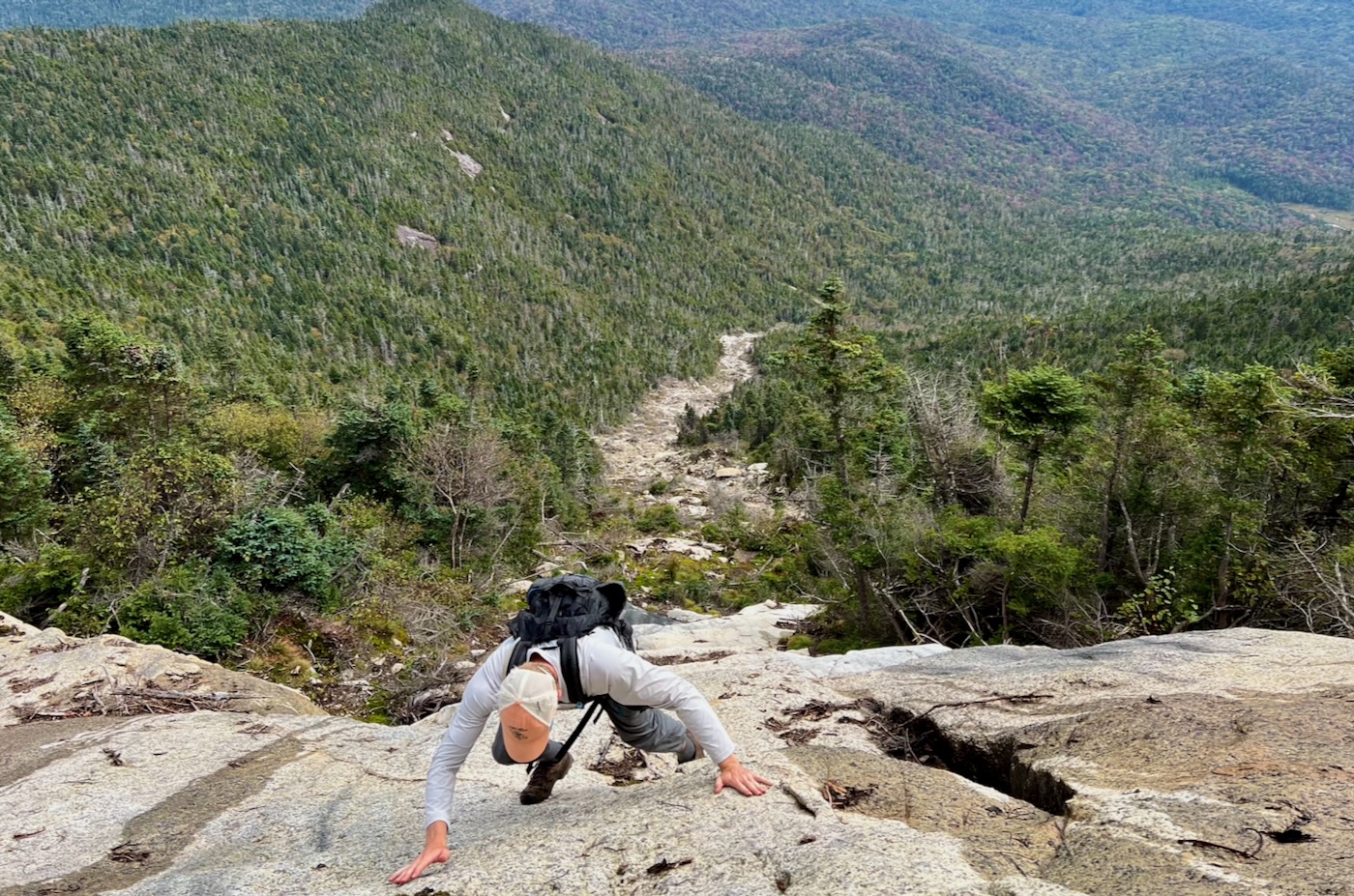
My fear of heights kicked in as I climbed the seemingly vertical slab, also praying that my vibram soles gave me enough traction to prevent any slippage. Along the way, once I settled myself onto the little holds available, I took a couple angle measurements to see just what we were up against.
The bottom of the headwall was around 40 degrees, but as I neared the top, there were sections in the high 40’s to lower 50’s, certainly a no-fall-zone.
Eventually, I made it to the small ledge atop the slide where my brother was capturing photos, ending our climbing for the day. In total, the slide proper took about an hour to complete and rose roughly 1,000’ in elevation in just .35 miles. Now came the worst part of the day: the bushwhack. Although it took less than five minutes, the krummholz was so thick that you couldn’t see two feet in front of you. I was thankful I chose to wear pants and a long sleeve shirt that morning.
We soon exited onto the trail, and within a ten second walk to the left made it to the summit at exactly four hours into the hike. Following a lunch consisting of tuna packets, trail mix, and homemade venison, a lackluster descent preceded, and after a little over two hours made it back to the trailhead, concluding our day seven hours and ten miles later. I anticipate it will make a tremendous expedition this winter.

For a second there I thought Russ (Bearpen) retired and became a writer.
I guess anyone can grab others handles.
Nice article.
Thanks for sharing your most excellent adventure: so well written it was like being there.
Awesome, great read. Appreciate you guys sharing the experience. Good luck making the reverse trip this winter.
That looks like a wild place. Very cool that you can share the experience with your brother. Looking forward to the winter version.
Thank you, nice article! What is your plan of attack on skis? That looks like a gnarly headwall.
Thank you for a nice exploration of a steep slide. Appears to have a good NE exposure, a relatively smooth granite “shark-free” surface to hold snow and a refreshing average steepness of 28 degrees (assuming GPS 0.35 mi is horizontal distance not the “hypotenuse”) for the slide.
May this year’s El Niño provide ample and stable snow conditions. Looking forward to living vicariously via a Spring trip report on skiing the slide.
Regards,
Mike
What an adventure! Curious as to what type of shoes you used on the slab: trail shoes, climbing shoes….?
Thank you all for the great feedback! I will most definitely make a post after skiing it.
Demersal, the plan is to probably skin in the same way to the slide, and then ascend until reaching the bottom of the headwall.
Peter, I climb slides in La Sportiva approach shoes. They aren’t the most water proof or comfortable, but they have just about the best grip you can get next to actual climbing shoes.
Quite a story TNS. Sweet debut!
Wow great writing and detail! I spend a lot of time in the high peaks when I was younger and I definitely miss it.
So…. Which brother was it? Would this amazing writing have anything to do with his third and fourth grade teacher?
Great article, pumped to tackle it this summer. Question: What was the approach to the slide like? I’m assuming Bushwack but how thick and how difficult to follow? There is a YouTube video from a few years back that looks pretty rough to get through. Appreciate any intel.
Ugh. Again, how do I miss these blog posts. So good. Thanks. This slide looks awesome.
Capt_planit: Subscribe and never miss a post!
If you ever get enough snow to cover the rough stuff, what a kick-ass run that would be if it doesn’t avalanche! The morning sun and afternoon freeze can create icy crust that new snow won’t bond to very well. I guess I’d be watching for that. However, you might be able to time it right to get a run someday. Good back country thrills in the Adirondacks are just an enjoyable fun fantasy for me since I moved to New Mexico before I got around to any winter mountaineering to speak of.