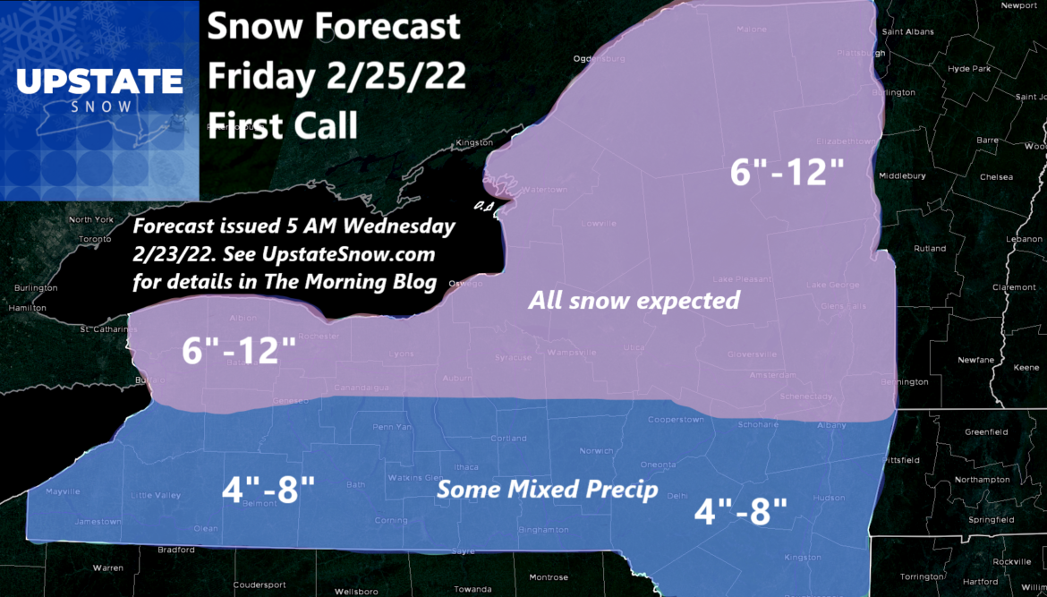
Very good consistency with respect to the deterministic data
for the Friday snow event. Probabilistic data also supports the
potential for 6 or more inches from this event and thus the
reason for the
watch issuance. Will be watching a couple of
items with this event. Strongest low level forcing (850
millibar
temperature
advection and surface easterly
flow to support
upslope precipitation) will be favored over our southern areas
and across southern New England. Meanwhile, drier air from large
Canadian high to our north will exist initially and this will
help lower precipitation amounts a bit over our northern areas.
However,
shortwave trough moves over the northern areas during
the day on Friday to enhance precipitation and seeing some
stronger
frontogenesis at 700 millibars over the northern areas
to support accumulating snow. In addition, snow ratios look to
be higher than
normal in the north versus southern areas and
this should help with accumulations despite lesser precipitation
amounts to the south. So at this time the potential for 6 to 10
inches of snow across most of our area exists and some of our
southern areas could push 12 inches given the favorable upslope
component. Bulk of the snow will fall between 12z and 00z so
while there will be some impacts with the morning commute Friday
morning, conditions during the day will deteriorate and the
evening commute may be the more difficult one.

