saratogahalfday
Well-known member
- Joined
- Jul 22, 2020
Area Forecast Discussion
National Weather Service Burlington VT
112 PM EST Tue Feb 22 2022
NEAR TERM /THROUGH WEDNESDAY/...
As of 1222 PM EST Tuesday...Crnt obs and radar show light
freezing rain wl enter the southern SLV in the next 30 to 45
minutes and quickly expand toward mss by 20z, where temp is
still only 20F as of noon. Given the complex thermal structure
in place acrs our region, fcst remains in pretty good shape.
Meanwhile, across central/eastern VT temps have warmed into the
upper 30s to lower 40s, a bit higher than expected, resulting in
less potential for freezing rain this evening. However, guidance
still shows pockets of below freezing temps developing toward
dinner-time, as temps cool before precip arrives with some
areas of freezing rain possible, so will keep advisory in place
for now.
Previous Discussion...A Winter Weather Advisory remains in
effect for the Saint Lawrence Valley in New York and portions of
central- eastern Vermont, including the Northeast Kingdom from
1 PM this afternoon through 1 AM Wednesday for ice accumulations
of 0.1 to 0.2 inches. Meanwhile, a Flood Watch remains in
effect beginning late tonight through Wednesday for all of
Vermont and most of northern New York except the Saint Lawrence
Valley for the combination of rainfall, snow melt, and localized
ice jam related flooding. Please see hydro section below for
additional details.
A low pressure system is currently tracking northeastward through
the Midwest and into the Great Lake region. This system will serve
as our weather-maker for the next 24 hours as it tracks along the
international border. As of 921 AM EST Tuesday. This front will
slowly advance northward throughout the day, bringing widespread
precipitation and warmer temperatures to the North Country. However,
temperatures will be slow to warm within the Saint Lawrence Valley
in New York where a shallow layer of northeast flow will keep
surface temperatures at or below freezing for most of the day.
Temperatures may also be slow to rise east of the Green Mountains in
Vermont. Ultimately, this will result in freezing rain across the
Saint Lawrence Valley and portions of central/eastern Vermont while
the rest of the forecast area receives rain. Precipitation is
expected to arrive this afternoon, spreading from southwest to
northeast throughout the evening. Total liquid precipitation will
range from 0.25 to 0.75 inches, with locally up to 1 inch. The
greatest amounts are expected across the southern Adirondacks and
southern Green Mountains where upslope enhancement will aid in
production. Regarding the freezing rain, up to 2 tenths of an inch
is expected within the Saint Lawrence Valley, while up to 1 tenth is
possible across portions central/eastern Vermont.
Temperatures will continue to rise through the overnight hours as
southerly winds finally take over for entire forecast area. With
that said, any freezing rain will change to plain rain late tonight,
mainly after 10 PM. The highest temperatures will occur early
Wednesday morning in the mid 40s to low 50s. Temperatures will then
fall throughout the day on Wednesday from west to east with the
passing of a cold front; by Wednesday evening, temperatures will
range from the low 20s to low 30s. Any lingering rain showers will
transition to mountain snow showers during this time.
The other concern with this storm will be the winds. A southerly low-
level jet of 60-80 knots at 850mb with develop overhead late
tonight. The good news is that the low levels of the atmosphere will
be very stable during this time thanks to the warm nose aloft and
the ongoing precipitation. This will limit any mixing potential and
prevent these strong winds from reaching the surface (the mountain
summits are a different story!) Still, we could still see an
occasional southerly gust in the 30-40 mph range late tonight. The
better potential for strong winds actually comes Wednesday afternoon
in the wake of the cold front attributed to deep layer mixing and a
westerly low-level jet of 45-55 knots at 850mb. This will result in
westerly wind gusts up to 35-45 mph, especially along the east-
facing downslope areas of the Adirondacks and Green Mountains.
Meanwhile, sustained wind speeds will be in the 15-20 mph range on
Wednesday afternoon.
&&
.SHORT TERM /WEDNESDAY NIGHT THROUGH THURSDAY/...
As of 434 AM EST Tuesday...Westerly flow aloft develops over the area
Wednesday night and Thursday as upper trough exits to the east. Any
lingering snow showers will come to an end Wednesday night with dry
weather expected on Thursday. Highs on Thursday will generally be in
the teens and twenties.
&&
.LONG TERM /THURSDAY NIGHT THROUGH MONDAY/...
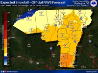
As of 434 AM EST Tuesday...Deterministic and probabilistic data all
support the idea of widespread snow developing across the area late
Thursday and especially during the day on Friday. Best temperature
advection and frontogenetic forcing will be to our south, but
shortwave trough moves over our area to enhance synoptic scale left.
With main surface low passing to our south our area will remain on
the cold side and thus looking at precipitation to be in the form of
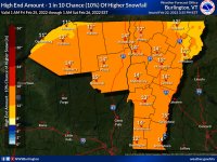
snow. Much of the data points to our entire area getting
accumulating snow with several inches possible. At this time our
southern areas would have the best potential to see the highest
amounts and of course we will continue to monitor this situation.
Snow tapers off from west to east Friday night and drier weather
returns for the weekend. An upper trough moves down from Canada
early next week for some additional snow showers and eventually
below normal temperatures.


