
You are using an out of date browser. It may not display this or other websites correctly.
You should upgrade or use an alternative browser.
You should upgrade or use an alternative browser.
Whiteface Conditions
- Thread starter NYSkiBlog
- Start date
ADKmike
Well-known member
- Joined
- Jul 22, 2020
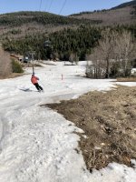
Great day yesterday, started off a little cold but full on blue sky and sun...snow softened...and what I think is our last day of the season was closed out properly with some deck beers at mid...
Attachments
Country Gun
Well-known member
- Joined
- Jul 22, 2020
Whiteface closing today.
Last edited:
- Joined
- Jul 15, 2020
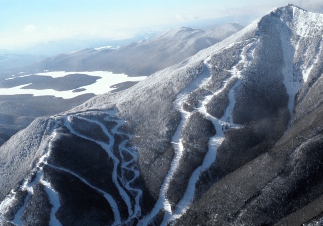
I went to see about updating our Whiteface map for the directory:
 nyskiblog.com
But the new map, there is something about it, just not sure:

 whiteface.com
For now I'm staying with the old map.
Whiteface Mountain Trail Map, Vertical Drop and Stats
Our profile of the resort in Wilmington, NY.
nyskiblog.com
But the new map, there is something about it, just not sure:
Trail Map - Check Open Lifts and Trails | Whiteface Mountain
Check out our new interactive Whiteface trail map and discover what lifts and trails are open, and find locations for mountain services.
whiteface.com
For now I'm staying with the old map.
MarzNC
Well-known member
- Joined
- Jul 18, 2020
Why not include both with appropriate captions? The two maps have very different perspectives. The new one is more useful for people who have never been to Whiteface, especially if they have kids who are beginners or are with adults who are cautious intermediates. Also makes the parking options more obvious for newbies. The old one gives the sense of the fact that Whiteface has a lot of vertical for the northeast.For now I'm staying with the old map.
Kevin Mastin is also an artist. In the same way that James Niehues is an artist. If Whiteface had gone with a Vista map, I would probably feel differently.
Mastin lived in Boston for a few years before moving back to his native Colorado. I imagine he spent some time traveling in New England when he was in the northeast. He worked with Niehues on map paintings for Keystone and ABasin. Neihues updated maps originally painted by his mentor, Bill Brown.

Kevin Mastin: Will technology replace hand-painted trail maps? - SlopeFillers
Behind every block of code or digital overlay is one simple thing: Art. Really incredible art. Art that has remained predominantly hand-painted for decades by people like Kevin Mastin. But how long will that last?
Gregg: What was the first resort trail map you did, when was it, and how did you get that job?
Kevin: Working for Keystone exposed me to ski maps. We were working with Jim Niehues, who I consider “the modern master of the ski trail map.” Jim was updating several of the maps which had been painted by his mentor, Bill C. Brown. Jim painted the artwork, but he did not create the overlays (trail names, lift lines, etc.). This was at the point when some graphic artists were still using press-type, photostats ands acetate overlays. Fortunately, I was already well-versed in creating vector art. So, on my first two maps, Keystone and Arapahoe Basin, Jim painted the art and I did the overlays digitally.
In 1994 Keystone greatly upgraded its mountain biking operation and I got my first opportunity to start a map from scratch—reading the maps, taking the aerial photos, sketching the layout, then painting the mountain—I finally had the chance to paint a widely seen illustration. I worked for Keystone and Vail Resorts until 1997 when I started my own shop.
MarzNC
Well-known member
- Joined
- Jul 18, 2020
JN means?It's ok, just not JN I guess. Looks better cropped, may go that way with it.
Also many of our maps are older. When things like liftlines change (like Gore), I like to update them.
Face4Me
Well-known member
- Joined
- Sep 12, 2020
I think I had heard that they are going to get rid of the Mixing Bowl lift and replace the Bear lift with one that follows the same line as the current lift, but starts down closer to where the Mixing Bowl lift currently starts. It will make it easer to access the Bear lift and won't force people to have to walk/skate across the bottom of the Fox (Lower Valley) trail.The latest ORDA board meeting approved something about replacing the bear lift and extending it "a couple hundred feet at the base" to minimize "traffic".


