Fall Weather 2020

NWS ALY Longterm

.LONG TERM /SUNDAY THROUGH THURSDAY/...

Increasing consensus for southern stream upper energy to track east
and northeast through the eastern and northeastern U.S. Wednesday
into early Thursday. There are considerable uncertainties in terms
of the track and timing of the system. However, considering the
origin of the southern stream system, quite a bit of potential
moisture, forcing and upper dynamics. So, including solid chances
for snow with the highest chances south of I-90 mainly Wednesday
afternoon and night.
Decreasing chances through Thursday. Details on
this potential snow event will get clearer as we get closer to
potential impact.
If Magic is opening next Thursday, expect a foot plus from this storm for them.
 
Aaand we're back.


.LONG TERM /MONDAY THROUGH THURSDAY/...

After a fair but cold day Tuesday, the focus turns to an approaching
southern stream system for Wednesday-Thursday. Latest guidance seems
to be better clustered with a low tracking off the mid Atlantic
coast and south/east of Long Island, then northeast off the New
England coast, but
there remain some differences in exactly how far
north/west, and strong the surface low may be. Latest 00Z/11 ECMWF
seems to be along the northern side of potential tracks, and
north/west of the deterministic 00Z/11 GFS and most GEFS members,
creating a more impactful snowstorm to the region, with the other
guidance suggesting better chances across southern areas. For now,
have increased PoPs across the region, but still kept below the
likely range due to lingering uncertainty, with greatest PoPs from
the mid Hudson Valley northeast into NW CT and the Berkshires for
Wednesday afternoon and night
, then decreasing Thursday morning.

The main PV anomaly associated with this potential storm system is
currently located in the northeast Pacific Ocean, and it will take a
few more days for better atmospheric data sampling of this
disturbance to incorporate into model guidance. So, until then,
additional changes in storm track, intensity, and potential impacts
to eastern NY/western New England will likely occur.
It is advisable
to monitor trends in the forecast this weekend, as potential impacts
become better refined.

In the wake of this possible system, blustery conditions with below
normal temperatures are likely for Thursday afternoon.


I'm surprised this far out the guys are talking about where the snow will (potentially) fall, but it is cool to see as long as you don't start booking it.

Starting to see hints of it here:

CONUS_GFS_SFC_ACCUM-SNOW-10_144HR.gif


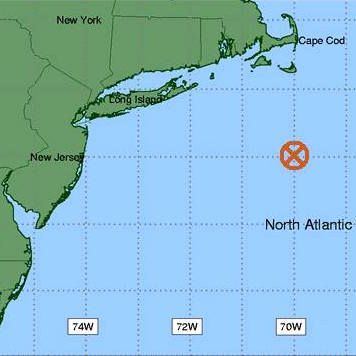
Here's a reference point for storm tracks:

 
From NWS ALY

.LONG TERM /MONDAY THROUGH FRIDAY/...

Strong southern stream energy tracks east approaching our region
Tuesday night into Wednesday and there are uncertainties as to how
far north it tracks
through Thursday. The latest broad consensus
from sources of guidance/ensembles is for the potential heaviest
precipitation to affect areas of the eastern Catskills, mid Hudson
Valley, NW CT and southern Berkshires
. However, even areas north of
there could see measurable precipitation
. Most if not all the
precipitation looks to be snow but the position of the precipitation
transition zone will be influenced by low level flow and the
ultimate track of surface and upper features, very uncertain this
far out in time. Precipitation should end by Thursday morning. Highs
Wednesday and Thursday in the 20s to lower 30s.
 
NWS ALY

.LONG TERM /TUESDAY NIGHT THROUGH SATURDAY/...

On Wednesday morning, clouds will continue to increase, as a fast
moving upper level disturbance moves from the Tennessee Valley
towards the mid Atlantic States and surface low pressure rapidly
develops near the Carolina coast. While the day will start off dry,
some snow may start to spread into southern areas for late in the
day. There is good confidence that any p-type will be snow, plenty
of cold air will be in place at both the surface and aloft.


The low pressure will continue to deepen for Wednesday night into
Thursday morning as it lifts northeast off the eastern seaboard.
This storm system will have the capability to produce both moderate
to heavy snowfall amounts and high snowfall rates, although where
this occurs is still far from certain.
There is still considerable
uncertainty regarding the exact track of this storm system, which
will determine how far north/west the steady snow will get. As of
right now, the operational guidance has tended to suggest that the
heaviest snowfall will be across eastern PA, northern NY, the NYC
area and into southern CT. This would give only a light snowfall (at
most) for the Capital Region on north/west. Still, many models
still suggest at least moderate snowfall is possible across the
Catskills, mid Hudson Valley and NW CT
and there are several
ensemble members (both within the 12z GEFS/Euro Ensembles) that
suggests a more northern track is possible, with steadier/heavier
snowfall across the entire area,
so the forecast is still far from
being locked in at this time.

The storm system will be departing on Thursday, with any lingering
precip ending across eastern zones by early afternoon. Behind the
storm system, cold and dry conditions look to be in place for the
remainder of the week and into the first part of next weekend.
Daytime temps will only be in the 20s, with single digits and teens
at night. With the possible snow cover on the ground, it will feel
quite wintry out. More snow showers are possible for the later
portion of next weekend.
 
Right now it looks like Belle is forecasted for 8-12 inches Wednesday . . . . And I haven't even tuned my skis : )
 
as of the Current model runs.. Wed/Thur is a non event NY ski areas...
 
It ain't over til it's over!
 
Back
Top