Today's Hike

chrsdipietro94@

Well-known member
Joined
Jul 23, 2020
I'm working on a project with a goal of walking our entire local trail system. We have a fairly well connected modular system throughout the valley. I was inspired to embark on this project by a guy who completed a project with a goal of covering all of the ground in San Francisco.

Typically, you can traverse a wide array of habitat and micro-climates in one walk. If you're really motivated, you can navigate a route from river level (675ft) up onto Mission Peak (6850ft) crossing 20 miles of well maintained trail and forest road. It would take all day, and by the end of that day, you would probably be pretty irritable because you still had to navigate back to town from point 6850, and it was already past sunset, and you started at sunrise (my wife and I did this when we first moved here... it was a true test of our marital abilities).

Having recently completed the network surrounding Saddle Rock Gateway trail-head, today I moved over to Foothills. Within each area, typically, I start with a loop consisting of some of the main veins and arteries. There's a lot of ground to cover in each zone. On subsequent trips I focus on navigating to new ground as efficiently as possible within the system. It took 9 return trips to Saddle Rock to cover all of the ground in that Canyon. Foothills/Horse Lake will probably take twice as many.

Here's what it looked like today.
FootHillsMap.jpg


FoothillsTrail.jpg


FootHillsLookingTown.jpg


This area is in full desert mode this time of year. Today was a bit windy. The trail-bed is the consistency dry concrete with 3 inches of beach sand/moon dust on top. Breezes kick up the dust. If somebody blows by you on a bike, you eat their dust... literally.

Here are a few shots from walks around Saddle Rock

SaddleRockLookingSouth.jpg


DesertPine.jpg

This an interesting angle. When you look at it from the East side of the river (head on) it looks like a saddle, hence the name. Looking at it on the South face, it looks a bit like a shark fin.
SaddleRockLookingNorth.jpg
 
On subsequent trips I focus on navigating to new ground as efficiently as possible within the system. It took 9 return trips to Saddle Rock to cover all of the ground in that Canyon. Foothills/Horse Lake will probably take twice as many.

With 9 return trips this sounds like a fun challenge, to string it together, taking into account limits and interests.

This is very cool.
 
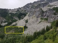
Walked up hill in a wonderful spot yesterday. I ascended the Chatter Creek trail to just below 6k. This trail offers spectacular views of Grindstone Mtn. The ski terrain in this zone is pretty amazing. It's just East of the crest, so the snow is plentiful, and a bit drier than on the West side. The trail winds its way through the historical record of debris piles from seasons past. Oddly enough, it rained? Rain never happens East of the crest in August. I had planned on making the trip up to Lake Ethel, but the scrambling became too risky with wet rocks.

Here's what it looked like:

GrindstoneMap.jpg


Wild Flowers in bloom up high
GrindstoneFlower.jpg


View of Colchuck zone over in the Enchantments
GrindStoneEnchantments.jpg


Wide view of Grindstone upon reaching the floor of the lower basin
GrindStoneWide.jpg

Here's a closer look of the face... the guardrails indicate some potential mandatory air..
GrindStoneUpperLower.jpg


It was interesting to see the record of last seasons slides in the run-out zone. At Mission, we had a lack-luster last-season in terms of snowfall (70% of norm). Over here (about 25 miles west of Mission), last season ended at about 120% of normal. West of this meridian (although still East cascade) get loads of snow. You can see slides debris piles here that broke from the South and East aspects.
GrindStoneRunout.jpg
 

Attachments

  • GrindStoneLowerCloseup.jpg
    GrindStoneLowerCloseup.jpg
    825.6 KB · Views: 165
Went over to the tall grass of the Foothills again yesterday. Completed the main loop in the upper section of this trail system. This is a multi-use trail that gets a lot of MTB traffic. In the past 3 months the traffic out in this zone has gone through the roof. It's starting to feel a bit overcrowded after 10AM. After a fairly simple (yet long) climb, it's fast and squirrelly on the down-hill.... lots of blind corners. These days, I prefer to walk this trail as opposed to ride. A fall resulting in injury from last season has left fear in my head every time I ride my MTB. On trails like this, the walker has the right-of-way. The local rule is "stop your bike and yield to the walker." Unfortunately, most of our local MTB community does not go by this rule. I had a near miss yesterday that probably would have hurt both of us. Be careful and stay healthy.

FootHillsHike2.jpg


Looking west at the Enchantments
GlacierView.jpg

GlacierView2.jpg

Looking North at Burch Mtn. The black spot in the center is a burn scar from last week.
BurnScrar.jpg
 
Rolling down low today. A brutal heat-wave is on the way, but today was pretty pleasant with exception of wind out of the North. The first 10 miles were straight into the wind (sustained 15mph, with gusts up to 30). I used an e-biker as a shepherd early, but she attacked on the climb up to the North bridge, and dropped me without effort on the steepest section.

Started at the south trail-head on the Apple Capital Loop and rode out to my new homestead.

Here's what it looked like.

ValleyRide.jpg

A few miles of fresh chip-seal. A splashy shoulder made this section pretty miserable
GrindTime.jpg

Sweet view of the Enchantments from Riverside Park in Cashmere
CashmereView.jpg

There is skate park and pump track here... 1 kid out there this morning tearing it up on a scooter.
ScooterSession.jpg

Little dude in the lower right getting ready to roll-in...
PumpTrack.jpg

Every town in the valley has a skate park and a pump track. This one is where the hard-core skaters do their work
BootlegPark.jpg


This made the route home a bit complicated... there are 4 more crossing from here. This train is at a complete stop and it is extraordinarily long.
Train.jpg

View from the new homestead
NewHomestead.jpg
 
Rolling down low today. A brutal heat-wave is on the way, but today was pretty pleasant with exception of wind out of the North. The first 10 miles were straight into the wind (sustained 15mph, with gusts up to 30). I used an e-biker as a shepherd early, but she attacked on the climb up to the North bridge, and dropped me without effort on the steepest section.

Started at the south trail-head on the Apple Capital Loop and rode out to my new homestead.

Here's what it looked like.

View attachment 4820
A few miles of fresh chip-seal. A splashy shoulder made this section pretty miserable
View attachment 4821
Sweet view of the Enchantments from Riverside Park in Cashmere
View attachment 4822
There is skate park and pump track here... 1 kid out there this morning tearing it up on a scooter.
View attachment 4823
Little dude in the lower right getting ready to roll-in...
View attachment 4824
Every town in the valley has a skate park and a pump track. This one is where the hard-core skaters do their work
View attachment 4827

This made the route home a bit complicated... there are 4 more crossing from here. This train is at a complete stop and it is extraordinarily long.
View attachment 4825
View from the new homestead
View attachment 4826

Washington sure is beautiful. The better half and I are conspiring on how to spend more time there as well as other states of interest in the fairly near future.

you are very lucky to live there!
 
Quick climb up to Clara Lake.... a short walk up to the sub-alpine. The is a great side-country spot at Mission.
ClaraMap.jpg


ClaraLake.jpg
 
Can you see smoke from the fires? It was dulling the clear blue sky in the east yesterday.
 
Yup... it's like a war zone over here... I shot this one a few days ago. There is about 400,000 acres burning about 50 miles to the North. The sun has been obscured for about 2 weeks now. Air quality is hazardous pretty much everywhere. It progressively gotten worse over the past few days.

Smoke.jpg
 
Back
Top