Harvey
Administrator
- Joined
- Jul 15, 2020
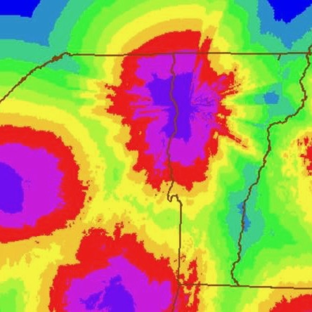
I always knew that radar didn't work as well far from the source, but I had no idea you could map it:

 nyskiblog.com
So while Gore may truely be in the donut hole, it's also in a radar hole.
I'm trying to figure out how to use this thing to create some custom maps like that one, wnat to see the Cats and all of NY:

Northeast Radar Quality Map • NYSkiBlog Directory
The Radar Quality Map is an NOAA product that indicates how accurate radar is in each location. Darker areas show the strongest signal.
So while Gore may truely be in the donut hole, it's also in a radar hole.
I'm trying to figure out how to use this thing to create some custom maps like that one, wnat to see the Cats and all of NY:


