Ripitz
Well-known member
- Joined
- Dec 23, 2020
I was originally hoping to put this together as a story for the front page but never found the time. Now that ski season is here it has gone stale. Here it is as a trip report free from the scissors of our tyrannical editor. Just kidding Harv- I appreciate your support and all of the work you do to give us this platform to share info and stories. Warning, without Harvey’s help, this TR is long.
The Catskill Nine

3:30am; I woke from a three hours rest. I frantically went over my gear one last time and did my best to squeak out a poop. I scarfed down some oatmeal with honey and washed it down with green tea and more honey. I’m nervous.
4:15am; Powerman picked me up and we rush off realizing we have no beer.
4:20am; The door to the beer cave at the gas station won’t open. The clerk informs us they can’t sell beer between 4 and 8am. Damn. What a rookie mistake, no finish line victory beer for us. With no time to waste we jump on the highway and head off to the southern Cats.
6:15am; Except for a few frosty cars parked overnight, we were the first ones at the parking area in Denning.
6:45am; We signed in and hit the trail in the dark with headlamps.
Our objective for the day was an ambitious round of the Catskill High Peaks surrounding the headwaters of the Neversink River; Table, Peekamoose, Lone, Rocky, Balsam Cap, Friday, Cornell, Wittenberg, back over Cornell and finally Slide, the highest in the range. These peaks are collectively known as the “Catskill Nine”, ”Neversink Nine”, or simply, ”The Nine”.

Neversink River

We quickly ditched the lamps as the sun came up to light our way over the Neversink and up towards Table Mountain.


We stopped to enjoy the first rays of the day with Van Wyck Mtn in the distance.


It was a beautiful morning and the woods were stunning.

The smell of woodsmoke led us to the Bouton Lean-to.

Two volunteers from the NY/NJ Trail Conference were there for a work day after spending the night. A full crew was about to hike in to help with the build. The new lean-to was built by the Bruderhoff at their place, disassembled, then helicoptered in and reassembled. We thanked them for their efforts and continued on our way.
We saw the first ice of the year.

The smell of Balsam was intoxicating.


10am; We (me) are moving very slow. We knocked off Table and Peekamoose and then got a view of our next four bushwack peaks with the Devil’s Path ridge-line in the distance.

Of the 35 peaks over 3,500ft, 16 do not have a maintained or blazed trail to the summit. They do however have many herd paths, also called social trails, that lead the way. A small pile of rocks was a sign for us as we stepped off the trail and into the bush.

Things got thick real quick

And wild.

We had hard maps and compasses for navigation but our phones were quick and easy to help find the way. It was like we were cheating but it helped keep us moving. On long days in the backcountry, speed is your friend. It also kept us from tramping down the plants into the fragile forest floor. Now that we’ve been through there I’d like to return using only natural means.


12:30pm; Rocky. The bushwhack peaks have canisters with notepads so you can sign in to say you were there.

After knocking off Lone and Rocky we headed off to Balsam Cap. This area is rarely traveled. Most people come to these peaks from other directions and few link them this way.

1:30pm; Balsam Cap

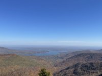
We got a sneak peek of the Ashokan Resevoir.

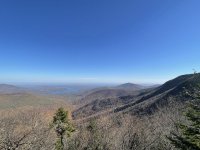
Then came the real deal.

Along with Cornell and Wittenberg

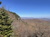
Friday‘s cliffs with the eastern Devil’s Path in the distance.

2:30pm; Friday

Deep in the thick of it we came upon a marker tree. These trees were made by the indigenous people to signal direction, medicinal plants, ceremonial areas and most often water. As I was jockeying into position to take a picture of it and wondering if it was one, I turned to discover a spring emerging from under a rock. I was giddy and covered with goosebumps. There is so much we don’t know.


We continued the trek into what is known as one of the thickest miles in the Cats. Between Friday and Cornell is a mountain known as the Dink.

It is thick and shwacky. I came prepared with safety glasses and leather gloves and went to work. There were places where we couldn’t see each other. At one point I called out to Powerman to find him and he was no more than fifteen feet away.


3:30pm; We hit the marked trail to Cornell. Our goal was 4pm so we were feeling good. After all of the shwacking the maintained trail felt like a superhighway. At one point I let my guard down while jumping over a crevice in some rocky cliffs. I collapsed like a cheap beach chair on the other side convinced I blew out my knee. I slid backwards and self-arrested with my trekking poles nearly taking a switch fifteen footer down to the forest below. I was freaked. Powerman came to check on me and after I collected myself I was able to shake it off, stand up and start crushing again. No time for that bullshit.
4pm; Cornell, with views of Slide.

4:30pm; Wittenberg, with what is known as the best view in these hills.

The Catskill Nine
3:30am; I woke from a three hours rest. I frantically went over my gear one last time and did my best to squeak out a poop. I scarfed down some oatmeal with honey and washed it down with green tea and more honey. I’m nervous.
4:15am; Powerman picked me up and we rush off realizing we have no beer.
4:20am; The door to the beer cave at the gas station won’t open. The clerk informs us they can’t sell beer between 4 and 8am. Damn. What a rookie mistake, no finish line victory beer for us. With no time to waste we jump on the highway and head off to the southern Cats.
6:15am; Except for a few frosty cars parked overnight, we were the first ones at the parking area in Denning.
6:45am; We signed in and hit the trail in the dark with headlamps.
Our objective for the day was an ambitious round of the Catskill High Peaks surrounding the headwaters of the Neversink River; Table, Peekamoose, Lone, Rocky, Balsam Cap, Friday, Cornell, Wittenberg, back over Cornell and finally Slide, the highest in the range. These peaks are collectively known as the “Catskill Nine”, ”Neversink Nine”, or simply, ”The Nine”.
Neversink River
We quickly ditched the lamps as the sun came up to light our way over the Neversink and up towards Table Mountain.
We stopped to enjoy the first rays of the day with Van Wyck Mtn in the distance.
It was a beautiful morning and the woods were stunning.
The smell of woodsmoke led us to the Bouton Lean-to.
Two volunteers from the NY/NJ Trail Conference were there for a work day after spending the night. A full crew was about to hike in to help with the build. The new lean-to was built by the Bruderhoff at their place, disassembled, then helicoptered in and reassembled. We thanked them for their efforts and continued on our way.
We saw the first ice of the year.
The smell of Balsam was intoxicating.
10am; We (me) are moving very slow. We knocked off Table and Peekamoose and then got a view of our next four bushwack peaks with the Devil’s Path ridge-line in the distance.
Of the 35 peaks over 3,500ft, 16 do not have a maintained or blazed trail to the summit. They do however have many herd paths, also called social trails, that lead the way. A small pile of rocks was a sign for us as we stepped off the trail and into the bush.
Things got thick real quick
And wild.
We had hard maps and compasses for navigation but our phones were quick and easy to help find the way. It was like we were cheating but it helped keep us moving. On long days in the backcountry, speed is your friend. It also kept us from tramping down the plants into the fragile forest floor. Now that we’ve been through there I’d like to return using only natural means.
12:30pm; Rocky. The bushwhack peaks have canisters with notepads so you can sign in to say you were there.
After knocking off Lone and Rocky we headed off to Balsam Cap. This area is rarely traveled. Most people come to these peaks from other directions and few link them this way.
1:30pm; Balsam Cap
We got a sneak peek of the Ashokan Resevoir.
Then came the real deal.
Along with Cornell and Wittenberg
Friday‘s cliffs with the eastern Devil’s Path in the distance.
2:30pm; Friday
Deep in the thick of it we came upon a marker tree. These trees were made by the indigenous people to signal direction, medicinal plants, ceremonial areas and most often water. As I was jockeying into position to take a picture of it and wondering if it was one, I turned to discover a spring emerging from under a rock. I was giddy and covered with goosebumps. There is so much we don’t know.
We continued the trek into what is known as one of the thickest miles in the Cats. Between Friday and Cornell is a mountain known as the Dink.
It is thick and shwacky. I came prepared with safety glasses and leather gloves and went to work. There were places where we couldn’t see each other. At one point I called out to Powerman to find him and he was no more than fifteen feet away.
3:30pm; We hit the marked trail to Cornell. Our goal was 4pm so we were feeling good. After all of the shwacking the maintained trail felt like a superhighway. At one point I let my guard down while jumping over a crevice in some rocky cliffs. I collapsed like a cheap beach chair on the other side convinced I blew out my knee. I slid backwards and self-arrested with my trekking poles nearly taking a switch fifteen footer down to the forest below. I was freaked. Powerman came to check on me and after I collected myself I was able to shake it off, stand up and start crushing again. No time for that bullshit.
4pm; Cornell, with views of Slide.
4:30pm; Wittenberg, with what is known as the best view in these hills.
Attachments
Last edited:


