
The latest GFS 0z and 6z are pointing towards a major snow event for the Catskills, Adirondacks and all of ski country. Both runs are a little weaker and further south than previous runs with the 500mb closed low.
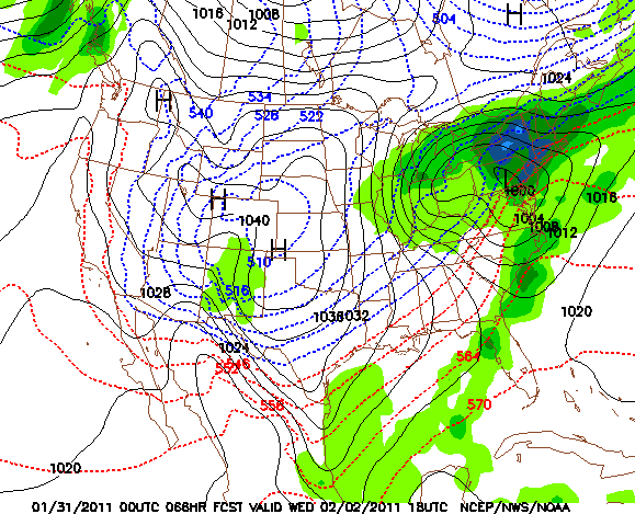
This is a good thing because this storm track should shut off warming aloft. Normally a storm track like this one could deliver a mixed bag of precipitation types for New York and the Northeast. In this case, the position of the High in eastern Canada is crucial in the set up — it will hold all that cold air in place. Bottom line: as of 7:30 a.m. Monday, we’re calling for 12-24 for all of the major ski areas.
I’m glad the "Canadian High" can help you guys out. Meanwhile, up here inside the High, it is -30 C (aka -22 F) with only a little snow in the forecast.
Well, that Canadian High may be failing us down here… hope the sleet stays away from the northcountry.
Looks like everyone north of alb is safe..
I’m sure it’s a fairly heavy snow.
We got 3 inches of sleet here… totally wrecking my plan for a powder morning here… hoping to get north this weekend.
This weekend looks good.. might be few inches of fresh too.