
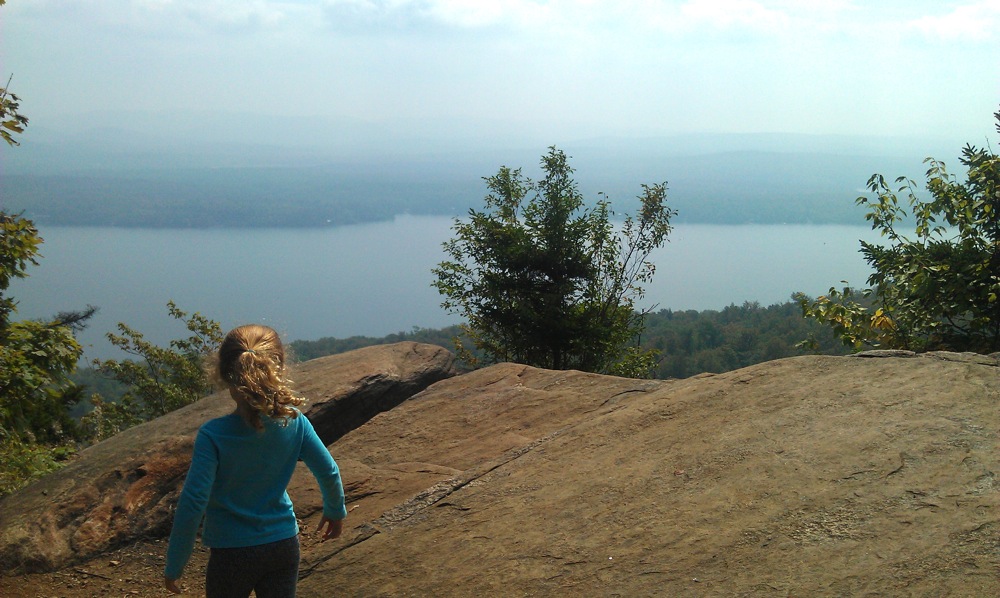
Echo Cliffs on Panther Mountain are at the end of short, steep, well-worn trail off the West Shore Road on Piseco Lake. The climb offers challenging blowdown, interesting boulders formations, a steep scramble for the summit, and a great view as a reward.
We found this hike in Kids on the Trail! published by the Adirondack Mountain Club. It’s another great kid-friendly hike, but again today the book’s vague instructions for reaching the trailhead were frustrating.
With the Eastern Adirondacks off limits due to the effects of tropical storm Irene, we again looked to the west in our new guidebook. After hiking Castle Rock, Neve wanted to climb again for more views. We made the hour long drive over to Piseco Lake.
The Echo Cliffs trail has really no protection from downpours in the way of waterbars, so it’s eroded to rubble and bedrock in many spots. In addition, there was a significant amount of fresh blowdown from the recent storm. But the hike is under a mile in each direction, so we treated every new obstacle as an opportunity to improvise.
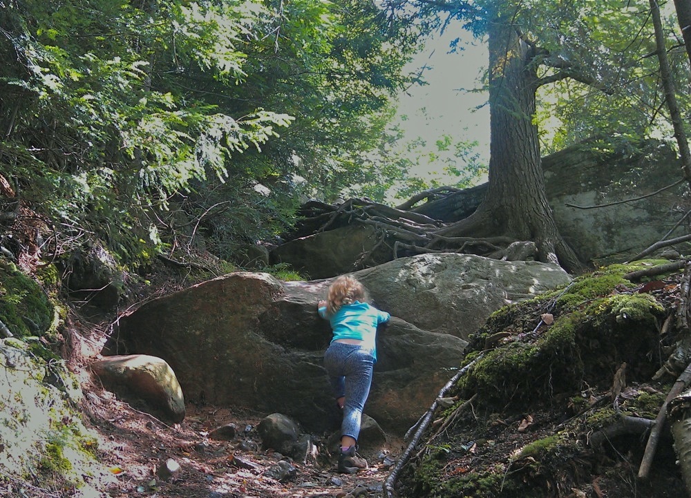
Towards the top, a young hiker needs great concentration to imagine the safest, surest way through roots, dirt, slippery bedrock and mud. It was interesting that all the blowdown, was farther down the mountain.
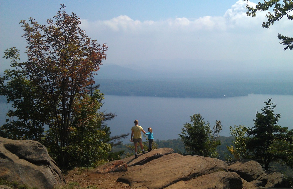
It was hot at the top. Much hotter than even a few steps back into the trees. But it was also spectacular — seeing almost all of Piseco Lake. After 45 minutes we headed down. I’m not sure why but for the first time in a long time, I enjoyed the hike down even more than the climb. It reminded me of skiing. Great day.
Haven’t done that hike as it’s a bit outside of my usual stomping grounds, but there’s some rock climbing there as well so maybe I’ll eventually check it out.
Sounds like the trail is the typical straight-up-the-mountain variety. The Ferris Lake Unit Mgt Plan (draft was issued in 2006) called for rehabilitation of that trail, but obviously that hasn’t happened yet.
Interesting that you should mention more blowdown from Irene at lower elevations. I’ve heard that same phenomenon reported in other locations (i.e. High Peaks) as well, where there was less blowdown at higher elevations.
I don’t know how far it is for you, but have you done the hike across the river from Bear Mountain State Park? The mountain is Anthony’s Nose..it’s a fairly short hike with an amazing view of the valley and river and I often follow it up with a trip up the road to the town of Cold Springs for some antiquing and a late lunch.
By the way, I love following your family adventures on your blog! Can’t wait to one day create memories like this with my kids.
HELLO HELLO HELLO ….So was there an ECHO ECHO echooooo?
Echo Cliffs is outside of our stomping grounds too. We were looking for hikes to the west of us, to try to avoid areas hit hardest by Irene. Neve really wanted some kind of cliff or peak, and her current limit seems to be about 600 feet of vert, up and down, so our options were limited.
@Anon – we didn’t do any shouting, but I had a hard time seeing any nearby face that could create an echo. Wanted to test it, but it’s a popular spot.
Good suggestion on Anthony’s nose; it’s close enough to where we live. Our 8 year old loved summiting Cascade in the ADKs in May, but a lot of the time it’s a struggle to get her to have fun in the woods. This is a kid who wants to summit Mt Marcy.
I also witnessed the same thing in the central adk over the weekend. There was all kinds of blowdown up until about 2000. I saw many whole trees uprooted. Above 2500 it was difficult to tell that a storm went through. I expected it to get worse higher up. It was kind of strange. This was taken at about 3400 feet.